support@meisterdrucke.com  ·  0043 4257 29415

Deutsch English Italiano Español Français Nederlands Português Svenska Polski Dansk
Search by artist, work title or style – e.g. Monet, Starry Night, Impressionism, Hokusai wave, nude. Describe the scene – e.g. green meadow, abstract with lots of red, dark oil painting, standing nude next to a tree.

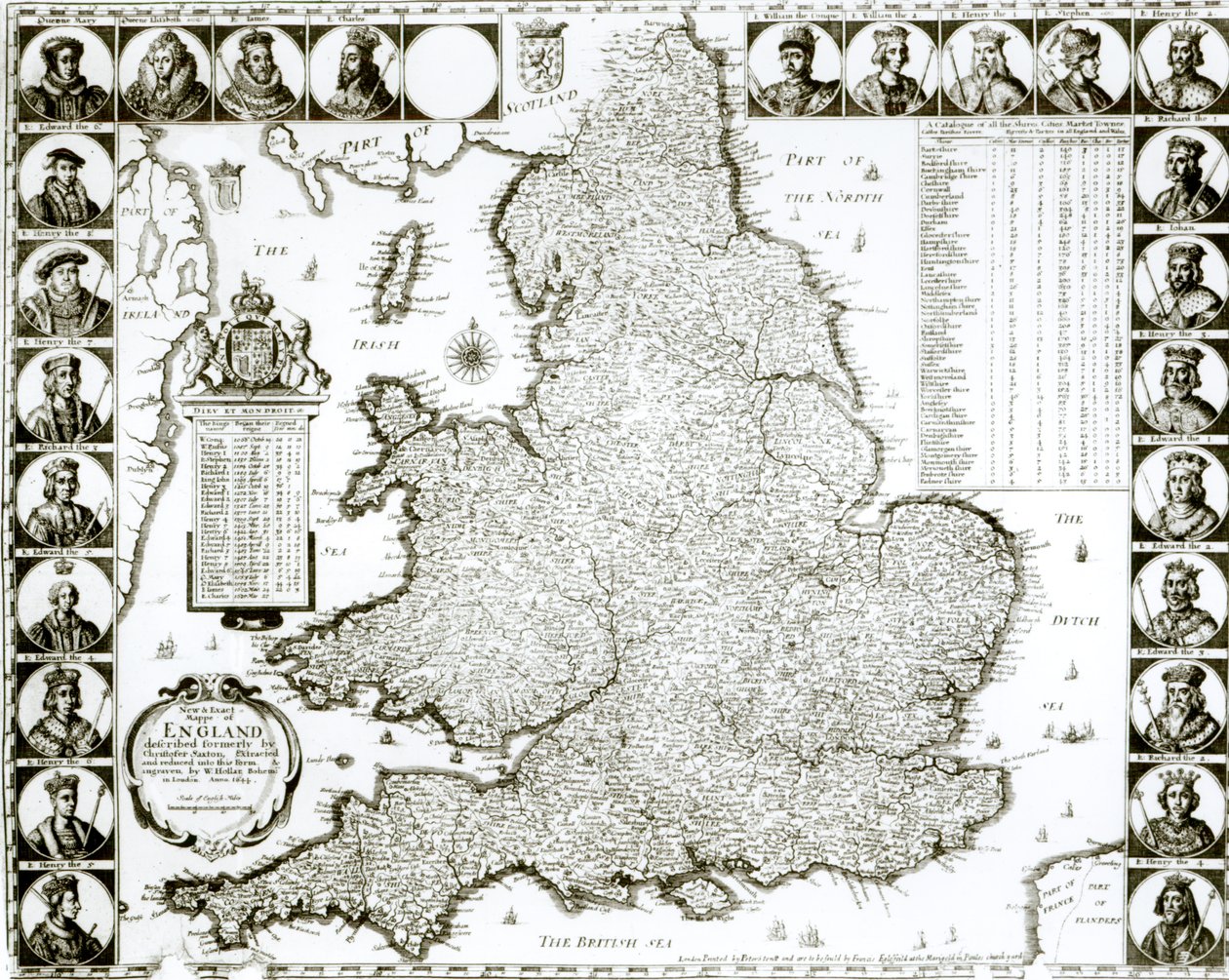
Map of England and Wales, 1644 by Wenceslaus Hollar

Map of England and Wales, 1644

(Map of England and Wales, 1644 )


Wenceslaus Hollar

€ 121.68
Tax-free
   Configure art print
1644  ·  engraving  ·  Image ID: 63266

Baroque  ·  Cartography

Map of England and Wales, 1644 by Wenceslaus Hollar. Available as an art print on canvas, photo paper, watercolor board, natural paper, or Japanese paper.
cartography · mapping · shires · cities · market towns · coat of arms · kings · british sea · north sea · irish sea · ships · mapping · Private Collection / Bridgeman Images
Other color versions of this image  
AR/3D   View in 3D / AR zu Favoriten hinzufügen   Add to favorites    Change wall color    View picture in a room
0 Reviews

Configure art print

Picture Frame

Medium & Stretcher

Glass & Passepartout

Miscellaneous & Extras

 Save / compare configuration
Preview Icon

Summary

Gemälde
Veredelung
Keilrahmen
Museumslizenz

€ 121.68
(inkl. 20% MwSt)
   Add to cart

Bildschärfe: PERFEKT

If you'd like us to adjust the brightness, colors, or crop the image, we're happy to do this for you at no extra cost. Just get in touch!

Similar artworks selected for you

A New Map of the Kingdom of England and the Principality of Wales, 1669 Britain as It Was Divided in the Time of the English Saxons, 1616 Great Britain, in Map of Britain and Ireland Most Accurate Description of the Kingdom of England and the Principality of Wales Great Britain and Ireland Britain As It Was Divided In The Time of the English Saxons especially during their Heptarchy Map of England, Scotland and Ireland (Great Britain) Ancient Description of the British Isles Wales, in Map of the Kingdom of Great Britain and Ireland, 1610 Britannia Atlas The Kingdom of England (engraved by Jodocus Hondius) Map of England, Wales and Ireland, Theatrum Orbis Terrarum by Abraham Ortelius England, in British Islands: England, Scotland, and Ireland The Invasions of England and Ireland with All Their Civil Wars Since the Conquest, c.1627 England Britania Insula quae dup Regna continet Angliam et Scotiam cum Hibernia adiacente, engraved by Paulo Forlani, 1562 New map of the most flourishing kingdom of England, by Humphrey Lloyd of Denbigh Map of the kingdoms of England, Scotland and Ireland (Great Britain) A New Map of England Scotland and Ireland, c.1690 Map of England and Ireland drawn in 1606 (coloured engraving) Map of Britain and Ireland, published Paris 1640 Ireland and Great Britain, in Map depicting the Invasions of England and Ireland with all their Civil Wars since the Conquest, c. 1627 Anglia: England and Wales. 1579
Show more similar artworks

Similar artworks selected for you

A New Map of the Kingdom of England and the Principality of Wales, 1669 Britain as It Was Divided in the Time of the English Saxons, 1616 Great Britain, in Map of Britain and Ireland Most Accurate Description of the Kingdom of England and the Principality of Wales Great Britain and Ireland Britain As It Was Divided In The Time of the English Saxons especially during their Heptarchy Map of England, Scotland and Ireland (Great Britain) Ancient Description of the British Isles Wales, in Map of the Kingdom of Great Britain and Ireland, 1610 Britannia Atlas The Kingdom of England (engraved by Jodocus Hondius) Map of England, Wales and Ireland, Theatrum Orbis Terrarum by Abraham Ortelius England, in British Islands: England, Scotland, and Ireland The Invasions of England and Ireland with All Their Civil Wars Since the Conquest, c.1627 England Britania Insula quae dup Regna continet Angliam et Scotiam cum Hibernia adiacente, engraved by Paulo Forlani, 1562 New map of the most flourishing kingdom of England, by Humphrey Lloyd of Denbigh Map of the kingdoms of England, Scotland and Ireland (Great Britain) A New Map of England Scotland and Ireland, c.1690 Map of England and Ireland drawn in 1606 (coloured engraving) Map of Britain and Ireland, published Paris 1640 Ireland and Great Britain, in Map depicting the Invasions of England and Ireland with all their Civil Wars since the Conquest, c. 1627 Anglia: England and Wales. 1579
Show more similar artworks

More art prints by Wenceslaus Hollar

Dutch Warships Naves Bellicæ Hollandicæ, 1647 The Town and Castle of Deal, Kent, 1640 Shell, Hippopus hippopus. Shells (series title) Five boys and a satyr, 1646 Animals and Plants: Leopard with Plants and Insects, 1662 Lion and tulip Great View of Prague Hollar-Rostock Generous Greek Woman in the City of Pera First English Revolution (1641-1649): execution of English politician Thomas Wentworth de Strafford (1593-1641) on 12/05/1641 at Tower Hill in London. Engraving by Wenceslaus Hollar (1607-1677), 17th century, Private Collection Head study of a man with protruding chin and snub nose looking upwards in profile to the left, 1625-77 Theophrastus Bombastus von Hohenheim Paracelsus, Swiss alchemist and physician, 16th century Old St Paul’s Cathedral Burning in the Great Fire of London, 1666 Bust of a man with hooked nose, prominent upper lip, open mouth and short curly hair, 1665 Deformed heads of a bald man and a woman with horns on her head. Varie figurae et probae (series title). Caricatures, heads and deformities after Leonardo da Vinci (series title)
Show more works by Wenceslaus Hollar

More art prints by Wenceslaus Hollar

Dutch Warships Naves Bellicæ Hollandicæ, 1647 The Town and Castle of Deal, Kent, 1640 Shell, Hippopus hippopus. Shells (series title) Five boys and a satyr, 1646 Animals and Plants: Leopard with Plants and Insects, 1662 Lion and tulip Great View of Prague Hollar-Rostock Generous Greek Woman in the City of Pera First English Revolution (1641-1649): execution of English politician Thomas Wentworth de Strafford (1593-1641) on 12/05/1641 at Tower Hill in London. Engraving by Wenceslaus Hollar (1607-1677), 17th century, Private Collection Head study of a man with protruding chin and snub nose looking upwards in profile to the left, 1625-77 Theophrastus Bombastus von Hohenheim Paracelsus, Swiss alchemist and physician, 16th century Old St Paul’s Cathedral Burning in the Great Fire of London, 1666 Bust of a man with hooked nose, prominent upper lip, open mouth and short curly hair, 1665 Deformed heads of a bald man and a woman with horns on her head. Varie figurae et probae (series title). Caricatures, heads and deformities after Leonardo da Vinci (series title)
Show more works by Wenceslaus Hollar

More motifs from the category Cartography

A New Map of the Roman Empire, from "A Prospect of the Most Famous Parts of the World", published by Bassett and Chiswell, 1676 Iceland, from an Atlas of the World in 33 maps, Venice, 1st September 1553 (detail from 330951) Double Hemisphere World Map, 1587 The Velasco Map, facsimile, 1610 Map of the Battle of Friedland, published by William Blackwood and Sons, Edinburgh and London, 1848 Map of Cairo, from Civitates Orbis Terrarum by Georg Braun (1541-1622) and Frans Hogenberg (1535-90), c.1572 Map of Phillipsburg, from Map of Ms. Lat. 463, fol. 81v-82r, Map of Gaul, Belgium, Lyon and Aquitaine Miniature Nautical Map of the Adriatic, 1624 Map of Padua, from "Les Villes de Venétie", 1704, published by Pierre Mortier in Amsterdam MS HM 2182 The Forbidden City in Peking, from a collection of maps made during a Vietnamese embassy to China Map of France, c. 1914 Ms. 988, Vol.3 fol.10 Map of Saint-Quentin, from the ’Atlas Louis XIV’, 1683-88 Map of the Gold Coast at the Time of the Third Ashanti Expedition in 1874
View More from "Cartography"

More motifs from the category Cartography

A New Map of the Roman Empire, from "A Prospect of the Most Famous Parts of the World", published by Bassett and Chiswell, 1676 Iceland, from an Atlas of the World in 33 maps, Venice, 1st September 1553 (detail from 330951) Double Hemisphere World Map, 1587 The Velasco Map, facsimile, 1610 Map of the Battle of Friedland, published by William Blackwood and Sons, Edinburgh and London, 1848 Map of Cairo, from Civitates Orbis Terrarum by Georg Braun (1541-1622) and Frans Hogenberg (1535-90), c.1572 Map of Phillipsburg, from Map of Ms. Lat. 463, fol. 81v-82r, Map of Gaul, Belgium, Lyon and Aquitaine Miniature Nautical Map of the Adriatic, 1624 Map of Padua, from "Les Villes de Venétie", 1704, published by Pierre Mortier in Amsterdam MS HM 2182 The Forbidden City in Peking, from a collection of maps made during a Vietnamese embassy to China Map of France, c. 1914 Ms. 988, Vol.3 fol.10 Map of Saint-Quentin, from the ’Atlas Louis XIV’, 1683-88 Map of the Gold Coast at the Time of the Third Ashanti Expedition in 1874
View More from "Cartography"

A selection of our top sellers

Reclining Semi-Nude (Masturbating), 1912-13 The Great Wave of Kanagawa Poppy Field, 1873 Summer evening on the beach at Skagen. The painter and his wife. Shooting Stars (Franz and Mary von Stuck) The Singing Man, 1928 The Two Crowns Boy Writing with His Sister, 1875 Suprematist Composition: White on White, 1918 Moonrise Irises Main and Side Paths The Course of Empire: The Arcadian or Pastoral State The Wanderer above the Sea of Fog Moonrise over the Sea
Show more artworks

A selection of our top sellers

Reclining Semi-Nude (Masturbating), 1912-13 The Great Wave of Kanagawa Poppy Field, 1873 Summer evening on the beach at Skagen. The painter and his wife. Shooting Stars (Franz and Mary von Stuck) The Singing Man, 1928 The Two Crowns Boy Writing with His Sister, 1875 Suprematist Composition: White on White, 1918 Moonrise Irises Main and Side Paths The Course of Empire: The Arcadian or Pastoral State The Wanderer above the Sea of Fog Moonrise over the Sea
Show more artworks


What our customers think about us


Frequently Asked Questions about Meisterdrucke


Personalizing your art print at Meisterdrucke is simple and intuitive: Choose a frame, set the image size, pick a printing medium, and add suitable glazing or a stretcher frame. We also offer additional customization options like mats, fillets, and spacers. If you have any questions, our customer service team is ready to help you create your perfect artwork.

At Meisterdrucke, you can visualize your configured artwork directly in your own room. Simply upload a photo of your space and see how the artwork looks in it. If you're visiting us on a mobile device — phone or tablet — our augmented reality feature brings the picture to life and projects it right into your room. A unique experience that combines art and technology.

Choosing the right medium is often a matter of personal taste. To give you a better idea, we've provided some images for each medium. We also offer a sample set of all paper variants, so you can decide not just visually but by touch as well. You can order the sample set free of charge — only shipping costs apply.

Don't worry! At Meisterdrucke, we don't just process orders mechanically. Every order is manually reviewed by our team. If we spot any inconsistencies or issues with your configuration, we'll get in touch with you right away. And of course, our friendly and patient support team is always here to help you with your configuration. We'll work with you by phone or email to adjust your image so the final result is exactly what you had in mind.


Still have questions?

Are you interested in an art print from our manufactory but still unsure? Do you need advice on choosing the medium or help with the order?

Our experts are happy to assist you.

+43 4257 29415
support@meisterdrucke.com
Mo-Do: 7:00 - 16:00 | Fr: 7:00 - 13:00

Still have questions?

Are you interested in an art print from our manufactory but still unsure? Do you need advice on choosing the medium or help with the order?

Our experts are happy to assist you.

+43 4257 29415
support@meisterdrucke.com
Mo-Do: 7:00 - 16:00 | Fr: 7:00 - 13:00


Meisterdrucke

   Kärntner Strasse 46
        9586 Finkenstein am Faaker See
        Austria
        +43 4257 29415
        support@meisterdrucke.com
Other languages

                   
Erfahrungen & Bewertungen zu Meisterdrucke
Post.at DHL Express Quehenberger Cargoboard
Kaiser Franz Joseph

Meisterdrucke
Kärntner Strasse 46
9586 Finkenstein am Faaker See · Austria
+43 4257 29415 · support@meisterdrucke.com
Post.at DHL Express Quehenberger Cargoboard


(c) 2026 meisterdrucke.us