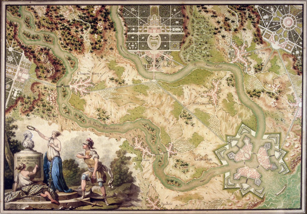
An imaginary map of Czartorysk by Tadeusz Kosciuszko

An imaginary map of Czartorysk

(An imaginary map of Czartorysk (brush, pen und wc on paper))


Tadeusz Kosciuszko

€ 122.73
Enthält 0% MwSt.
   Configure art print
Undated  ·  brush, pen and watercolour on paper  ·  Picture ID: 125738

Nonclassified artists  ·  Cartography

An imaginary map of Czartorysk by Tadeusz Kosciuszko. Available as an art print on canvas, photo paper, watercolor board, uncoated paper or Japanese paper.
plan · layout · fantasy · figures · river · forest · woodland · classical · parkland · formal garden · gardens · commemorative · bust · allegiance · honour · veneration · Czartoryski Museum, Cracow, Poland / Bridgeman Images
AR/3D   View in 3D / AR zu Favoriten hinzufügen   Add to favorites    Select wall color    View painting in a room
0 Reviews

Configure art print

Picture Frame

Medium & Stretcher

Glass & Passepartout

Miscellaneous & Extras

 Save / compare configuration
Preview Icon

Summary

Gemälde
Veredelung
Keilrahmen
Museumslizenz

€ 122.73
(inkl. 20% MwSt)
   Add to cart

Bildschärfe: PERFEKT

Should you desire adjustments to brightness and color, or a custom crop of the motif, we are happy to make these changes at no additional cost to you. Please do not hesitate to contact us.

Similar artworks selected for you

Map of Plon from Civitates Orbis Terrarum Allegorical Map of the Stages of Love Plan and Map of the town, citadel and surroundings of Amiens, from the Peterhof, Russia: Elevation of the English Palace and plan of the park Peterhof, Russia: Elevation of the English Palace and Plan of the Park Plan and Map of Saint-Jean-Pied-de-Port, from the Atlas Louis XIV, 1683-88 Map of the town and citadel of Bellisle, from the Map of Raab, from Louis XIV Atlas, map of Collioure Map of Saint-Quentin, from the A Map inspired by Candide by Francois Voltaire for a competition organised by the Ecole Nationale des Ponts et Chaussees in Paris The Carte du Tendre, a map of an imaginary country, from volume II of Clelie written by Mademoiselle de Scudery, engraved by Francois Chauveau (1613-76) 1656 Schleswig, Holstein, Germany - in Battle of Ter won by the King Map of Jerusalem (Hierosolymorum), Israel Map of the Magellan Straits, from A coloured chart of Plymouth Harbour, and of the country up to Tavistock; drawn possibly by Robert Spry Plan of the Battle of Kunersdorf, August 12th, 1759 Plon, Germany Plan and Map of the Town and Citadel of Bayonne, from the The Siege of Turin in 1639, Color Engraving from Theatrum Sabaudiae Thirty Years Plan of the Citadel of Turin During the Siege of 1640 Heilbronn and its Eastern Surroundings 1578 Map of Jerusalem, from Map of Concarneau, from the Speculum Romanae Magnificentiae: Ancient Rome, and its Hills, from the West, 1582 Speculum Romanae Magnificentiae: Ancient Rome and its Hills, from the West Ms. 988 Vol.3, fol.61
Show more similar artworks

Other motives from the category Cartography

Map of Berlin, Published by Carl Glueck Verlag, Berlin, 1860 Map of Cutch and Kathiawar, published under the direction of Colonel G.C. de Pree, S.C., Surveyor General of India, 1885 Map of the Adriatic Sea Map of Nottinghamshire Map of Canada from Map of New Belgium with a View of New Amsterdam, compiled by Nicolaes Visscher c.1651-55 Atlas 131 fol.13 Map of Saintes, Capital of Saintonge, from Map of Walbrook Ward and Dowgate Ward, London Map of Durham Insurance Map of the City of Philadelphia; volume 2, plate15, 1887 Map of Laputa (flying island top right) and Balnibarbii (main port Maldonada) from Part III: A Voyage to Laputa, Balnibarbi, Luggnagg, Glubbdubdrib, and Japan in Gulliver Map of Padua, from Map of Asia, Tartaria, Japan, the Philippines and the East Indies, engraved by G. van Gouwen, c.1690 An imaginary map of Czartorysk Map of the Bay of Bengal, the China Sea and Java
View More from "Cartography"

Excerpt from our top sellers

Vase of Flowers Spruce Thicket in the Snow Lucifer Night: A Port in the Moonlight, 1748 The Open Window Head of a Skeleton with a Burning Cigarette The Heart of the Andes Beautiful Princess The Incredulity of St. Thomas, 1602-03 Hypnosis The Bookworm Women of Tahiti, On the Beach, 1891 Venus and Mars The Harvesters View of the Dents-du-Midi from Champéry
Show More Artworks


What our customers think about us


Frequently Asked Questions about Meisterdrucke


Personalizing your art print at Meisterdrucke is a simple and intuitive process that allows you to design an artwork exactly to your specifications: Choose a frame, determine the image size, decide on a printing medium, and add suitable glazing or a stretcher frame. We also offer customization options such as mats, fillets, and spacers. Our customer service is available to help you design your perfect artwork.

At Meisterdrucke, you have the fascinating option to visualize the artwork you configured directly in your own space. For a tailored preview, simply upload a photo of your room and let the artwork appear on it. If you visit us via a mobile device, be it a phone or tablet, our augmented reality feature brings the image to life and seamlessly projects it into your space. An experience that uniquely combines art and technology.

Choosing the medium is often a matter of personal taste. To give you a clearer idea, we have provided some images for each medium. For a holistic experience, we also offer you a sample set of all paper variants so you can make a decision not just visually but also haptically. You can take advantage of the sample set free of charge – only the shipping costs will apply. You can order the sample set directly.

Do not worry. At Meisterdrucke, we do not proceed mechanically. We manually review each order. If there are any inconsistencies or peculiarities in the configuration, we will immediately contact you. Of course, our courteous and patient support is always at your side to assist you with the configuration. Together with you, we adjust your image by phone or email so that the final result exactly meets your expectations.


Do you have any questions?

Are you interested in an art print from our manufactory but still unsure? Do you need advice on choosing the medium or help with the order?

Our experts are happy to assist you.

+43 4257 29415
support@meisterdrucke.com
Mo-Do: 7:00 - 16:00 | Fr: 7:00 - 13:00

Do you have any questions?

Are you interested in an art print from our manufactory but still unsure? Do you need advice on choosing the medium or help with the order?

Our experts are happy to assist you.

+43 4257 29415
support@meisterdrucke.com
Mo-Do: 7:00 - 16:00 | Fr: 7:00 - 13:00


Meisterdrucke

   Kärntner Strasse 46
        9586 Finkenstein am Faaker See
        Austria
        +43 4257 29415
        support@meisterdrucke.com
Other languages

                   
Erfahrungen & Bewertungen zu Meisterdrucke
Partner Logos

Kaiser Franz Joseph

Meisterdrucke
Kärntner Strasse 46
9586 Finkenstein am Faaker See · Austria
+43 4257 29415 · office@meisterdrucke.com
Partner Logos


(c) 2025 meisterdrucke.us