support@meisterdrucke.com  ·  0043 4257 29415

Deutsch English Italiano Español Français Nederlands Português Svenska Polski Dansk
Search by artist, work title or style – e.g. Monet, Starry Night, Impressionism, Hokusai wave, nude. Describe the scene – e.g. green meadow, abstract with lots of red, dark oil painting, standing nude next to a tree.

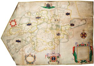
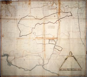
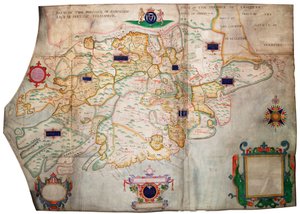
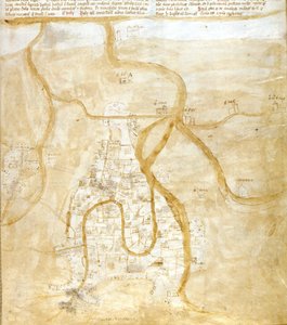
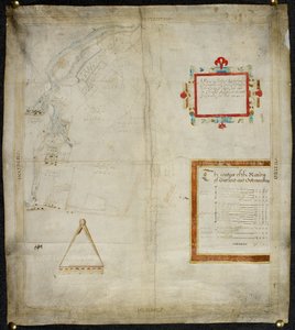
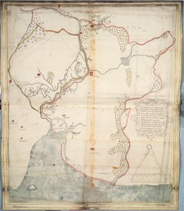
Map of the Manor of Shifnal, Shropshire, 1635 by J. Harrison

Map of the Manor of Shifnal, Shropshire, 1635

(Map of the Manor of Shifnal, Shropshire, 1635 (ink und colour on vellum))


J. Harrison

€ 109.78
Tax-free
   Configure art print
1635  ·  ink and colour on vellum  ·  Image ID: 238117

Nonclassified artists  ·  Cartography

Map of the Manor of Shifnal, Shropshire, 1635 by J. Harrison. Available as an art print on canvas, photo paper, watercolor board, natural paper, or Japanese paper.
mapping · cartography · plan · country estate · rural · compass · residence · His Grace The Duke of Norfolk, Arundel Castle / Bridgeman Images
AR/3D   View in 3D / AR zu Favoriten hinzufügen   Add to favorites    Change wall color    View picture in a room
0 Reviews

Configure art print

Picture Frame

Medium & Stretcher

Glass & Passepartout

Miscellaneous & Extras

 Save / compare configuration
Preview Icon

Summary

Gemälde
Veredelung
Keilrahmen
Museumslizenz

€ 109.78
(inkl. 20% MwSt)
   Add to cart

Bildschärfe: PERFEKT

If you'd like us to adjust the brightness, colors, or crop the image, we're happy to do this for you at no extra cost. Just get in touch!

Similar artworks selected for you

The description of the castle and lands of Insbeguin lying within 3 miles of Yohall on the west side thereof Ireland South of the Shannon The Battle off Gravelines, 8 August 1588 Namur, from Atlas de Louis XIV. Plans des places etrangeres, 1665 Isle of Ven and Uranienborg, the palace and observatory of Tycho Brahe (engraving) Denmark - in Uranienborg from Civitates Orbis Terrarum Map of Lismore, Ireland Jerusalem - in Ms. 986, Vol. 1, Plan and Map of Cambrai, from the “Atlas Louis XIV”, 1683-88 Chart of the course of the River Medway from Rochester to The Nore Plymouth Citadel Plan of the Citadel of Turin During the Siege of 1640 Tangiers Map Map of the Skøyen Farm, Østre Aker, with the Farm Ms. 988, Vol. 3, fol. 7 Plan and Map of the Town, Citadel and Surroundings of Amiens, from the ’Atlas Louis XIV’, 1683-88 Dover to Sandwich and Blacknerse to Gravelines - The Spanish Armada and the English Fleet off Calais, c. 1590 Project for the construction of a channel of communication between the Atlantic Ocean and the Mediterranean Sea, including part approximately between Toulouse and Pexiora; in the regions of Midi-Pyrenees and Languedoc-Roussillon, France A tinted plan of the siege works. Journal of the siege of Bergen op Zoom, by the French, in 1747; preceded by an account of the state of the French artillery at that time. Province of Munster, Ireland, c.1595 Louisburg Fortress and Harbour, Cape Breton Plymouth A coloured plan of the siege of Bergen op Zoom Detail from map of city of Verona and its suburbs, Italy Map of Venice Map of the Seven Marshland Townships Plan of town and fortress of Gariah Plan of the Position of the Army under the command of Lieut. Genl. Burgoyne near Still Water, in which it encamped on 20th September 1777 Map of Bayford and Goodmanston Manors in Murston and Sittingbourne, co. Kent: 1590
Show more similar artworks

More motifs from the category Cartography

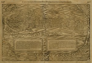
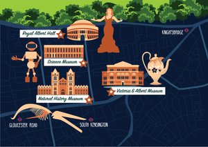
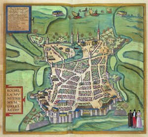
Partial Map of the Middle East in the 1890s, from "The Citizen Ms Lat 463 f.111v-112r Map of Phoenicia, Mesopotamia and Babylon Map of Treviso, from Map of Berlin and Cölln, 1652 Map of the Black Sea Copy of Catalan Map of Europe, North Africa and the Middle East Map of Venice, by Sebastian Münster (1488-1552), published in Basel, c. 1560 Map of Britain in 658, produced by Stanford’s Geographical Establishment Map of the Siege of the Castle of Burgos, published by William Blackwood and Sons, Edinburgh and London, 1848 Map of Mexico and Central America, from the Map of South Kensington Map of the Battle of Marengo, published by William Blackwood and Sons, Edinburgh and London, 1848 Map of La Rochelle, from Topographical Map and Survey of the Village of Issy, 1740 Map of the Vendée depicting the area of the Vendée Revolt (1793-96) in March 1793, c. 1815
View More from "Cartography"

A selection of our top sellers

View across the Sawahs to Gunung Agung, c. 1937-1939 The Boulevard Montmartre at Night Silent Night Composition VIII. Painting by Wassily Kandinsky (or Wassily Kandinski or Kandinskij, 1866-1944). 1915 Sun. 201x140 cm New York, Guggenheim Museum Avenue in Overveen The Great Wave of Kanagawa Roe Deer and Landscape Flying Kites The Savage State from The Course of Empire Water Lilies, 1906 Peasant Wedding Seated Woman with Bent Knees, 1917 Limits of Reason, 1927. Luncheon of the Boating Party Moon over Landscape
Show more artworks


What our customers think about us


Frequently Asked Questions about Meisterdrucke


Personalizing your art print at Meisterdrucke is simple and intuitive: Choose a frame, set the image size, pick a printing medium, and add suitable glazing or a stretcher frame. We also offer additional customization options like mats, fillets, and spacers. If you have any questions, our customer service team is ready to help you create your perfect artwork.

At Meisterdrucke, you can visualize your configured artwork directly in your own room. Simply upload a photo of your space and see how the artwork looks in it. If you're visiting us on a mobile device — phone or tablet — our augmented reality feature brings the picture to life and projects it right into your room. A unique experience that combines art and technology.

Choosing the right medium is often a matter of personal taste. To give you a better idea, we've provided some images for each medium. We also offer a sample set of all paper variants, so you can decide not just visually but by touch as well. You can order the sample set free of charge — only shipping costs apply.

Don't worry! At Meisterdrucke, we don't just process orders mechanically. Every order is manually reviewed by our team. If we spot any inconsistencies or issues with your configuration, we'll get in touch with you right away. And of course, our friendly and patient support team is always here to help you with your configuration. We'll work with you by phone or email to adjust your image so the final result is exactly what you had in mind.


Still have questions?

Are you interested in an art print from our manufactory but still unsure? Do you need advice on choosing the medium or help with the order?

Our experts are happy to assist you.

+43 4257 29415
support@meisterdrucke.com

Mo-Do: 7:00 - 16:00 | Fr: 7:00 - 13:00

Still have questions?

Are you interested in an art print from our manufactory but still unsure? Do you need advice on choosing the medium or help with the order?

Our experts are happy to assist you.

+43 4257 29415
support@meisterdrucke.com
Mo-Do: 7:00 - 16:00 | Fr: 7:00 - 13:00


Meisterdrucke

   Kärntner Strasse 46
        9586 Finkenstein am Faaker See
        Austria
        +43 4257 29415
        support@meisterdrucke.com
Other languages

                   
Erfahrungen & Bewertungen zu Meisterdrucke
Post.at DHL Express Quehenberger Cargoboard
Kaiser Franz Joseph

Meisterdrucke
Kärntner Strasse 46
9586 Finkenstein am Faaker See · Austria
+43 4257 29415 · support@meisterdrucke.com
Post.at DHL Express Quehenberger Cargoboard


(c) 2026 meisterdrucke.us