support@meisterdrucke.com  ·  0043 4257 29415

Deutsch English Italiano Español Français Nederlands Português Svenska Polski Dansk
Search by artist, work title or style – e.g. Monet, Starry Night, Impressionism, Hokusai wave, nude. Describe the scene – e.g. green meadow, abstract with lots of red, dark oil painting, standing nude next to a tree.

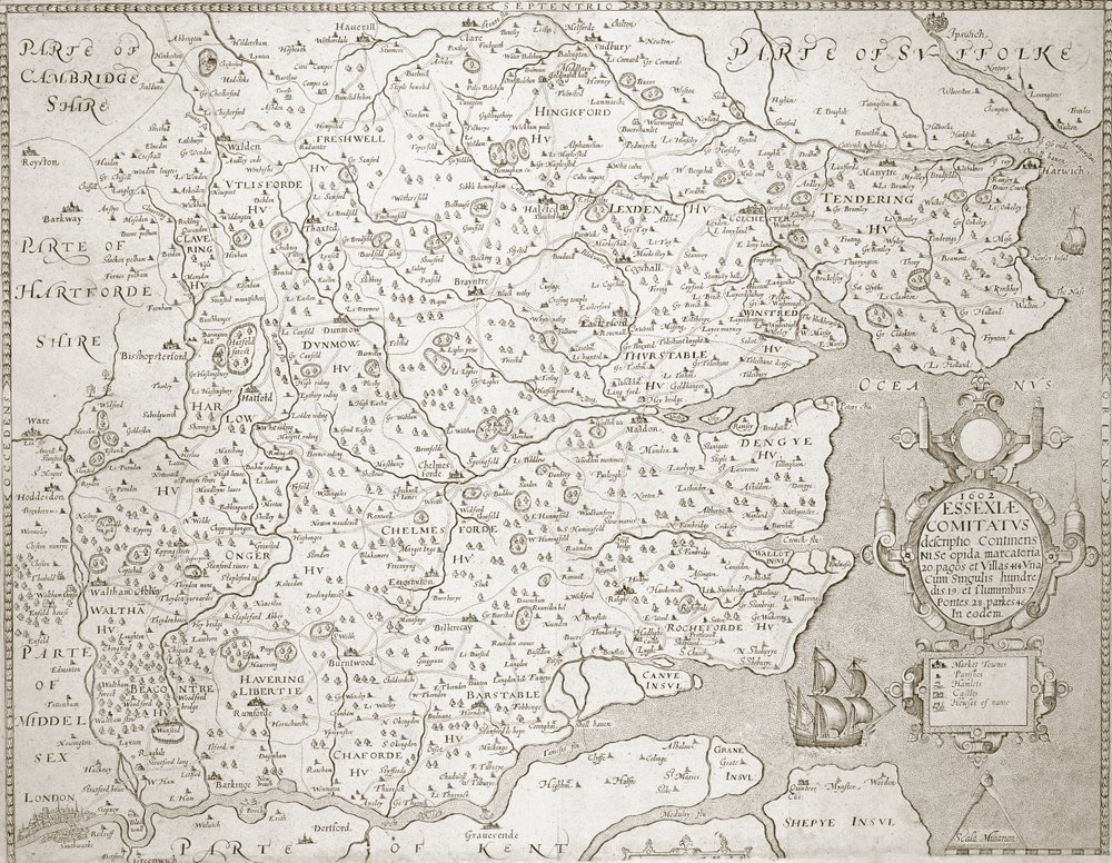
Map of Essex, 1602-03 by William Smith

Map of Essex, 1602-03

(Map of Essex, 160203 )


William Smith

€ 121.41
Tax-free
   Configure art print
Undated  ·  engraving  ·  Image ID: 249833

Nonclassified artists  ·  Cartography

Map of Essex, 1602-03 by William Smith. Available as an art print on canvas, photo paper, watercolor board, natural paper, or Japanese paper.
Private Collection / Bridgeman Images
AR/3D   View in 3D / AR zu Favoriten hinzufügen   Add to favorites    Change wall color    View picture in a room
0 Reviews

Configure art print

Picture Frame

Medium & Stretcher

Glass & Passepartout

Miscellaneous & Extras

 Save / compare configuration
Preview Icon

Summary

Gemälde
Veredelung
Keilrahmen
Museumslizenz

€ 121.41
(inkl. 20% MwSt)
   Add to cart

Bildschärfe: PERFEKT

If you'd like us to adjust the brightness, colors, or crop the image, we're happy to do this for you at no extra cost. Just get in touch!

Similar artworks selected for you

Hamshire, olim pars Belgarum. J. Norden descripsit. W. Hole sculp., from Camden Map of Lazio Region, from Theatrum Orbis Terrarum Map of Essex, Engraved by William Web, Published 1645 Map of Yorkshire, engraved by William Web, published 1645 Frieslandt Holy Land and Palestina (engraving) 1593 Map of the Danube by Cornelis de Jode Limburg, Belgium 1584 Map - Terra Sancta Castillia with Madrid and Toledo, Spain (engraving) Essex, in 17th Century Map of the Eastern Mediterranean by Stefano Scolari Turkey - Cyprus (engraving) Stafford County and Town, engraved by Jodocus Hondius from John Speed Belgium (engraving) Leicester, engraved by Jodocus Hondius from John Speed Holland and Brabant, Belgium (engraving) The Countie and Citie of Lyncolne, Engraved by Jodocus Hondius from John Speed Bourges, France Wurttemberg, south Germany (engraving) Surrey, in Middlesex, in The County of Leinster with the City of Dublin Described, engraved by Jodocus Hondius, from Map of Suffolk, engraved by William Web 1596 Hollandia Comitatus Kaerius Alsatia, Germany (engraving) Somerset, in Foggia, Italy, in Map of the Archbishopric and Electorate of Mainz, c. 1695
Show more similar artworks

More art prints by William Smith

Philip Bury Duncan, 1837 Philip Bury Duncan Staffa and Its Caves A Pig in a Sty Map of Essex, 1602-03 View of London from the south, showing the River Thames, London Bridge and the Tower Oak Tree Clay Fossils, Illustration from A Landscape with Distant Classical Ruins, a Bridge, Figures, and Cattle A Bay Pony by a River Geological map of the neighbourhood of Bath, engraved by John Cary and then hand-coloured by the artist, c.1799 Rainy Mountains, 1910 Fleuron from Book: An Historical Account of the Expedition Against the Ohio Indians, in the Year MDCCLXIV A Landscape with Distant Classical Ruins, a Bridge, Figures, and Cattle Johannes Gay South-west Prospect of the English and Dutch Forts at Sakkundi, c.1744
Show more works by William Smith

More motifs from the category Cartography

Map of Le Marais, Paris Map depicting North America as Divided by the European Powers, 1774 Map of Fisk-Kill and the Position of the French Army Map of Trento, from Les Villes de Venetie, 1704, published by Pierre Mortier in Amsterdam Eastern Hemisphere, from a Series of World Maps published by John Tallis and Co., New York and London Map of the route taken by Vitus Bering (1681-1741) across Siberia to Kamchatka, from Navigantium atque Itinerantium Bibliotheca, published 1744 Inscription from Rocque World Map, early 18th century Mount Sinai and the Red Sea, from an Atlas of the World in 33 Maps, Venice, 1st September 1553 (detail from 330963) A new and accurate map of the world, 1676 Bologna, detail from the “Galleria delle Carte Geografiche”, 1580-83 Map of the Battle of Trafalgar, published by William Blackwood and Sons, Edinburgh and London, 1848 Part of the Tabula Peutingeriana (Peutinger Table, Peutinger Map), an illustrated itinerarium of the road network in the Roman Empire. Detail of Italy from the Peutinger Map copy Part of Africa, from an Atlas of the World in 33 Maps, Venice, 1st September 1553 (detail) Map of the Northern Sky with representations of the constellations, c.1515
View More from "Cartography"

A selection of our top sellers

The Sin, 1899 Thalia, the Muse of Comedy, 1897 Circe Invidiosa, 1892 The Japanese Footbridge and the Water Lily Pool, Giverny Reclining female nude with long hair Dancers in blue, 1890 Narcissus Portrait of a Young Woman Malcesine on Lake Garda Napoleon Crossing the Alps Noonday Heat Starry Night, c. 1850-65 Panorama of Views of Kanazawa Under Full Moon, from the series Landscape from Saint-Rémy The Consummation of Empire, 1836
Show more artworks


What our customers think about us


Frequently Asked Questions about Meisterdrucke


Personalizing your art print at Meisterdrucke is simple and intuitive: Choose a frame, set the image size, pick a printing medium, and add suitable glazing or a stretcher frame. We also offer additional customization options like mats, fillets, and spacers. If you have any questions, our customer service team is ready to help you create your perfect artwork.

At Meisterdrucke, you can visualize your configured artwork directly in your own room. Simply upload a photo of your space and see how the artwork looks in it. If you're visiting us on a mobile device — phone or tablet — our augmented reality feature brings the picture to life and projects it right into your room. A unique experience that combines art and technology.

Choosing the right medium is often a matter of personal taste. To give you a better idea, we've provided some images for each medium. We also offer a sample set of all paper variants, so you can decide not just visually but by touch as well. You can order the sample set free of charge — only shipping costs apply.

Don't worry! At Meisterdrucke, we don't just process orders mechanically. Every order is manually reviewed by our team. If we spot any inconsistencies or issues with your configuration, we'll get in touch with you right away. And of course, our friendly and patient support team is always here to help you with your configuration. We'll work with you by phone or email to adjust your image so the final result is exactly what you had in mind.


Still have questions?

Are you interested in an art print from our manufactory but still unsure? Do you need advice on choosing the medium or help with the order?

Our experts are happy to assist you.

+43 4257 29415
support@meisterdrucke.com
Mo-Do: 7:00 - 16:00 | Fr: 7:00 - 13:00

Still have questions?

Are you interested in an art print from our manufactory but still unsure? Do you need advice on choosing the medium or help with the order?

Our experts are happy to assist you.

+43 4257 29415
support@meisterdrucke.com
Mo-Do: 7:00 - 16:00 | Fr: 7:00 - 13:00


Meisterdrucke

   Kärntner Strasse 46
        9586 Finkenstein am Faaker See
        Austria
        +43 4257 29415
        support@meisterdrucke.com
Other languages

                   
Erfahrungen & Bewertungen zu Meisterdrucke
Post.at DHL Express Quehenberger Cargoboard
Kaiser Franz Joseph

Meisterdrucke
Kärntner Strasse 46
9586 Finkenstein am Faaker See · Austria
+43 4257 29415 · support@meisterdrucke.com
Post.at DHL Express Quehenberger Cargoboard


(c) 2026 meisterdrucke.us