support@meisterdrucke.com  ·  0043 4257 29415

Deutsch English Italiano Español Français Nederlands Português Svenska Polski Dansk
Search by artist, work title or style – e.g. Monet, Starry Night, Impressionism, Hokusai wave, nude. Describe the scene – e.g. green meadow, abstract with lots of red, dark oil painting, standing nude next to a tree.

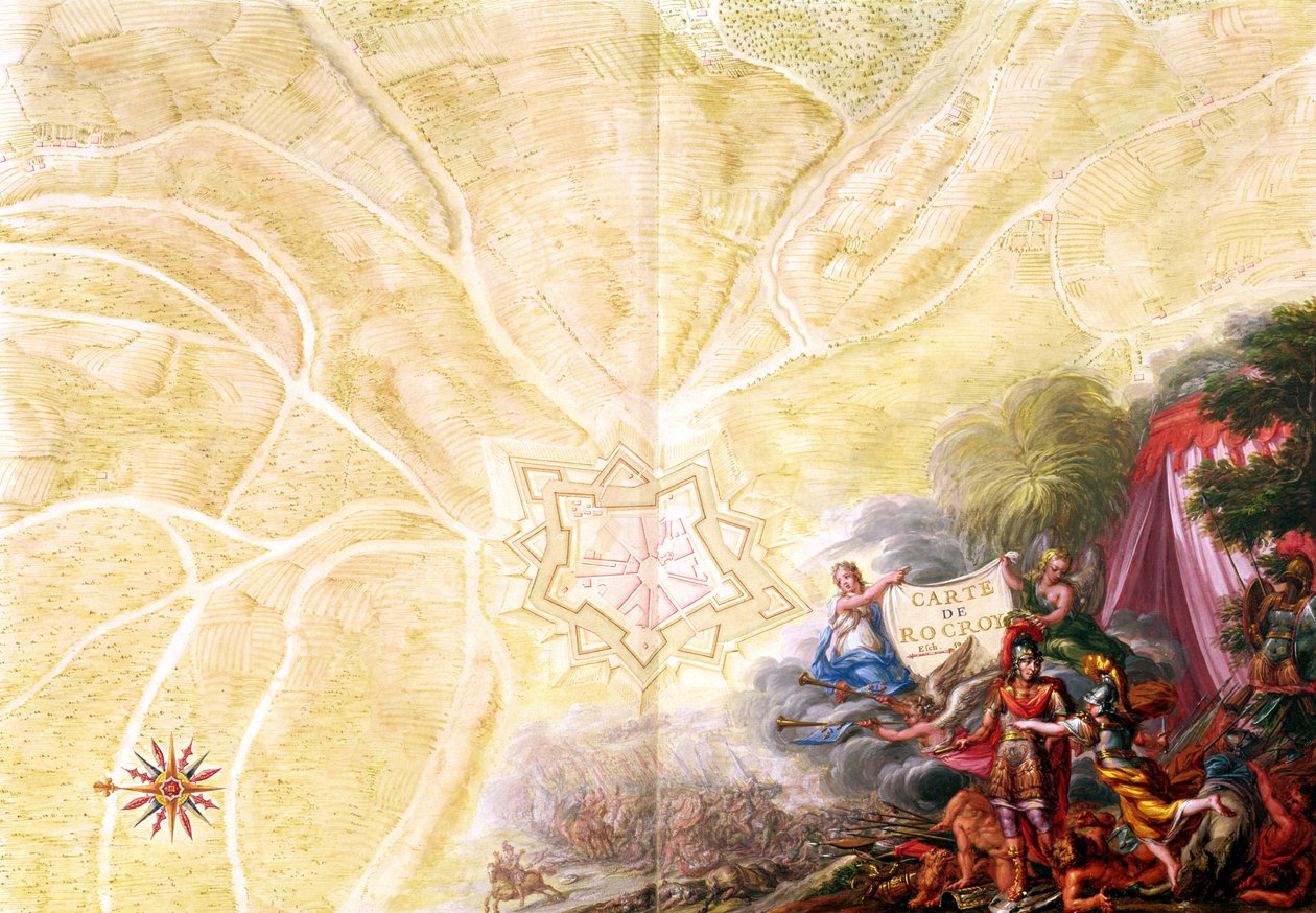
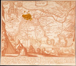
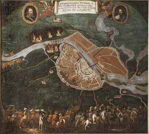
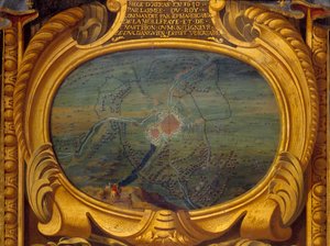
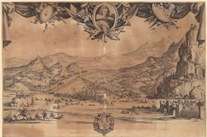
Ms 988 Volume 3 fol. 14, Map of Rocroi, from ’Atlas de Louis XIV’, 1683-88 by Sebastien Le Prestre de Vauban

Ms 988 Volume 3 fol. 14, Map of Rocroi, from ’Atlas de Louis XIV’, 1683-88

(Ms 988 Tome 3 fol.14 Map of Rocroi, from 'Atlas de Louis XIV', 1683-88 )


Sebastien Le Prestre de Vauban

€ 133.83
Tax-free
   Configure art print
1688  ·  Gouache on paper  ·  Image ID: 91256

Nonclassified artists  ·  Cartography

Ms 988 Volume 3 fol. 14, Map of Rocroi, from ’Atlas de Louis XIV’, 1683-88 by Sebastien Le Prestre de Vauban. Available as an art print on canvas, photo paper, watercolor board, natural paper, or Japanese paper.
carte de · plan · compass · aerial view · soldiers · thirty years war · franco-swedish period · france · bastion · fort · fortress · Min. Defense - Service Historique de l'Armee de Terre,France / Bridgeman Images
AR/3D   View in 3D / AR zu Favoriten hinzufügen   Add to favorites    Change wall color    View picture in a room
0 Reviews

Configure art print

Picture Frame

Medium & Stretcher

Glass & Passepartout

Miscellaneous & Extras

 Save / compare configuration
Preview Icon

Summary

Gemälde
Veredelung
Keilrahmen
Museumslizenz

€ 133.83
(inkl. 20% MwSt)
   Add to cart

Bildschärfe: PERFEKT

If you'd like us to adjust the brightness, colors, or crop the image, we're happy to do this for you at no extra cost. Just get in touch!

Similar artworks selected for you

Map of Saint-Quentin, from the Plan and Map of Toulon, from the Ms. 987, Vol.2 fol.63 Plan of Toulon, from the Plan of Le Havre, from the Plan and Map of Saint-Jean-Pied-de-Port, from the Atlas Louis XIV, 1683-88 Map of the Environs of the Town and Castle of Oléron, from the Atlas of Louis XIV Naval battle between the Turkish and Venetian fleets in 1661 Siege of Mons by the Allied Troops in 1709, early 18th century Siege of Mons by the Allied Troops in 1709 Map of the town and citadel of Bellisle, from the Louis XIV Atlas, map of Collioure The Conquest of Friedrichstadt on February 12, 1713 Capture of the Fortress of Audenarde by the Allied Troops in 1708 Capture of the Fortress of Audenarde by the Allied Troops in 1708, early 18th century Plan and Map of the Town and Citadel of Bayonne, from the Ms. 988 Vol.3, fol.61 The Battle of Novgorod Map of Concarneau, from the Sitting from the Rochelle from 10/08/1627 to 28/10/1628, Musée de Versailles. Siege and Attack Tactics in Clashes Between Natives and Conquerors Marco Polo The City of Valenciennes Thirty Years An imaginary map of Czartorysk Map of the east coast of North America The city of Makassar, held by the Portuguese and taken by the Dutch in 1660 Techniques of Siege and Attack, from Americae Tertia Pars Battle of Avigliano Siege of La Rochelle, 10th August 1627-28th October 1628
Show more similar artworks

More art prints by Sebastien Le Prestre de Vauban

Ms. 986, Vol. 1, Ms. 986, Vol. 1, Plan and Map of Cambrai, from the “Atlas Louis XIV”, 1683-88 Ms 988, volume 3, fol. 45, plan and map of the town and citadel of Bayonne, from the Ms 988 Vol. 3 fol. 29, Map and plan of Saint-Malo, from the Square Fort in Antibes, Fortification by Vauban (17th Century) Ms. 986, Vol. 3, fol. 63 Plan and Map of Toulon, from the “Atlas Louis XIV”, 1683-88 Ms 988 volume 3 fol. 33 Map of the town and citadel of Belle-Île, from the “Atlas Louis XIV”, 1683-88 Map of Paris and its Surroundings, from Ms. 988 Vol. 3, fol. 61 Ms. 988, Vol.3 fol.10 Map of Saint-Quentin, from the ’Atlas Louis XIV’, 1683-88 Ms. 988, Volume 3, fol. 39: Map of the town and citadel of Saint-Martin, Île de Ré, from the „Atlas Louis XIV“, 1683-88 Ms. 988, Vol. 3, fol. 7 Plan and Map of the Town, Citadel and Surroundings of Amiens, from the ’Atlas Louis XIV’, 1683-88 Ms 988 volume 3 fol.31 Map of Concarneau, from the ’Atlas Louis XIV’, 1683-88 Map of the Environs of the Town and Castle of Oléron, from the Atlas of Louis XIV Frontispiece to
Show more works by Sebastien Le Prestre de Vauban

More motifs from the category Cartography

Map of the world, Map of France depicting the departmental divisions, 1798 Loggan Map of Sixteenth-Century France, from the Map of Madras at the time of the capture of the town and Fort of St. George in 1746 by the French under the command of Mahé de la Bourdonnais, 1750 Iceland, from an Atlas of the World in 33 maps, Venice, 1st September 1553 (detail from 330951) Map of Cambrai, from ’Civitates Orbis Terrarum’ by Georg Braun (1541-1622) and Frans Hogenberg (1535-90), c. 1572 Map of the China Sea, from a facsimile of the Miller Atlas by Pedro and Jorge Reinel, and Lopo Homem, made in 1519 Map of Trento, from Les Villes de Venetie, 1704, published by Pierre Mortier in Amsterdam Map of Southern Italy, Corsica, and Sardinia known in Ancient Times as Great Greece or Magna Graecia, early 18th century Map of Crompond, from ’Guerre de l’Amerique’, 1782 Map of Visby, from ‘Civitates Orbis Terrarum’ by Georg Braun (1541-1622) and Frans Hogenberg (1535-90), c.1572-1617 Fol. 7v: Map of the North Pole, from Map of Alexandria from “Civitates Orbis Terrarum Coloniae Agrippinae”, 1572 Map of Aleppo, c. 1600
View More from "Cartography"

A selection of our top sellers

Cypress Road under the Starry Sky Luncheon on the Grass Cosmic Cliffs in the Carina Nebula (NIRCam Image) The Luncheon: Monet The Great Wave off Kanagawa, c. 1830 Poor Little Bear!, 1912 Camelot, illustration from Woman on the Beach, 1908 Munich Beer Garden Vassilissa in the Forest, illustration from the Russian folk tale, The Destruction of an Empire The Dream of the Fisherman Blooming Cherry Tree Composition, 1930 Seascape near Les Saintes-Maries-de-la-Mer
Show more artworks


What our customers think about us


Frequently Asked Questions about Meisterdrucke


Personalizing your art print at Meisterdrucke is simple and intuitive: Choose a frame, set the image size, pick a printing medium, and add suitable glazing or a stretcher frame. We also offer additional customization options like mats, fillets, and spacers. If you have any questions, our customer service team is ready to help you create your perfect artwork.

At Meisterdrucke, you can visualize your configured artwork directly in your own room. Simply upload a photo of your space and see how the artwork looks in it. If you're visiting us on a mobile device — phone or tablet — our augmented reality feature brings the picture to life and projects it right into your room. A unique experience that combines art and technology.

Choosing the right medium is often a matter of personal taste. To give you a better idea, we've provided some images for each medium. We also offer a sample set of all paper variants, so you can decide not just visually but by touch as well. You can order the sample set free of charge — only shipping costs apply.

Don't worry! At Meisterdrucke, we don't just process orders mechanically. Every order is manually reviewed by our team. If we spot any inconsistencies or issues with your configuration, we'll get in touch with you right away. And of course, our friendly and patient support team is always here to help you with your configuration. We'll work with you by phone or email to adjust your image so the final result is exactly what you had in mind.


Still have questions?

Are you interested in an art print from our manufactory but still unsure? Do you need advice on choosing the medium or help with the order?

Our experts are happy to assist you.

+43 4257 29415
support@meisterdrucke.com

Mo-Do: 7:00 - 16:00 | Fr: 7:00 - 13:00

Still have questions?

Are you interested in an art print from our manufactory but still unsure? Do you need advice on choosing the medium or help with the order?

Our experts are happy to assist you.

+43 4257 29415
support@meisterdrucke.com
Mo-Do: 7:00 - 16:00 | Fr: 7:00 - 13:00


Meisterdrucke

   Kärntner Strasse 46
        9586 Finkenstein am Faaker See
        Austria
        +43 4257 29415
        support@meisterdrucke.com
Other languages

                   
Erfahrungen & Bewertungen zu Meisterdrucke
Post.at DHL Express Quehenberger Cargoboard
Kaiser Franz Joseph

Meisterdrucke
Kärntner Strasse 46
9586 Finkenstein am Faaker See · Austria
+43 4257 29415 · support@meisterdrucke.com
Post.at DHL Express Quehenberger Cargoboard


(c) 2026 meisterdrucke.us