support@meisterdrucke.com  ·  0043 4257 29415

Deutsch English Italiano Español Français Nederlands Português Svenska Polski Dansk
Search by artist, work title or style – e.g. Monet, Starry Night, Impressionism, Hokusai wave, nude. Describe the scene – e.g. green meadow, abstract with lots of red, dark oil painting, standing nude next to a tree.

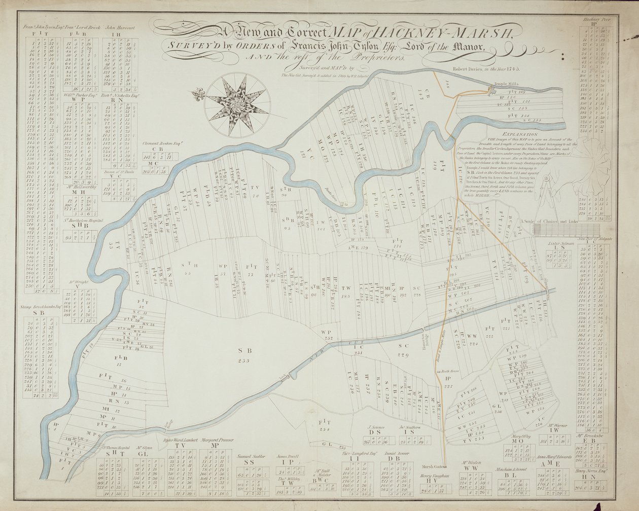
A New and Correct Map of Hackney Marsh, 1745 by Robert Davies

A New and Correct Map of Hackney Marsh, 1745

(A New and Correct Map of Hackney Marsh, 1745 )


Robert Davies

€ 119.08
Tax-free
   Configure art print
1745  ·  lithograph  ·  Image ID: 155389

Nonclassified artists  ·  Cartography

A New and Correct Map of Hackney Marsh, 1745 by Robert Davies. Available as an art print on canvas, photo paper, watercolor board, natural paper, or Japanese paper.
north east london · plan · city · owners · proprietor · river · marshes · river lea · new cut · Lee navigation · Private Collection / Bridgeman Images
AR/3D   View in 3D / AR zu Favoriten hinzufügen   Add to favorites    Change wall color    View picture in a room
0 Reviews

Configure art print

Picture Frame

Medium & Stretcher

Glass & Passepartout

Miscellaneous & Extras

 Save / compare configuration
Preview Icon

Summary

Gemälde
Veredelung
Keilrahmen
Museumslizenz

€ 119.08
(inkl. 20% MwSt)
   Add to cart

Bildschärfe: PERFEKT

If you'd like us to adjust the brightness, colors, or crop the image, we're happy to do this for you at no extra cost. Just get in touch!

Similar artworks selected for you

Map of Willesden, London (litho) A Topographical Sketch of New York A survey of the Kings lordship or manor of East Greenwich Map of Willesden, London Map of Yorktown, Virginia, October 1781 Draft for the Park Layout at the Future Royal Residence in Christiania Map of Hoogly River Map of the Parish or Borough of Leeds Plan of Faux Hall [now Vauxhall] manor, in Lambeth, co. Surrey Map of Leeds, surveyed by John Tuke Fireman Battle of Camden, Augt. 16 Battle of Green Spring, Map of the Land on the Left Bank of the James River Opposite Jamestown in Virginia Where the Battle of July 6 Map of Lismore, Ireland Waller County, Texas Manhattan Island from the Battery to Above Turtle Bay Map for the Battle of Austerlitz, December 2nd, 1805 Vicinity of Harpers Ferry Section of the Northern Course of the Canal from the Tide in the Elk River at Frenchtown to the Forked [Oak] in Mr. Rudulph Map of Amsterdam and Surrounding Areas Captain Snow A Plan of New York Island, and Part of Long Island, with the Surrounding Country St. Helen Map of the mouth of the Chicago River, Illinois with the plan of the proposed piers for improving the harbour, 1830 Plan of the proposed navigable canal between river Kennet at Newbury in Berks and river Avon in Somerset: whereby a navigable communication will be opened between London and Bristol [also] Wilts & Berks & Somerset Coal Canals, surveyed by John Rennie The map is hand-drawn (ca 1780) and shows Telemark A Map of Manhattanville Situated on York Island 1870 Copy of Map from 1599 of Haarlem Bleachfields Near Bloemendaal Map of Ivry and the surrounding area
Show more similar artworks

Similar artworks selected for you

Map of Willesden, London (litho) A Topographical Sketch of New York A survey of the Kings lordship or manor of East Greenwich Map of Willesden, London Map of Yorktown, Virginia, October 1781 Draft for the Park Layout at the Future Royal Residence in Christiania Map of Hoogly River Map of the Parish or Borough of Leeds Plan of Faux Hall [now Vauxhall] manor, in Lambeth, co. Surrey Map of Leeds, surveyed by John Tuke Fireman Battle of Camden, Augt. 16 Battle of Green Spring, Map of the Land on the Left Bank of the James River Opposite Jamestown in Virginia Where the Battle of July 6 Map of Lismore, Ireland Waller County, Texas Manhattan Island from the Battery to Above Turtle Bay Map for the Battle of Austerlitz, December 2nd, 1805 Vicinity of Harpers Ferry Section of the Northern Course of the Canal from the Tide in the Elk River at Frenchtown to the Forked [Oak] in Mr. Rudulph Map of Amsterdam and Surrounding Areas Captain Snow A Plan of New York Island, and Part of Long Island, with the Surrounding Country St. Helen Map of the mouth of the Chicago River, Illinois with the plan of the proposed piers for improving the harbour, 1830 Plan of the proposed navigable canal between river Kennet at Newbury in Berks and river Avon in Somerset: whereby a navigable communication will be opened between London and Bristol [also] Wilts & Berks & Somerset Coal Canals, surveyed by John Rennie The map is hand-drawn (ca 1780) and shows Telemark A Map of Manhattanville Situated on York Island 1870 Copy of Map from 1599 of Haarlem Bleachfields Near Bloemendaal Map of Ivry and the surrounding area
Show more similar artworks

More motifs from the category Cartography

Cyclorama fold out map detailing the History of the Great Rebellion, c.1870 Map of the Siege of Mantua, published by William Blackwood and Sons, Edinburgh and London, 1848 Fol. 34v, Map of Australia, from Map of the Paris to St. Germain Railway, by A. M. Perrot, 26th August 1837 An Arab Trader on a Camel, detail from a Renaissance map of Europe, after Jacopo Russo, 1528 Fol. 39v Map of the Magellan Straits, from “Cosmographie Universelle”, 1555 A Map of Marylebone, London, 1746 Map showing the localities of the Indian tribes of the US in 1833, illustration from Map of the mouth of the Chicago River, Illinois with the plan of the proposed piers for improving the harbour, 1830 Map of Central Asia, 1834 Van Diemen’s Island or Tasmania, from a Series of World Maps published by John Tallis and Co., London and New York, 1850s Scott Map of the Battle of Marengo, published by William Blackwood and Sons, Edinburgh and London, 1848 German Map Showing the Extent of Surface Area and Population of the Principal Countries of Europe, c. 1785 Map of Paris, from the Atlas de Paris by Jean de la Caille, 1714
View More from "Cartography"

More motifs from the category Cartography

Cyclorama fold out map detailing the History of the Great Rebellion, c.1870 Map of the Siege of Mantua, published by William Blackwood and Sons, Edinburgh and London, 1848 Fol. 34v, Map of Australia, from Map of the Paris to St. Germain Railway, by A. M. Perrot, 26th August 1837 An Arab Trader on a Camel, detail from a Renaissance map of Europe, after Jacopo Russo, 1528 Fol. 39v Map of the Magellan Straits, from “Cosmographie Universelle”, 1555 A Map of Marylebone, London, 1746 Map showing the localities of the Indian tribes of the US in 1833, illustration from Map of the mouth of the Chicago River, Illinois with the plan of the proposed piers for improving the harbour, 1830 Map of Central Asia, 1834 Van Diemen’s Island or Tasmania, from a Series of World Maps published by John Tallis and Co., London and New York, 1850s Scott Map of the Battle of Marengo, published by William Blackwood and Sons, Edinburgh and London, 1848 German Map Showing the Extent of Surface Area and Population of the Principal Countries of Europe, c. 1785 Map of Paris, from the Atlas de Paris by Jean de la Caille, 1714
View More from "Cartography"

A selection of our top sellers

Reclining Female Nude The Guardian of Paradise Port Light Stag Beetle Ball at the Moulin de la Galette Atlantic Roll, 1895 In the Grey, 1919 Composition C; Composition No. III; Composition with Red, Yellow A Corner of the Garden at Montgeron, 1876-7 Reclining Nude, 1917-18 Composition No. VII, 1913 Lunch - The Soup, Version II, 1910 The Birth of Venus Meadows near Greifswald Woman with Parasol Turned to the Left, 1886
Show more artworks

A selection of our top sellers

Reclining Female Nude The Guardian of Paradise Port Light Stag Beetle Ball at the Moulin de la Galette Atlantic Roll, 1895 In the Grey, 1919 Composition C; Composition No. III; Composition with Red, Yellow A Corner of the Garden at Montgeron, 1876-7 Reclining Nude, 1917-18 Composition No. VII, 1913 Lunch - The Soup, Version II, 1910 The Birth of Venus Meadows near Greifswald Woman with Parasol Turned to the Left, 1886
Show more artworks


What our customers think about us


Frequently Asked Questions about Meisterdrucke


Personalizing your art print at Meisterdrucke is simple and intuitive: Choose a frame, set the image size, pick a printing medium, and add suitable glazing or a stretcher frame. We also offer additional customization options like mats, fillets, and spacers. If you have any questions, our customer service team is ready to help you create your perfect artwork.

At Meisterdrucke, you can visualize your configured artwork directly in your own room. Simply upload a photo of your space and see how the artwork looks in it. If you're visiting us on a mobile device — phone or tablet — our augmented reality feature brings the picture to life and projects it right into your room. A unique experience that combines art and technology.

Choosing the right medium is often a matter of personal taste. To give you a better idea, we've provided some images for each medium. We also offer a sample set of all paper variants, so you can decide not just visually but by touch as well. You can order the sample set free of charge — only shipping costs apply.

Don't worry! At Meisterdrucke, we don't just process orders mechanically. Every order is manually reviewed by our team. If we spot any inconsistencies or issues with your configuration, we'll get in touch with you right away. And of course, our friendly and patient support team is always here to help you with your configuration. We'll work with you by phone or email to adjust your image so the final result is exactly what you had in mind.


Still have questions?

Are you interested in an art print from our manufactory but still unsure? Do you need advice on choosing the medium or help with the order?

Our experts are happy to assist you.

+43 4257 29415
support@meisterdrucke.com
Mo-Do: 7:00 - 16:00 | Fr: 7:00 - 13:00

Still have questions?

Are you interested in an art print from our manufactory but still unsure? Do you need advice on choosing the medium or help with the order?

Our experts are happy to assist you.

+43 4257 29415
support@meisterdrucke.com
Mo-Do: 7:00 - 16:00 | Fr: 7:00 - 13:00


Meisterdrucke

   Kärntner Strasse 46
        9586 Finkenstein am Faaker See
        Austria
        +43 4257 29415
        support@meisterdrucke.com
Other languages

                   
Erfahrungen & Bewertungen zu Meisterdrucke
Post.at DHL Express Quehenberger Cargoboard
Kaiser Franz Joseph

Meisterdrucke
Kärntner Strasse 46
9586 Finkenstein am Faaker See · Austria
+43 4257 29415 · support@meisterdrucke.com
Post.at DHL Express Quehenberger Cargoboard


(c) 2026 meisterdrucke.us