support@meisterdrucke.com  ·  0043 4257 29415

Deutsch English Italiano Español Français Nederlands Português Svenska Polski Dansk
Search by artist, work title or style – e.g. Monet, Starry Night, Impressionism, Hokusai wave, nude. Describe the scene – e.g. green meadow, abstract with lots of red, dark oil painting, standing nude next to a tree.

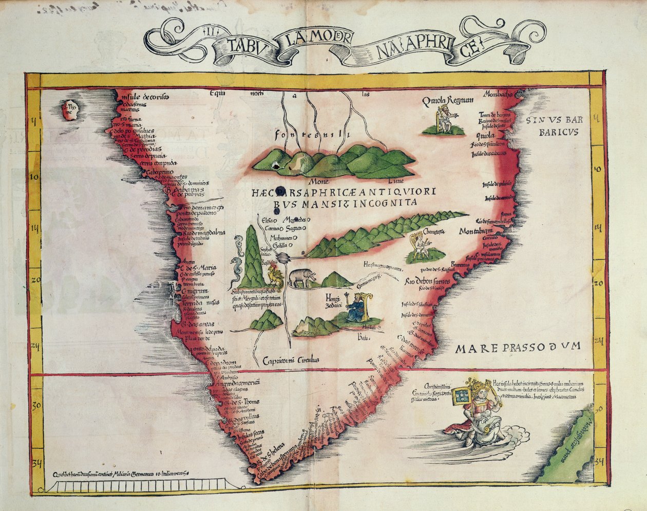
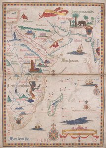
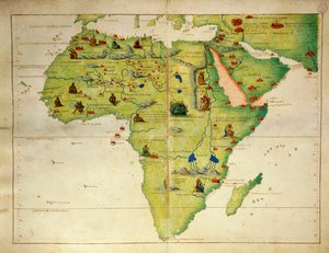
Map of Southern Africa, published in Strasbourg in 1522 by Ptolemy

Map of Southern Africa, published in Strasbourg in 1522

(Map of Southern Africa, published in Strasbourg in 1522 )


Ptolemy

€ 120.59
Tax-free
   Configure art print
1522  ·  coloured engraving  ·  Image ID: 192633

Ancient Art  ·  Cartography

Map of Southern Africa, published in Strasbourg in 1522 by Ptolemy. Available as an art print on canvas, photo paper, watercolor board, natural paper, or Japanese paper.
south · cape of good hope · mozambique · african · elephant · snake · detail · hills · mountains · hill · mountain · kings · thrones · latin · geography · Bibliotheque des Arts Decoratifs, Paris, France / Bridgeman Images
AR/3D   View in 3D / AR zu Favoriten hinzufügen   Add to favorites    Change wall color    View picture in a room
0 Reviews

Configure art print

Picture Frame

Medium & Stretcher

Glass & Passepartout

Miscellaneous & Extras

 Save / compare configuration
Preview Icon

Summary

Gemälde
Veredelung
Keilrahmen
Museumslizenz

€ 120.59
(inkl. 20% MwSt)
   Add to cart

Bildschärfe: PERFEKT

If you'd like us to adjust the brightness, colors, or crop the image, we're happy to do this for you at no extra cost. Just get in touch!

Similar artworks selected for you

Map of North Africa and West Africa, published in Strasbourg in 1522 Argentina, Chile, Strait of Magellan, Land of Fire, in Gold Yielding Regions of Peru, Volume VII, Atlas Maior, by Joan Blaeu South Africa, in Map of the gold-bearing regions in Peru, from the Atlas Maior, Sive Cosmographia Blaviana, 1662 The Red Sea and Arabia Gulf to the supposed Malay Peninsula, from a Strassburg edition of Ptolemy Harbor of Palos, by Abraham Ortelius (1528-1598), Plate The Continent of Africa, from an Atlas of the World in 33 Maps, Venice, 1st September 1553 Brazil and Peru Tabula Magellanica: Map of Strait of Magellan Map of Florida, from New and Accurate Map of the Bishoprics of Stavanger and Bergen Chart of the English Channel Illustration from the Queen Mary Atlas Southern India and Sri Lanka Port of Palos in Andalusia, from Theatrum Orbis Terrarum by Abraham Ortelius Map of South America, 1593 Africa, from Atlas of the World in thirty-three Maps 1513 map of West and North Africa Coast of North Carolina (detail) Mar del Zur Map of New Belgium and New England Map of the Coast of Africa and the River Gambia, 1622 Map of Colombia and Peru. 1590. Territory of Treviso, Veneto region, Italy by Willem Janszoon Blaeu Cape Finisterre after the portulan of Luca J. Waghenaer tresoor de zeevaert, Leiden 1592 South America America Meridionalis: from the Atlas of Gerardus Mercator, 1633, 1936 Andalusia, Spain (engraving) Map Engraved by Bellin After Earlier Voyages
Show more similar artworks

More art prints by Ptolemy

Ulm Ptolemy World Map Map of the World, Based on Descriptions and Co-ordinates Given in Map of the Known World, from „Geographia“ Map Depicting North Africa, from an Atlas by Ptolemy, 1st Half of the 16th Century Map of the world, 1486 Ms Lat 463 f.111v-112r Map of Phoenicia, Mesopotamia and Babylon Ms. Lat. 463, fol. 81v-82r, Map of Gaul, Belgium, Lyon and Aquitaine Map of North Africa and West Africa, published in Strasbourg in 1522 Map of Spain and Portugal, from “Geographia” Map of the British Isles, from “Geographia” Map of Central Europe, 1486 (detail of 157909) Map of the world, based on descriptions and coordinates given in Map of Africa, plate 18 from an Atlas of the World, 1486 Map of Southern Africa, published in Strasbourg in 1522 Map of France, from
Show more works by Ptolemy

More motifs from the category Cartography

Map of the Battle of Laon, published by William Blackwood and Sons, Edinburgh and London Renaissance map of Europe, Jacopo Russo (after), 1528 Maps Made during the Voyage of a Vietnamese Embassy to China Map of the World using the Mercator Projection, from Map of Spain and Portugal, 1731 City Map of Jerusalem in the 1890s, from Map of Central Asia Double Hemisphere World Map, 1587 Map of Mexico or New Spain, 1625 Map of Barth, from MS W.658 fol.304v Map of the Nile from the Kitab-I Bahriye A Map of Clerkenwell, City of London, 1746 Miniature Nautical Map of the Mediterranean, 1584 Plan and map of the town and citadel of Mont-Louis, 1776 Map of the Gujarat state of India, published under the direction of Colonel J.T. Walker, Surveyor General of India
View More from "Cartography"

A selection of our top sellers

The Temptation of St. Anthony, right-hand panel, detail of a couple riding a fish Oak Grove, 1887 After the Ball The Sailing Boat, Evening Effect, 1885 Water Lilies ("Yellow Nirvana") Supper at Emmaus Poppies Women from Galicia at the Window, c. 1655-1660 Beat the Whites with the Red Wedge, Poster, 1920 Bear in Snow, 1940 The Carpet Merchant The Garden of Earthly Delights, 1490-1500 The Yellow Books, 1887 Suprematist Composition: White on White, 1918 Hammamet, 1914
Show more artworks


What our customers think about us


Frequently Asked Questions about Meisterdrucke


Personalizing your art print at Meisterdrucke is simple and intuitive: Choose a frame, set the image size, pick a printing medium, and add suitable glazing or a stretcher frame. We also offer additional customization options like mats, fillets, and spacers. If you have any questions, our customer service team is ready to help you create your perfect artwork.

At Meisterdrucke, you can visualize your configured artwork directly in your own room. Simply upload a photo of your space and see how the artwork looks in it. If you're visiting us on a mobile device — phone or tablet — our augmented reality feature brings the picture to life and projects it right into your room. A unique experience that combines art and technology.

Choosing the right medium is often a matter of personal taste. To give you a better idea, we've provided some images for each medium. We also offer a sample set of all paper variants, so you can decide not just visually but by touch as well. You can order the sample set free of charge — only shipping costs apply.

Don't worry! At Meisterdrucke, we don't just process orders mechanically. Every order is manually reviewed by our team. If we spot any inconsistencies or issues with your configuration, we'll get in touch with you right away. And of course, our friendly and patient support team is always here to help you with your configuration. We'll work with you by phone or email to adjust your image so the final result is exactly what you had in mind.


Still have questions?

Are you interested in an art print from our manufactory but still unsure? Do you need advice on choosing the medium or help with the order?

Our experts are happy to assist you.

+43 4257 29415
support@meisterdrucke.com

Mo-Do: 7:00 - 16:00 | Fr: 7:00 - 13:00

Still have questions?

Are you interested in an art print from our manufactory but still unsure? Do you need advice on choosing the medium or help with the order?

Our experts are happy to assist you.

+43 4257 29415
support@meisterdrucke.com
Mo-Do: 7:00 - 16:00 | Fr: 7:00 - 13:00


Meisterdrucke

   Kärntner Strasse 46
        9586 Finkenstein am Faaker See
        Austria
        +43 4257 29415
        support@meisterdrucke.com
Other languages

                   
Erfahrungen & Bewertungen zu Meisterdrucke
Post.at DHL Express Quehenberger Cargoboard
Kaiser Franz Joseph

Meisterdrucke
Kärntner Strasse 46
9586 Finkenstein am Faaker See · Austria
+43 4257 29415 · support@meisterdrucke.com
Post.at DHL Express Quehenberger Cargoboard


(c) 2026 meisterdrucke.us