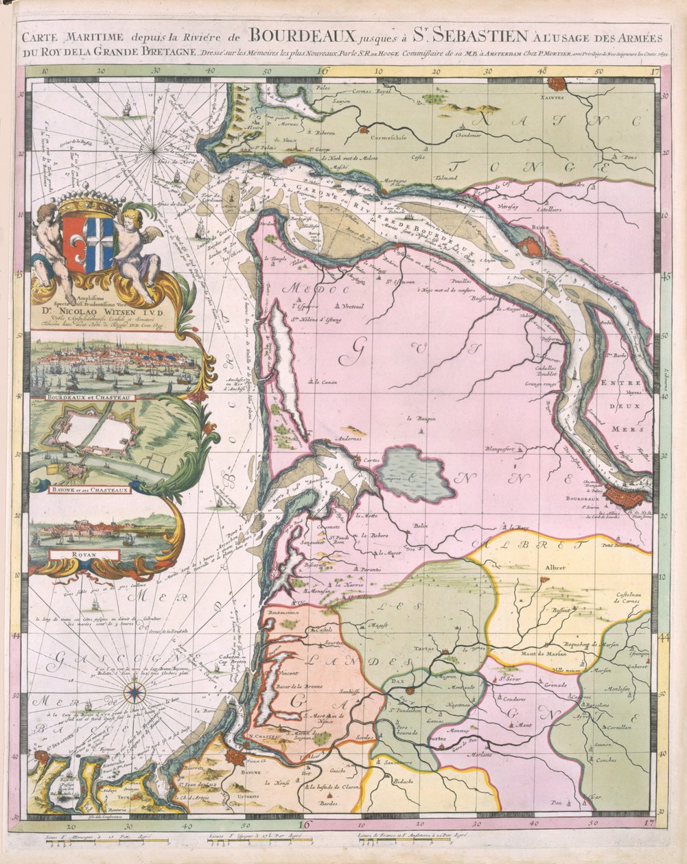
La Naptune Francois, ou Atlas des Cartes Marines, 1693 by Pierre Mortier

La Naptune Francois, ou Atlas des Cartes Marines, 1693

(La Naptune Francois, ou Atlas des Cartes Marines, 1693 )


Pierre Mortier

€ 112.91
Enthält 0% MwSt.
   Configure art print
1693  ·  colour lithograph  ·  Picture ID: 108161

Nonclassified artists  ·  Cartography

La Naptune Francois, ou Atlas des Cartes Marines, 1693 by Pierre Mortier. Available as an art print on canvas, photo paper, watercolor board, uncoated paper or Japanese paper.
maps · mapping · cartography · french coast · coastline · coastal · plans · plan · invasion · northern · bordeaux · crest · coat of arms · cartouche · Private Collection / Bridgeman Images
AR/3D   View in 3D / AR zu Favoriten hinzufügen   Add to favorites    Select wall color    View painting in a room
0 Reviews

Configure art print

Picture Frame

Medium & Stretcher

Glass & Passepartout

Miscellaneous & Extras

 Save / compare configuration
Preview Icon

Summary

Gemälde
Veredelung
Keilrahmen
Museumslizenz

€ 112.91
(inkl. 20% MwSt)
   Add to cart

Bildschärfe: PERFEKT

Should you desire adjustments to brightness and color, or a custom crop of the motif, we are happy to make these changes at no additional cost to you. Please do not hesitate to contact us.

Similar artworks selected for you

America, plate 17 from The coast of England from the Southforeland to Orfordness Cliuia Ducatus et Rauestein Dominium Tertia pars Brabantiae: qua continetur Marchionat. SRI horum urbs primaria Antuerpia / ex archetypo Michaelis Florenty a Langren Biscaia and Guipuscoa, Part of Ancient Cantabria Map of the Margraviate of Brandenburg (Germany) (etching) Map of the Zuiderzee and the Wadden Sea Taurica Chersonesus, Today Called Perekop and Gazar Accurate Map of the Upland Shears with the Situation and Area around the Royal Swedish Capital and Resident City of Stockholm, c.1740 Map of the Persian Empire Based Mainly on the Geographical Writings of Arabs and Persians by Adriaan Reland Hungarian War Theatre Mecklenburg-Vorpommern, Berlin, Brandenburg, Germany New Drawing of the Island of Rügen and the Stralsund as well as the City of Stralsund and the New Deep with All Its Situations in Large with Privilege Map of Quebec, Canada Map of the Mediterranean with allegorical figures and sea monsters embellishing the insets A Chart of the East Coast of Scotland from a Sea-Atlas Containing an Hydrographical Description of Most of the Sea-Coasts of the Known Parts of the World by Samuel Thornton, 1707 (hand coloured print) Map of the Holy Land New and Exact Description of the County of Wertheim and Neighboring Regions Map of the Province of Groningen, Netherlands Map of Russia From: Theatrum Orbis Terrarum Netherlands (engraving) Congo, Central Africa (engraving) Map of Friesland Friesland, Groningen, Netherlands Map of Estonia and Livonia Duchy of Schleswig Northern Part Argow with Southern Part of Zurichgow Map of Holland, Showing Settlements, Marshes, Woodlands, Hills, Roads, Rivers and Other Geographical Features, c.1710 Map of Holland, showing settlements, marshes, woodlands, hills, roads, rivers and other geographical features. Shows title in a decorative cartouche to the upper left with Fame, Neptune and Thetis accompanied by putti bearing the arms of the United Provinc
Show more similar artworks

Other art prints by Pierre Mortier

A three-masted Galleass under way by sail, oars shipped, from A Brigantine Giving Chase to a Felucca, and About to Board Her, from A three-masted Galleass under way by oar, from Le Neptune Francois, c.1693-1700 British Navy: a first-rate ship flying the White Ensign; three-decker with Admiral Section through a French first-rate ship of 104 cannon, from Royal (flagship) of the English fleet, flying the Royal Standard, from Map of Padua, from Map of Rovigo, from Map of Treviso, from Galley Under Sail, Flying Standard of the Commander of the Squadron, from Map of Belluno, from Map of Trento, from Map of Verona, from Map of Serravalle, from Types of Shipping: a Double-Masted Galley: Section Through, from
Discover more works by Pierre Mortier

Other motives from the category Cartography

Map of the Kingdom of Scotland, 17th century Scotia Regnum Londinium Antiqua, map of London, published by William Darton, 1563 New Comic Map of London Map of the Middle East, from Theatrvm Orbis Terrarvm, 1570 Map of the city of Siam, capital of the kingdom of that name after a survey done by a French engineer in 1687, published in the 1751 edition of Histoire Generale des Voyages by Antoine Prevost Map of Vienna, published by Klimsch und Co., Frankfurt, c.1860 Map of Central Europe, from Loggan Map showing the route of the Armada fleet, engraved by Augustine Ryther, 1588 Plan of the enclosed gardens and Chateau de Gaillon, from Battle of Waterloo, Map of the Battlefield, Engraved by Jacowick, 1816 The City of Jerusalem and the surrounding area, detail from the Madaba mosaic map, Byzantine, 6th century Map of Great Britain, Europe and North West Africa, from Portugaliae Monumenta Cartographica, an Account of the Discoveries of Fernao Gomez from 1470-75 A Map of Clerkenwell, City of London, 1746 Map of the Archbishopric and Electorate of Mainz, c. 1695
View More from "Cartography"

Excerpt from our top sellers

Flower Still Life on a Marble Ledge The Convalescent. 1888 Reclining Nude Woman on White Cushion The Harvesters Hygieia Several Circles Newt Pond Circe Offering the Cup to Ulysses, 1891 The Great Wave off Kanagawa The Magpie Geranium, Mexico City Schlemmer, Oskar View of El Castillo, 1844 View on Delft The Dream
Show More Artworks


What our customers think about us


Frequently Asked Questions about Meisterdrucke


Personalizing your art print at Meisterdrucke is a simple and intuitive process that allows you to design an artwork exactly to your specifications: Choose a frame, determine the image size, decide on a printing medium, and add suitable glazing or a stretcher frame. We also offer customization options such as mats, fillets, and spacers. Our customer service is available to help you design your perfect artwork.

At Meisterdrucke, you have the fascinating option to visualize the artwork you configured directly in your own space. For a tailored preview, simply upload a photo of your room and let the artwork appear on it. If you visit us via a mobile device, be it a phone or tablet, our augmented reality feature brings the image to life and seamlessly projects it into your space. An experience that uniquely combines art and technology.

Choosing the medium is often a matter of personal taste. To give you a clearer idea, we have provided some images for each medium. For a holistic experience, we also offer you a sample set of all paper variants so you can make a decision not just visually but also haptically. You can take advantage of the sample set free of charge – only the shipping costs will apply. You can order the sample set directly.

Do not worry. At Meisterdrucke, we do not proceed mechanically. We manually review each order. If there are any inconsistencies or peculiarities in the configuration, we will immediately contact you. Of course, our courteous and patient support is always at your side to assist you with the configuration. Together with you, we adjust your image by phone or email so that the final result exactly meets your expectations.


Do you have any questions?

Are you interested in an art print from our manufactory but still unsure? Do you need advice on choosing the medium or help with the order?

Our experts are happy to assist you.

+43 4257 29415
support@meisterdrucke.com
Mo-Do: 7:00 - 16:00 | Fr: 7:00 - 13:00

Do you have any questions?

Are you interested in an art print from our manufactory but still unsure? Do you need advice on choosing the medium or help with the order?

Our experts are happy to assist you.

+43 4257 29415
support@meisterdrucke.com
Mo-Do: 7:00 - 16:00 | Fr: 7:00 - 13:00


Meisterdrucke

   Kärntner Strasse 46
        9586 Finkenstein am Faaker See
        Austria
        +43 4257 29415
        support@meisterdrucke.com
Other languages

                   
Erfahrungen & Bewertungen zu Meisterdrucke
Post.at DHL Express Quehenberger Cargoboard
Kaiser Franz Joseph

Meisterdrucke
Kärntner Strasse 46
9586 Finkenstein am Faaker See · Austria
+43 4257 29415 · office@meisterdrucke.com
Post.at DHL Express Quehenberger Cargoboard


Meisterdrucke 2707 Bewertungen auf ProvenExpert.com

(c) 2025 meisterdrucke.us