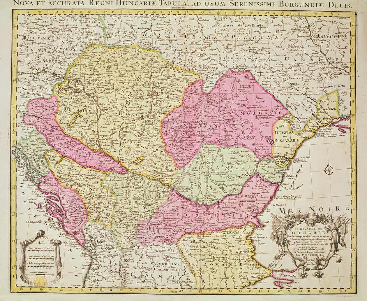
Map of the Kingdom of Hungary by Pierre Mortier

Map of the Kingdom of Hungary

(Map of the Kingdom of Hungary, 1742 (hand coloured engraving))


Pierre Mortier

€ 110.72
Enthält 0% MwSt.
   Configure art print
1742  ·  hand coloured engraving  ·  Picture ID: 130881

Nonclassified artists  ·  Cartography

Map of the Kingdom of Hungary by Pierre Mortier. Available as an art print on canvas, photo paper, watercolor board, uncoated paper or Japanese paper.
serbia · romania · bulgaria · moldavia · bosnia · croatia · transylvania · transilvania · slovakia · eastern europe · balkans · magyar · hungarian empire · states · countries · eastern european · mapping · cartography · cartouche · Private Collection / Bridgeman Images
Other color variations of this picture  
AR/3D   View in 3D / AR zu Favoriten hinzufügen   Add to favorites    Select wall color    View painting in a room
0 Reviews

Configure art print

Picture Frame

Medium & Stretcher

Glass & Passepartout

Miscellaneous & Extras

 Save / compare configuration
Preview Icon

Summary

Gemälde
Veredelung
Keilrahmen
Museumslizenz

€ 110.72
(inkl. 20% MwSt)
   Add to cart

Bildschärfe: PERFEKT

Should you desire adjustments to brightness and color, or a custom crop of the motif, we are happy to make these changes at no additional cost to you. Please do not hesitate to contact us.

Similar artworks selected for you

Map of the Kingdom of Hungary (etching) Map of the Kingdom of Hungary and the States which are United to its Crown, pub. by Jan Barend Elwe, Amsterdam, 1742 The Northriding of Yorkshire South-West Turkmenistan, Iran, West Afghanistan, West Pakistan 1744 Map of the Balkan Peninsula Centered on the Kingdom of Hungary by Johann Matthias Hase The Wiflispurgergow / Gerardo Mercatore Author Karstia, Carniola, Histria and Windic March Taurica Chersonesus, Today Called Perekop and Gazar Comitatus Darbiensis Empire of the Great Mogul Bituricum Ducatus = Duchy of Berry Map of Swabia (Germany) Baden-Württemberg, Bavaria, Germany Low Countries Map of the Iberic Peninsula, Kingdom of Portugal and Spain Description of the Eastern Empire and Surrounding Regions, under Constantine Porphyrogenitus and His Predecessors Map of the Eastern Roman Empire and Adjacent Regions During the Time of Constantine VII Porphyrogennetos and His Predecessors (8th-9th Centuries) Pyrenees Mountains and International Border Between France and Spain Showing the Mountain Passes Between the Two Countries Map of Persia Argow with Southern Part of Zurichgow The Course of the Danube from its Source to its Mouth, based on the most recent memoires of P. Coroneli and S. Sanson, Geographer to the King Sclavonia, Croatia, Bosnia and Dalmatia (Engraving) Map of Peru, Guyana, Brazil and the Amazon Regions (etching) Swabian Circle Including All Subdivided States Switzerland and Italy Regions Belgium (engraving) La Rioja, Navarre, Aragon, Catalonia, Valencian Community, Castile-La Mancha, Madrid, Castile and León, Spain Latvia, Belarus, Ukraine, Poland
Show more similar artworks

Other art prints by Pierre Mortier

A three-masted Galleass under way by sail, oars shipped, from A three-masted Galleass under way by oar, from Le Neptune Francois, c.1693-1700 British Navy: a first-rate ship flying the White Ensign; three-decker with Admiral Section through a French first-rate ship of 104 cannon, from A Brigantine Giving Chase to a Felucca, and About to Board Her, from Map of Treviso, from Map of Trento, from Map of Padua, from Map of Serravalle, from Royal (flagship) of the English fleet, flying the Royal Standard, from Map of Rovigo, from Map of Belluno, from La Naptune Francois, ou Atlas des Cartes Marines, 1693 Map of the Kingdom of Hungary The Theatre of War in Italy
Discover more works by Pierre Mortier

Other motives from the category Cartography

Map and fortifications of Neuf-Brisach Detail of Italy from the Peutinger map copy Map of the Siege of St. Jean d Atlas 131 fol.13 Map of Saintes, Capital of Saintonge, from Map of the travels of Abraham, Isaac and Jacob, 1652 Ms. 988, Tome 3, fol. 39 Map of the town and citadel of Saint-Martin, Ile de Ré, from the Map of the Battle of Marengo General Map Including Arabia, Japan, the Korean Peninsula and the Greater Part of the Indonesian Archipelago, 1631 Map of the Battle of Friedland, Published by William Blackwood and Sons, Edinburgh and London, 1848 Map of Alexander the Great The City of Jerusalem and the surrounding area, detail from the Madaba mosaic map, Byzantine, 6th century Map of Prussia and Poland, published by William Blackwood and Sons, Edinburgh and London, 1848 Map of Barth, from Map of the Battle of Aspern or Essling Map of Persia, 1638
View More from "Cartography"

Excerpt from our top sellers

Garden in Giverny The Nightmare, 1781 Still Life with Coffee Fish Blood The Great Wave off Kanagawa (from the series Sunset on the Seine at Lavacourt, Winter Effect Adele Bloch-Bauer Naked Young Man Sitting by the Sea, 1836 Spruce Thicket in the Snow Landscape with Church and Path The Piri Reis World Map, 1513 Seascape near Les Saintes-Maries-de-la-Mer Rapallo, View of Portofino. Circa 1906 Tahitian Landscape, Paul Gauguin (1893) Evening at the Iris Field
Show More Artworks


What our customers think about us


Frequently Asked Questions about Meisterdrucke


Personalizing your art print at Meisterdrucke is a simple and intuitive process that allows you to design an artwork exactly to your specifications: Choose a frame, determine the image size, decide on a printing medium, and add suitable glazing or a stretcher frame. We also offer customization options such as mats, fillets, and spacers. Our customer service is available to help you design your perfect artwork.

At Meisterdrucke, you have the fascinating option to visualize the artwork you configured directly in your own space. For a tailored preview, simply upload a photo of your room and let the artwork appear on it. If you visit us via a mobile device, be it a phone or tablet, our augmented reality feature brings the image to life and seamlessly projects it into your space. An experience that uniquely combines art and technology.

Choosing the medium is often a matter of personal taste. To give you a clearer idea, we have provided some images for each medium. For a holistic experience, we also offer you a sample set of all paper variants so you can make a decision not just visually but also haptically. You can take advantage of the sample set free of charge – only the shipping costs will apply. You can order the sample set directly.

Do not worry. At Meisterdrucke, we do not proceed mechanically. We manually review each order. If there are any inconsistencies or peculiarities in the configuration, we will immediately contact you. Of course, our courteous and patient support is always at your side to assist you with the configuration. Together with you, we adjust your image by phone or email so that the final result exactly meets your expectations.


Do you have any questions?

Are you interested in an art print from our manufactory but still unsure? Do you need advice on choosing the medium or help with the order?

Our experts are happy to assist you.

+43 4257 29415
support@meisterdrucke.com
Mo-Do: 7:00 - 16:00 | Fr: 7:00 - 13:00

Do you have any questions?

Are you interested in an art print from our manufactory but still unsure? Do you need advice on choosing the medium or help with the order?

Our experts are happy to assist you.

+43 4257 29415
support@meisterdrucke.com
Mo-Do: 7:00 - 16:00 | Fr: 7:00 - 13:00


Meisterdrucke

   Kärntner Strasse 46
        9586 Finkenstein am Faaker See
        Austria
        +43 4257 29415
        support@meisterdrucke.com
Other languages

                   
Erfahrungen & Bewertungen zu Meisterdrucke
Post.at DHL Express Quehenberger Cargoboard
Kaiser Franz Joseph

Meisterdrucke
Kärntner Strasse 46
9586 Finkenstein am Faaker See · Austria
+43 4257 29415 · office@meisterdrucke.com
Post.at DHL Express Quehenberger Cargoboard


Meisterdrucke 2717 Bewertungen auf ProvenExpert.com

(c) 2025 meisterdrucke.us