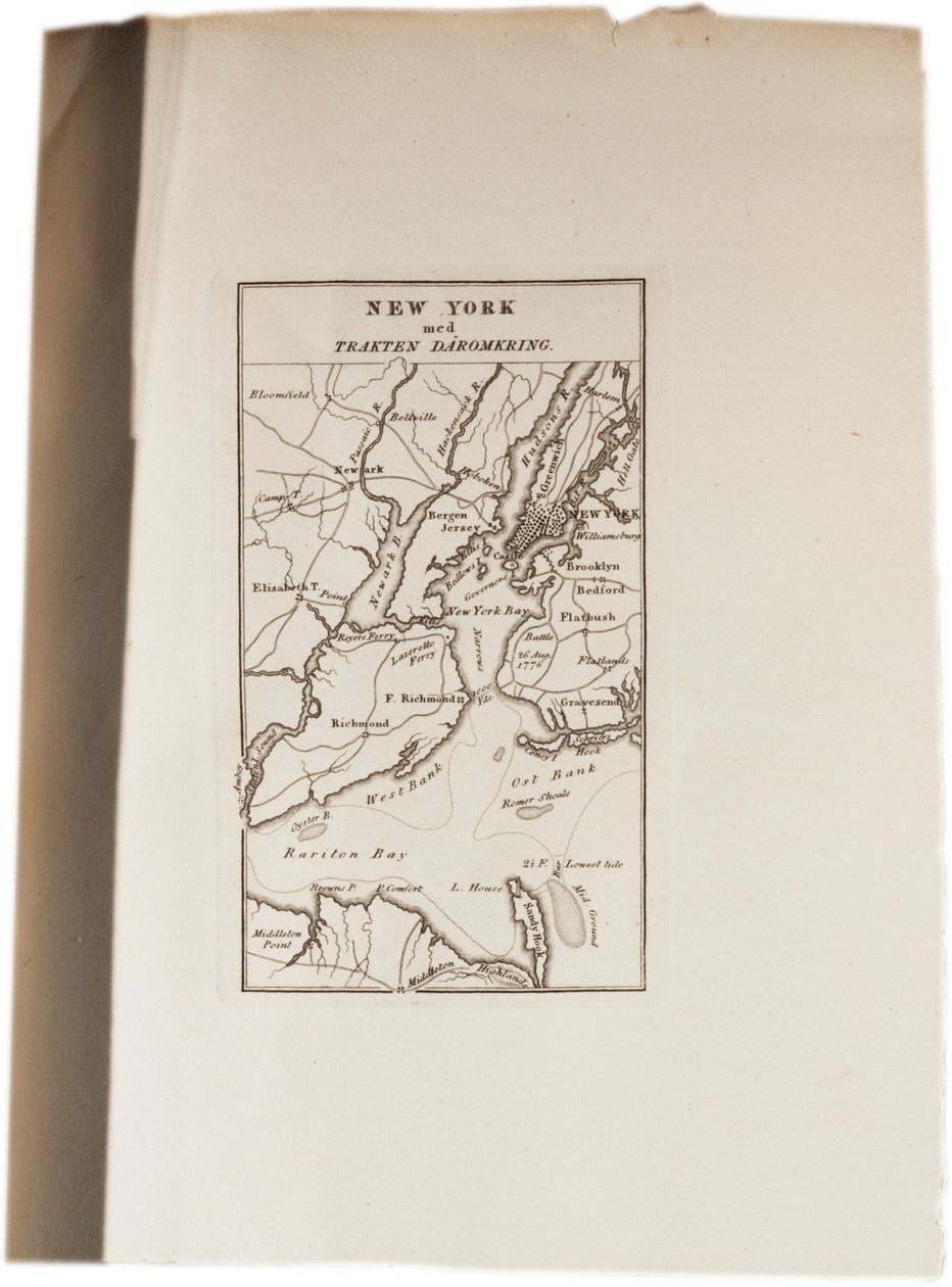
Map of New York, from an Atlas of the United States, 1824 by Axel Leonhard Klinckowström

Map of New York, from an Atlas of the United States, 1824

(Map of New York, from an Atlas of the United States, 1824 )


Axel Leonhard Klinckowström

€ 119.25
Enthält 0% MwSt.
   Configure art print
1824  ·  Gravur  ·  Picture ID: 292523

Nonclassified artists  ·  Cartography

Map of New York, from an Atlas of the United States, 1824 by Axel Leonhard Klinckowström. Available as an art print on canvas, photo paper, watercolor board, uncoated paper or Japanese paper.
new york · maps · mapping · cartography · city · manhattan · coast · coastal · city · united states · America · American · Gilder Lehrman Collection, New York, USA / Bridgeman Images
AR/3D   View in 3D / AR zu Favoriten hinzufügen   Add to favorites    Select wall color    View painting in a room
0 Reviews

Configure art print

Picture Frame

Medium & Stretcher

Glass & Passepartout

Miscellaneous & Extras

 Save / compare configuration
Preview Icon

Summary

Gemälde
Veredelung
Keilrahmen
Museumslizenz

€ 119.25
(inkl. 20% MwSt)
   Add to cart

Bildschärfe: PERFEKT

Should you desire adjustments to brightness and color, or a custom crop of the motif, we are happy to make these changes at no additional cost to you. Please do not hesitate to contact us.

Similar artworks selected for you

Fourth Map of Europe: Ptolemy Rome 1490 New York at the Beginning of the Eighteenth Century A plan of the operations of the King Nova Scotia, c.1760 Map of New York Island with the adjacent rocks and other remarkable parts of Hell-Gate Acadia, the Provinces of Sagadahoc and Maine, New Hampshire, Rhode Island and Part of Massachusetts and Connecticut, Engraving by G. Zuliani Map of New York and the Vicinity Plan of the city of New York showing the made and swampland, 1856 Map showing the movements of marshals Grouchy and Blucher A Plan of New York Island Course of the Scheldt from Fort Bath to Antwerp, 1832 Pages from Plan of New York Island with Part of Long Island, Staten Island and East New Jersey and the Engagement on the Woody Heights of Long Island between the British Forces, under the command of General Sir William Howe Map of Pennsylvania at the beginning of the 18th century, from Humphrey Plan of Choul and Surat River Plan of the Harbour of the Seychelles Map of the United States, 1816 Chart of the Mississippi River from the Ohio River to Gulf of Mexico Havelock Plan of the harbour of Praslin, late 18th to early 19th century Topographical Map of the Great Road from London to Bath and Bristol, with the Country Three Miles on Each Side A plan of New York Island, with part of Long Island, Staten Island and East New Jersey, with a particular description of the engagement on the woody heights of Long Island between Flatbush and Brooklyn A Topographical Map of the Northern Part of New York Island Indian Campaign of 1832: Map of the Country Chart of the Battle off Cherbourg A Map of the country of the Five Nations, belonging to the province of New York; and of the lakes near which the nations of far Indians live, with part of Canada, by Cadwallader Colden Indian campaign of 1832: Map of the country Frederick County A Chart of the Harbour of Rhode Island and Narraganset Bay
Show more similar artworks

Other art prints by Axel Leonhard Klinckowström

Third Street, Philadelphia, from an Atlas of the United States Map of New York, from an Atlas of the United States, 1824 Atlas of the United States Bridge over the Schuylkill near Philadelphia, from an Atlas of the United States Wings of the Capitol, Washington, in 1819, from an Atlas of the United States Cut-away Views of Fulton Broadway, New York, from an Atlas of the United States, 1824 Map of Philadelphia, from an Atlas of the United States, 1824 Design of a Typical New York Dwelling, from an Atlas of the United States, 1824 Sketch of Ward Hoboken Opposite New York, from an Atlas of the United States, 1824 New York Harbour, from Brooklyn to Long Island, from an Atlas of the United States, 1824 Ruins of an old fort in Tennessee, from an Atlas of the United States, 1824
Discover more works by Axel Leonhard Klinckowström

Other motives from the category Cartography

Map of Barbados West Coast of Africa, from Lisbon to Sierra Leone, from Map of Vienna Map of the Battle of Novi, published by William Blackwood and Sons, Edinburgh and London, 1848 Map of the Battles of Smolensko and Valtelina, Published by William Blackwood and Sons Map of the Adriatic Sea Double Hemisphere World Map Map of the Battle of Friedland, Published by William Blackwood and Sons, Edinburgh and London, 1848 Map of the Battle of Cape St. Vincent, published by William Blackwood and Sons, Edinburgh and London, 1848 Map of the Battle of Jena, published by William Blackwood and Sons, Edinburgh and London, 1848 Map of Brazil, from Dutch Marine Maps, 1637 Map of the Battle of Wagram, published by William Blackwood and Sons, Edinburgh and London, 1848 Map of Australia and Magellan Island from Pictorial Map of London Map of the Battle of Camperdown, published by William Blackwood and Sons, Edinburgh and London, 1848
View More from "Cartography"

Excerpt from our top sellers

Rosa Damascena, from Les Roses, 1817-24 Portrait of a Lady Flute Concert with Frederick the Great in Sanssouci, 1850-1852 Ploughing in Nivernais, 1849 Group of Egrets, 1925-36 Illustration to the Divine Comedy by Dante Alighieri Abyss of Hell After the Bath Garden in Giverny Peasant Wedding The Plain of Auvers Setting Sun The Port at Sunset, Opus 236 The Garden of Earthly Delights Native Birds, Including the Toucan, Amazon, Brazil, from The Entrance to the Grand Canal, Venice, ca 1730
Show More Artworks


What our customers think about us


Frequently Asked Questions about Meisterdrucke


Personalizing your art print at Meisterdrucke is a simple and intuitive process that allows you to design an artwork exactly to your specifications: Choose a frame, determine the image size, decide on a printing medium, and add suitable glazing or a stretcher frame. We also offer customization options such as mats, fillets, and spacers. Our customer service is available to help you design your perfect artwork.

At Meisterdrucke, you have the fascinating option to visualize the artwork you configured directly in your own space. For a tailored preview, simply upload a photo of your room and let the artwork appear on it. If you visit us via a mobile device, be it a phone or tablet, our augmented reality feature brings the image to life and seamlessly projects it into your space. An experience that uniquely combines art and technology.

Choosing the medium is often a matter of personal taste. To give you a clearer idea, we have provided some images for each medium. For a holistic experience, we also offer you a sample set of all paper variants so you can make a decision not just visually but also haptically. You can take advantage of the sample set free of charge – only the shipping costs will apply. You can order the sample set directly.

Do not worry. At Meisterdrucke, we do not proceed mechanically. We manually review each order. If there are any inconsistencies or peculiarities in the configuration, we will immediately contact you. Of course, our courteous and patient support is always at your side to assist you with the configuration. Together with you, we adjust your image by phone or email so that the final result exactly meets your expectations.


Do you have any questions?

Are you interested in an art print from our manufactory but still unsure? Do you need advice on choosing the medium or help with the order?

Our experts are happy to assist you.

+43 4257 29415
support@meisterdrucke.com
Mo-Do: 7:00 - 16:00 | Fr: 7:00 - 13:00

Do you have any questions?

Are you interested in an art print from our manufactory but still unsure? Do you need advice on choosing the medium or help with the order?

Our experts are happy to assist you.

+43 4257 29415
support@meisterdrucke.com
Mo-Do: 7:00 - 16:00 | Fr: 7:00 - 13:00


Meisterdrucke

   Kärntner Strasse 46
        9586 Finkenstein am Faaker See
        Austria
        +43 4257 29415
        support@meisterdrucke.com
Other languages

                   
Erfahrungen & Bewertungen zu Meisterdrucke
Post.at DHL Express Quehenberger Cargoboard
Kaiser Franz Joseph

Meisterdrucke
Kärntner Strasse 46
9586 Finkenstein am Faaker See · Austria
+43 4257 29415 · office@meisterdrucke.com
Post.at DHL Express Quehenberger Cargoboard


Meisterdrucke 2717 Bewertungen auf ProvenExpert.com

(c) 2025 meisterdrucke.us