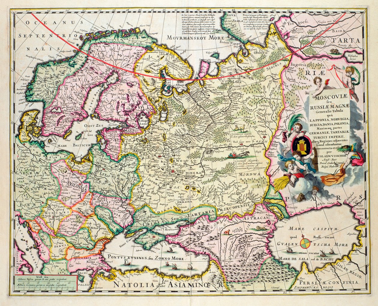
Map of Asia Minor Showing Norway, Sweden, Denmark, Lapland, Poland, Turkey, Russia and the Moscow Region, c.1626 by Nicolaes Jansz Visscher

Map of Asia Minor Showing Norway, Sweden, Denmark, Lapland, Poland, Turkey, Russia and the Moscow Region, c.1626

(Map of Asia Minor showing Norway, Sweden, Denmark, Lapland, Poland, Turkey, Russia and the Moscow region, c.1626 (hand coloured plate engraving))


Nicolaes Jansz Visscher

€ 111.53
Enthält 0% MwSt.
   Configure art print
Undated  ·  hand coloured plate engraving  ·  Picture ID: 79678

Nonclassified artists  ·  Cartography

Map of Asia Minor Showing Norway, Sweden, Denmark, Lapland, Poland, Turkey, Russia and the Moscow Region, c.1626 by Nicolaes Jansz Visscher. Available as an art print on canvas, photo paper, watercolor board, uncoated paper or Japanese paper.
europe · asia · eastern · caspian sea · scandinavia · northern · O'Shea Gallery, London, UK / Bridgeman Images
AR/3D   View in 3D / AR zu Favoriten hinzufügen   Add to favorites    Select wall color    View painting in a room
0 Reviews

Configure art print

Picture Frame

Medium & Stretcher

Glass & Passepartout

Miscellaneous & Extras

 Save / compare configuration
Preview Icon

Summary

Gemälde
Veredelung
Keilrahmen
Museumslizenz

€ 111.53
(inkl. 20% MwSt)
   Add to cart

Bildschärfe: PERFEKT

Should you desire adjustments to brightness and color, or a custom crop of the motif, we are happy to make these changes at no additional cost to you. Please do not hesitate to contact us.

Similar artworks selected for you

Map of Russia, Second Half of the 17th Century The Baltic Sea From: Baltikum Ducatuum Livoniae et Curlandiae cum vicinis Insulis Nova Exhibitio Geographica Russia (engraving) Russia Map of the Kingdom of Poland, Duchies of Lithuania and Livonia (Latvia) and Ukraine Poland, Estonia, Latvia Map of Europe, c.1554 Empire of Russia and Tartary Europe The Russian Empire Map of Russia and Moscow From: Theatrum Orbis Terrarum..., 1645 1766 Map - Map of Tartary Based on Relations Brittany, east Pays-de-la-Loire, France Map of Russia, around Moscow city Map of Brittany Russia Map of Russia From: Partes Septentrionalis et Orientalis First General Map of the Russian Empire Persian Empire, in Low Countries Map of Provence (France) France (Region: Languedoc-Roussillon, Provence-Alpes-Côte d Map of the Austrian Empire New Description of the Duchy of Schleswig Map of Asia 1692 Map of the Turkish Empire in Europe Moscow, Russia Map of Swabia (Germany) Map of Estonia and Livonia
Show more similar artworks

Other art prints by Nicolaes Jansz Visscher

Panorama of Gdansk from Biskupia Gorka Map of Asia Minor Showing Norway, Sweden, Denmark, Lapland, Poland, Turkey, Russia and the Moscow Region, c.1626 General map extending from India and Ceylon to northwestern Australia by way of southern Japan, the Philippines, the Malay Peninsula and the Indonesian archipelago Old London Bridge (detail) Map of Russia and Eastern Europe from Atlas Minor, 1745 America, Plate 84, from Novissima et Accuratissima Totius Americae Descriptio per N. Visscher, 1648 Werelt Caert, engraved by Daniel Stoopendaal, 1663-C.1680 Topiary maze with four exits and a central mound, engraved by Johannes Van den Aveele Panorama of London, 1616 Panorama of London and the Thames, part two showing St. Paul Panorama of London and the Thames, Part Three Showing Southwark, London Bridge and the Churches in the City, c.1600 17th Century Dutch Villagers Making Rope Portrait of a Man, 1681 Panorama of London and the Thames (detail)
Discover more works by Nicolaes Jansz Visscher

Other motives from the category Cartography

Map of the Tribe of Asher, 1590 World map of French-speaking countries, early 20th century Map of Great Britain, Europe and North West Africa, from Portugaliae Monumenta Cartographica, an Account of the Discoveries of Fernao Gomez from 1470-75 Map of Flissinga, from Map of Rome Map of Alexandria from Map of the World, 1780 Map of the Prussian States in 1799 Map of Modern London and Its Environs, 1845 A Map to Show the Situation of Royal Hunting Forests Where Robin Hood Lived, AD 1160-1247 Map of the Battle of Bautzen, published by William Blackwood and Sons, Edinburgh and London, 1848 Descriptive map of London poverty, 1889 Map of New France dedicated to Colbert by Duchesneau, Intendant, 1681 Feudal France at the time of the Accession of Hugues Capet in 987, map illustrated in a Histoire de France c.1880 Map of Hertfordshire
View More from "Cartography"

Excerpt from our top sellers

Judith Beheading Holofernes Shinshū Suwa-ko Watercolor No. 326 Dance at Le Moulin de la Galette Composition, 1930 Water Serpents II The Waterlily Pond Satan Viewing the Ascent to Heaven The Apple Tree Lucifer Antibes The Bookworm Iron Rolling Mill Poster advertising the Hamburg-Amerika Line Sheerness as Seen from the Nore
Show More Artworks


What our customers think about us


Frequently Asked Questions about Meisterdrucke


Personalizing your art print at Meisterdrucke is a simple and intuitive process that allows you to design an artwork exactly to your specifications: Choose a frame, determine the image size, decide on a printing medium, and add suitable glazing or a stretcher frame. We also offer customization options such as mats, fillets, and spacers. Our customer service is available to help you design your perfect artwork.

At Meisterdrucke, you have the fascinating option to visualize the artwork you configured directly in your own space. For a tailored preview, simply upload a photo of your room and let the artwork appear on it. If you visit us via a mobile device, be it a phone or tablet, our augmented reality feature brings the image to life and seamlessly projects it into your space. An experience that uniquely combines art and technology.

Choosing the medium is often a matter of personal taste. To give you a clearer idea, we have provided some images for each medium. For a holistic experience, we also offer you a sample set of all paper variants so you can make a decision not just visually but also haptically. You can take advantage of the sample set free of charge – only the shipping costs will apply. You can order the sample set directly.

Do not worry. At Meisterdrucke, we do not proceed mechanically. We manually review each order. If there are any inconsistencies or peculiarities in the configuration, we will immediately contact you. Of course, our courteous and patient support is always at your side to assist you with the configuration. Together with you, we adjust your image by phone or email so that the final result exactly meets your expectations.


Do you have any questions?

Are you interested in an art print from our manufactory but still unsure? Do you need advice on choosing the medium or help with the order?

Our experts are happy to assist you.

+43 4257 29415
support@meisterdrucke.com
Mo-Do: 7:00 - 16:00 | Fr: 7:00 - 13:00

Do you have any questions?

Are you interested in an art print from our manufactory but still unsure? Do you need advice on choosing the medium or help with the order?

Our experts are happy to assist you.

+43 4257 29415
support@meisterdrucke.com
Mo-Do: 7:00 - 16:00 | Fr: 7:00 - 13:00


Meisterdrucke

   Kärntner Strasse 46
        9586 Finkenstein am Faaker See
        Austria
        +43 4257 29415
        support@meisterdrucke.com
Other languages

                   
Erfahrungen & Bewertungen zu Meisterdrucke
Post.at DHL Express Quehenberger Cargoboard
Kaiser Franz Joseph

Meisterdrucke
Kärntner Strasse 46
9586 Finkenstein am Faaker See · Austria
+43 4257 29415 · office@meisterdrucke.com
Post.at DHL Express Quehenberger Cargoboard


Meisterdrucke 2707 Bewertungen auf ProvenExpert.com

(c) 2025 meisterdrucke.us