support@meisterdrucke.com  ·  0043 4257 29415

Deutsch English Italiano Español Français Nederlands Português Svenska Polski Dansk
Search by artist, work title or style – e.g. Monet, Starry Night, Impressionism, Hokusai wave, nude. Describe the scene – e.g. green meadow, abstract with lots of red, dark oil painting, standing nude next to a tree.

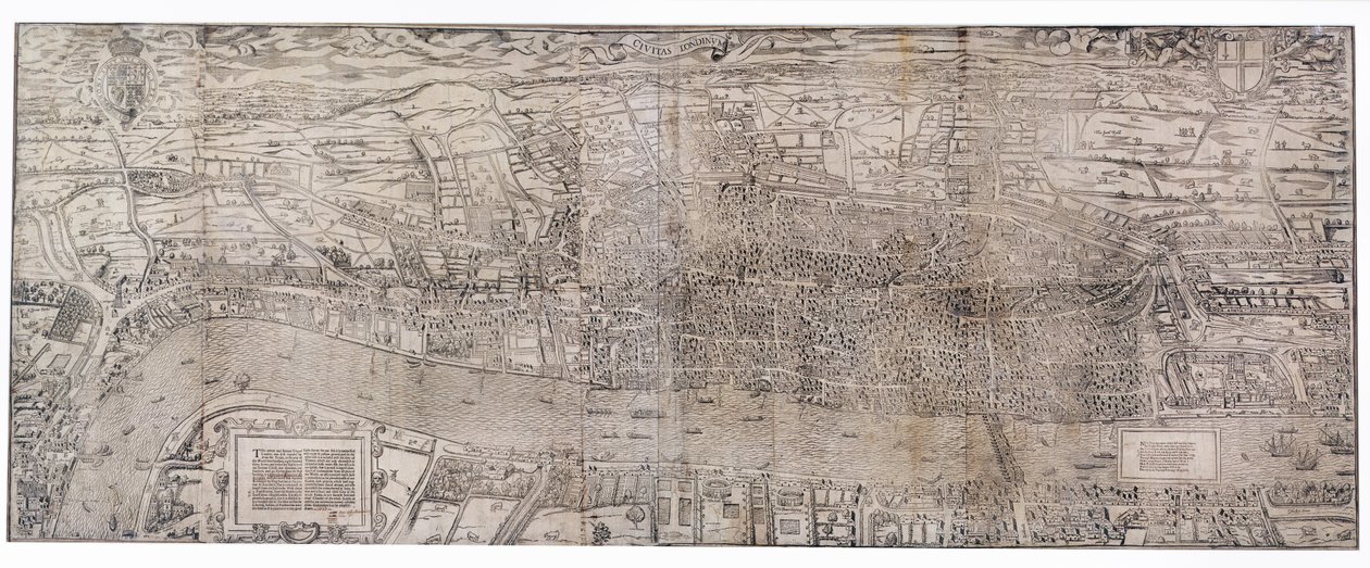
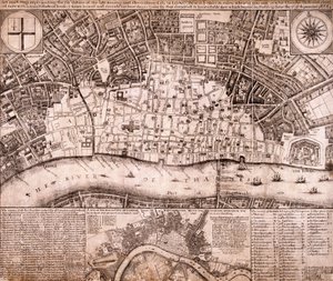
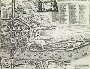
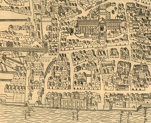
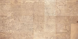
'Civitas Londinum', map of London, 1560

('Civitas Londinum', map of London, 1560 (woodblock print))


Ralph Agas

€ 98.21
Tax-free
   Configure art print
1560  ·  woodblock print  ·  Image ID: 204319

Nonclassified artists  ·  Cartography

'Civitas Londinum', map of London, 1560 by Ralph Agas. Available as an art print on canvas, photo paper, watercolor board, natural paper, or Japanese paper.
radulph aggas · birds-eye view · elizabethan · plan · river thames · London Metropolitan Archives, City of London / Bridgeman Images
Other color versions of this image  
AR/3D   View in 3D / AR zu Favoriten hinzufügen   Add to favorites    Change wall color    View picture in a room
0 Reviews

Configure art print

Picture Frame

Medium & Stretcher

Glass & Passepartout

Miscellaneous & Extras

 Save / compare configuration
Preview Icon

Summary

Gemälde
Veredelung
Keilrahmen
Museumslizenz

€ 98.21
(inkl. 20% MwSt)
   Add to cart

Bildschärfe: PERFEKT

If you'd like us to adjust the brightness, colors, or crop the image, we're happy to do this for you at no extra cost. Just get in touch!

Similar artworks selected for you

Map of Cairo, a Bird Survey of London A View-Plan of Zurich Plan of the City of London, published 1813 Plan of the City of London, published 1813 Map of Pisa Civitas Londinum Liège, with a view of the Palace Map of London, 1666 Liège, with a view of the Palace Vienna Wall Map, 1776 or 77 Panorama of Venice Liège, with a view of the Palace Map of Pisa Map of Rome. Lower Right Part Plan of the City of Rome. Part 10 with the Tiber and the Villa Farnesina Plan of the City of Rome: sheet 9 with the Piazza Navona, the Campo di Fiore and the Sant..., 1645 Plan of the City of Rome. Part 3 with the Santa Maria Maggiore, the Pantheon and Trajan Unknown Image View of Venice (upper left block) View of Venice View of Venice [upper left block], 1500 View of Venice View of London from the south, showing the River Thames, London Bridge and the Tower Siege of Kaiserswerth, 1702 Plan of the City of Kaiserswerth Detail of Tower of London, from Map of London, showing the Bear Baiting Garden in Southwark St. Pauls and Neighbourhood, 1897
Show more similar artworks

More art prints by Ralph Agas

Detail of Tower of London, from Charing Cross (detail) The Site of Shakespeare Detail of London North of the city from Civitas Londinium Detail of River Thames and St Paul Plan of London, c.1560-70 Civitas Londinum Map of London, showing the Bear Baiting Garden in Southwark Detail of London Wall East of Smithfield from Civitas Londinium
Show more works by Ralph Agas

More motifs from the category Cartography

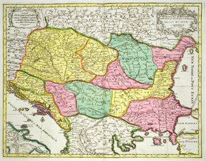
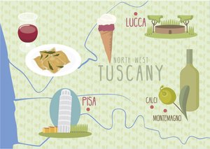
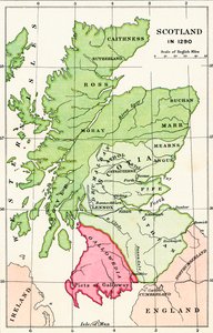
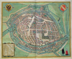
Reproduction of Map of Routes of St. James of Compostela, originally engraved by D. Serveaux 1648 Map of Kutch and Runn, India, 1854 Map of the Coast of Africa and the River Gambia, 1622 Map of Sixteenth Century Europe, from the The Continent of Africa, from an Atlas of the World in 33 Maps, Venice, 1st September 1553 Map of the Caribbean, 1715 Map of the Kingdom of Hungary and the States which are United to its Crown, pub. by Jan Barend Elwe, Amsterdam, 1742 Map of Lucca and Pisa, Tuscany, Italy Map of the Battle of Wagram, published by William Blackwood and Sons, Edinburgh and London, 1848 Australia, from a Series of World Maps Published by John Tallis and Co., London and New York, 1850s Detail of Italy from the Peutinger map copy West Coast of Africa, from Lisbon to Sierra Leone, from Map of Scotland in 1290, from Map of Strasbourg, from “Civitates Orbis Terrarum” by Georg Braun (1541-1622) and Frans Hogenberg (1535-90), c.1572
View More from "Cartography"

A selection of our top sellers

Eiger, Mönch and Jungfrau in the Morning Sun Pallas Athena (in Armour) The Gate of the Great Umayyad Mosque, Damascus, 1890 The Boulevard Montmartre on a Winter Morning The River of Light The Lady of Shalott Alpine Landscape at Sunset Suigin Grove and Masaki, on the Sumida River, from Snow at Louveciennes, 1878 Poppies Waterlilies: Green Reflections, 1914-18 (left and right section) Reclining Female Nude The Terrace, Annecy The Geographer Water Lilies ("Yellow Nirvana")
Show more artworks


What our customers think about us


Frequently Asked Questions about Meisterdrucke


Personalizing your art print at Meisterdrucke is simple and intuitive: Choose a frame, set the image size, pick a printing medium, and add suitable glazing or a stretcher frame. We also offer additional customization options like mats, fillets, and spacers. If you have any questions, our customer service team is ready to help you create your perfect artwork.

At Meisterdrucke, you can visualize your configured artwork directly in your own room. Simply upload a photo of your space and see how the artwork looks in it. If you're visiting us on a mobile device — phone or tablet — our augmented reality feature brings the picture to life and projects it right into your room. A unique experience that combines art and technology.

Choosing the right medium is often a matter of personal taste. To give you a better idea, we've provided some images for each medium. We also offer a sample set of all paper variants, so you can decide not just visually but by touch as well. You can order the sample set free of charge — only shipping costs apply.

Don't worry! At Meisterdrucke, we don't just process orders mechanically. Every order is manually reviewed by our team. If we spot any inconsistencies or issues with your configuration, we'll get in touch with you right away. And of course, our friendly and patient support team is always here to help you with your configuration. We'll work with you by phone or email to adjust your image so the final result is exactly what you had in mind.


Still have questions?

Are you interested in an art print from our manufactory but still unsure? Do you need advice on choosing the medium or help with the order?

Our experts are happy to assist you.

+43 4257 29415
support@meisterdrucke.com

Mo-Do: 7:00 - 16:00 | Fr: 7:00 - 13:00

Still have questions?

Are you interested in an art print from our manufactory but still unsure? Do you need advice on choosing the medium or help with the order?

Our experts are happy to assist you.

+43 4257 29415
support@meisterdrucke.com
Mo-Do: 7:00 - 16:00 | Fr: 7:00 - 13:00


Meisterdrucke

   Kärntner Strasse 46
        9586 Finkenstein am Faaker See
        Austria
        +43 4257 29415
        support@meisterdrucke.com
Other languages

                   
Erfahrungen & Bewertungen zu Meisterdrucke
Post.at DHL Express Quehenberger Cargoboard
Kaiser Franz Joseph

Meisterdrucke
Kärntner Strasse 46
9586 Finkenstein am Faaker See · Austria
+43 4257 29415 · support@meisterdrucke.com
Post.at DHL Express Quehenberger Cargoboard


(c) 2026 meisterdrucke.us