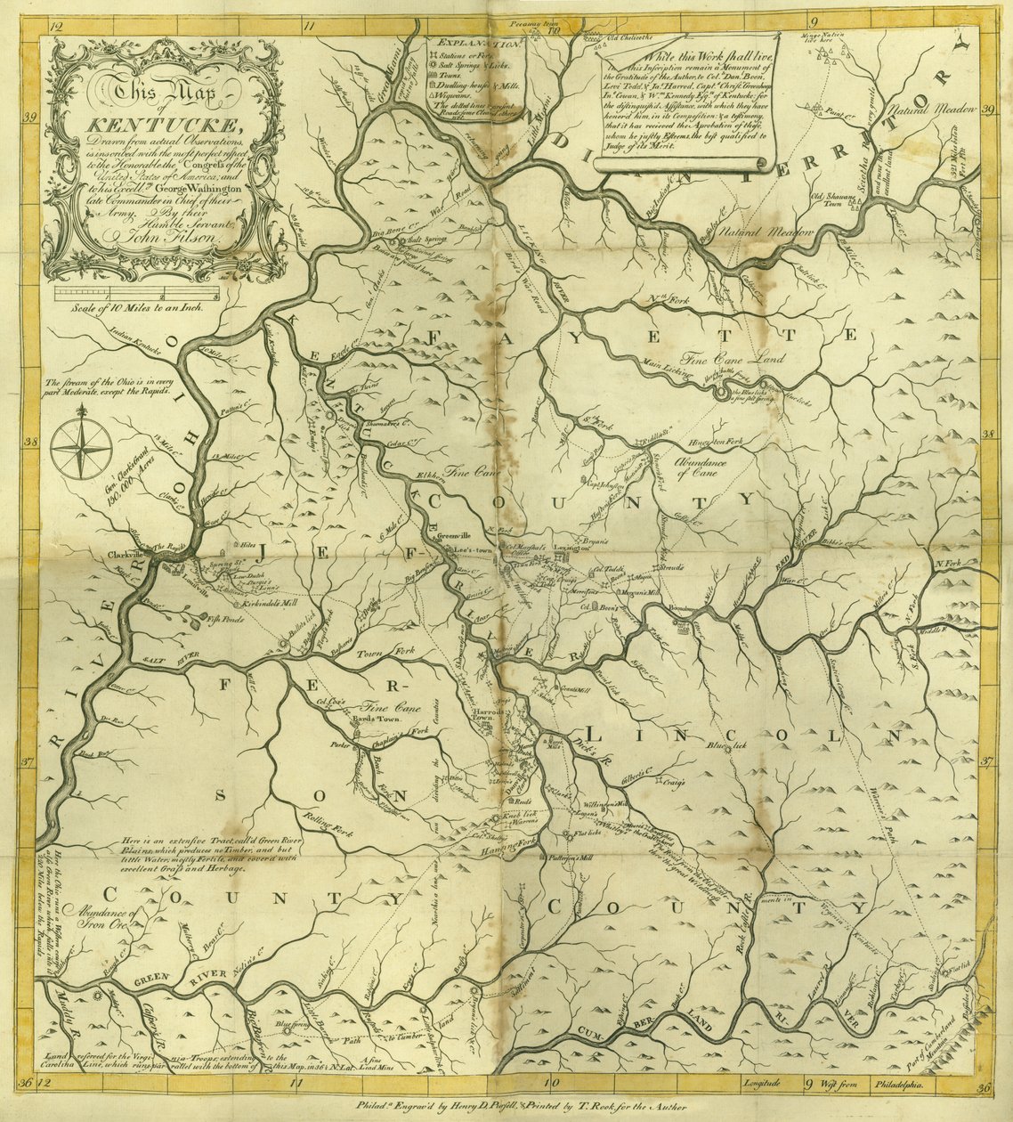
Map of Kentucke, Engraved by Henry D. Pursell, Printed by T. Rook, Philadelphia, 1784 by John Filson

Map of Kentucke, Engraved by Henry D. Pursell, Printed by T. Rook, Philadelphia, 1784

(Map of Kentucke..., engraved by Henry D. Pursell, printed by T. Rook, Philadelphia, 1784 )


John Filson

€ 104.24
Enthält 0% MwSt.
   Configure art print
1784  ·  coloured engraving  ·  Picture ID: 170154

Nonclassified artists  ·  Cartography

Map of Kentucke, Engraved by Henry D. Pursell, Printed by T. Rook, Philadelphia, 1784 by John Filson. Available as an art print on canvas, photo paper, watercolor board, uncoated paper or Japanese paper.
Newberry Library, Chicago, Illinois, USA / Bridgeman Images
AR/3D   View in 3D / AR zu Favoriten hinzufügen   Add to favorites    Select wall color    View painting in a room
0 Reviews

Configure art print

Picture Frame

Medium & Stretcher

Glass & Passepartout

Miscellaneous & Extras

 Save / compare configuration
Preview Icon

Summary

Gemälde
Veredelung
Keilrahmen
Museumslizenz

€ 104.24
(inkl. 20% MwSt)
   Add to cart

Bildschärfe: PERFEKT

Should you desire adjustments to brightness and color, or a custom crop of the motif, we are happy to make these changes at no additional cost to you. Please do not hesitate to contact us.

Similar artworks selected for you

A Map of Kentucky, in The Discovery, Settlement and present State of Kentucke A Trader A Map of the British and French Dominions in America A Map of the Province of New York with Part of Pennsylvania, and New England, from an Actual Survey by Captain Montrésor, Engineer, 1775 Land of the Cherokees with the western part of North Carolina and Virginia, engraving by G. Zuliani taken from Tome I of the Lombardy, Emilia-Romagna, Italy Colchis, Iberia, Albania and Caucasian Tribes A Map of the British and French Dominions in America Akershus Diocese Map of the Area of Parma (Italy) 1507 Ptolemaic Map of France The Battle of Falkirk, 28 January 1746 Chart of the Mississippi River from the Ohio River to Gulf of Mexico Lister and Mandal Counties in the Kingdom of Norway with the Help of Geographical Maps A Map of the British and French Dominions in America George Washington Castile and Leon, Spain A Map of the Most Inhabited Part of Virginia by Fry and Jefferson Particular Map of a Part of Louisiana Where the Rivers and Routes Were Estimated and Measured by Steps, by Messrs. Broutin, de Vergés, Engineers & Saucier, Draughtsman Mechlinia Dominion and Aerschot Duchy Georgia Map of Boston and Environs, ca. 1775 Austria (State: Lower Austria, Vienna, Styria, Burgenland), Slovakia, Hungary, north Serbia, Croatia (County: Vukovar-Syrmia, Osijek-Baranja, Brod-Posavina, Požega-Slavonia, Virovitica-Podravina, Bjelovar-Bilogora, Koprivnica-Križevci, Međimurje, Varaždin, 1513 Map Centered on Transylvania by Paolo Forlani Languedoc-Roussillon, France Unknown Image The Western Part of New France or Canada, Engraving by G. Zuliani Map of the Kingdom of Hungary Margraviate and Electorate of Brandenburg
Show more similar artworks

Other motives from the category Cartography

Map Showing the Military Campaigns of Louis XIV in the Low Countries, from Atlas Géographique et Militaire, Published in Paris, 1763 Map of Flissinga, from Maps Made during the Voyage of a Vietnamese Embassy to China Map of Northampton and adjacent counties, from Wallis Map of Naples, from Map of Lower Egypt, Showing the Lines of Railway and Projected Isthmus of Suez Canal Map of Phillipsburg, from Map of the Moluccas, 1522 A Map of the Route Hannibal took through Gaul and over the Alps into Italy Map of North Africa and West Africa, published in Strasbourg in 1522 Map of the south of England, including London, Surrey and Sussex Map of Andalusia, Spain Detail showing an African ruler from a Renaissance map of Europe, Jacopo Russo (after) 1528 Ethiopia, the Red Sea and Saudi Arabia, from an Atlas of the World in 33 Maps, Venice, 1st September 1553 (Detail)
View More from "Cartography"

Excerpt from our top sellers

What Freedom! 1903 Star of the Hero On Board a Sailing Ship The Dream The Wild Hunt of Odin The Alexander Mosaic, depicting the Battle of Issus between Alexander the Great and Darius III in 333 BC, Roman floor mosaic removed from the Casa del Fauno Circles in a Circle The Youth of Bacchus The Magpie The Deluge The Forest of Pines Wanderer Above the Sea of Fog The Quarrel of Oberon and Titania Self-Portrait in Orange Jacket The Soul of the Rose, 1908
Show More Artworks


What our customers think about us


Frequently Asked Questions about Meisterdrucke


Personalizing your art print at Meisterdrucke is a simple and intuitive process that allows you to design an artwork exactly to your specifications: Choose a frame, determine the image size, decide on a printing medium, and add suitable glazing or a stretcher frame. We also offer customization options such as mats, fillets, and spacers. Our customer service is available to help you design your perfect artwork.

At Meisterdrucke, you have the fascinating option to visualize the artwork you configured directly in your own space. For a tailored preview, simply upload a photo of your room and let the artwork appear on it. If you visit us via a mobile device, be it a phone or tablet, our augmented reality feature brings the image to life and seamlessly projects it into your space. An experience that uniquely combines art and technology.

Choosing the medium is often a matter of personal taste. To give you a clearer idea, we have provided some images for each medium. For a holistic experience, we also offer you a sample set of all paper variants so you can make a decision not just visually but also haptically. You can take advantage of the sample set free of charge – only the shipping costs will apply. You can order the sample set directly.

Do not worry. At Meisterdrucke, we do not proceed mechanically. We manually review each order. If there are any inconsistencies or peculiarities in the configuration, we will immediately contact you. Of course, our courteous and patient support is always at your side to assist you with the configuration. Together with you, we adjust your image by phone or email so that the final result exactly meets your expectations.


Do you have any questions?

Are you interested in an art print from our manufactory but still unsure? Do you need advice on choosing the medium or help with the order?

Our experts are happy to assist you.

+43 4257 29415
support@meisterdrucke.com
Mo-Do: 7:00 - 16:00 | Fr: 7:00 - 13:00

Do you have any questions?

Are you interested in an art print from our manufactory but still unsure? Do you need advice on choosing the medium or help with the order?

Our experts are happy to assist you.

+43 4257 29415
support@meisterdrucke.com
Mo-Do: 7:00 - 16:00 | Fr: 7:00 - 13:00


Meisterdrucke

   Kärntner Strasse 46
        9586 Finkenstein am Faaker See
        Austria
        +43 4257 29415
        support@meisterdrucke.com
Other languages

                   
Erfahrungen & Bewertungen zu Meisterdrucke
Post.at DHL Express Quehenberger Cargoboard
Kaiser Franz Joseph

Meisterdrucke
Kärntner Strasse 46
9586 Finkenstein am Faaker See · Austria
+43 4257 29415 · office@meisterdrucke.com
Post.at DHL Express Quehenberger Cargoboard


Meisterdrucke 2707 Bewertungen auf ProvenExpert.com

(c) 2025 meisterdrucke.us