support@meisterdrucke.com  ·  0043 4257 29415

Deutsch English Italiano Español Français Nederlands Português Svenska Polski Dansk
Search by artist, work title or style – e.g. Monet, Starry Night, Impressionism, Hokusai wave, nude. Describe the scene – e.g. green meadow, abstract with lots of red, dark oil painting, standing nude next to a tree.

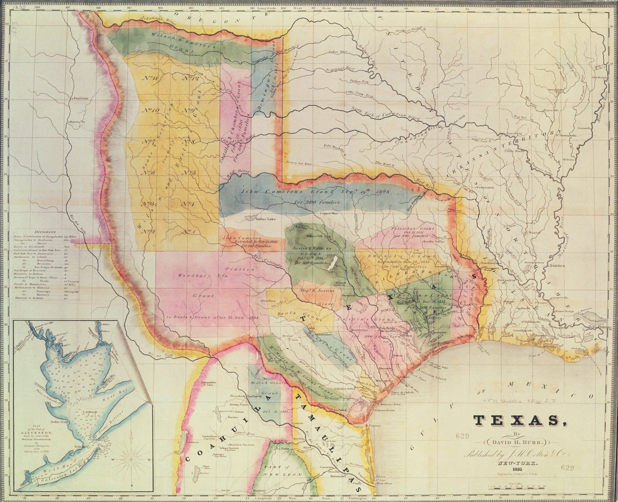
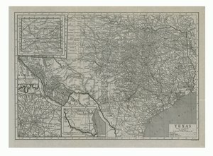
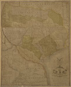
Map of the state of Texas, 1835 by David Burr

Map of the state of Texas, 1835

(Map of the state of Texas, 1835 )


David Burr

€ 120.17
Tax-free
   Configure art print
1835  ·  coloured engraving  ·  Image ID: 103853

Nonclassified artists  ·  Cartography

Map of the state of Texas, 1835 by David Burr. Available as an art print on canvas, photo paper, watercolor board, natural paper, or Japanese paper.
Private Collection / Bridgeman Images
AR/3D   View in 3D / AR zu Favoriten hinzufügen   Add to favorites    Change wall color    View picture in a room
0 Reviews

Configure art print

Picture Frame

Medium & Stretcher

Glass & Passepartout

Miscellaneous & Extras

 Save / compare configuration
Preview Icon

Summary

Gemälde
Veredelung
Keilrahmen
Museumslizenz

€ 120.17
(inkl. 20% MwSt)
   Add to cart

Bildschärfe: PERFEKT

If you'd like us to adjust the brightness, colors, or crop the image, we're happy to do this for you at no extra cost. Just get in touch!

Similar artworks selected for you

Map of Texas with Parts of the Adjoining States Presslers Map of Texas, 1867 Mitchell The Travellers Pocket Map of Louisiana Lloyd Map of Florida, 1826 A map of the British and French dominions in North America with the roads, distances, limits and extent of the settlements, humbly inscribed to the Right Honourable the Earl of Halifax and the other Right Honourable the Lords Commissioners for Trade & Plan New York, Done by the State of New York to Accompany the Memoir of Cadwallader Colden A map of the Southern States of North America Map of the United States in 1861, from “Our Whole Country: The Past and Present of the United States, Historical and Descriptive”, by John Warner Barber and Henry Hare, 1861 Map of the United States in 1803, from Map of Texas, USA A Map of the British and French Settlements in North America A New Map of Mexico and Adjacent Provinces A Map of the British Colonies in the United States Map showing the localities of the Indian tribes of the US in 1833, illustration from Unknown Image Gray Map of Connecticut, from ’Connecticut Historical Collections’ by John Warner Barber, 1856 A Set of Plans and Forts in America Reduced from Actual Surveys, 1765 Chart of Terra Australis (Australia) Map of Massachusetts, from Land of the Cherokees with the western part of North Carolina and Virginia, engraving by G. Zuliani taken from Tome I of the Map of the United States of America, British Provinces, Mexico, West Indies and Central America, 1850 A Map of the State of Pennsylvania Map to Illustrate the Route of Prince Maximilian of Wied in the Interior of North America from Boston to the Upper Missouri Map of Illinois Maryland, Southern New Jersey, Delaware and the Eastern Part of Virginia and North Carolina, Engraving by G. Zuliani from Tome I of the "Newest Atlas" Arkansas Museum #11510 #3
Show more similar artworks

More motifs from the category Cartography

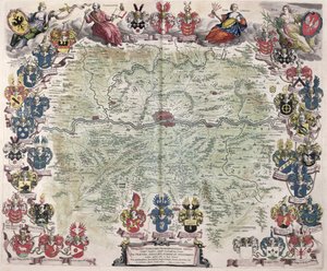
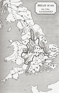
Map of Southern Britain, coloured to show geological areas of interest, annotated by William Smith (1769-1839) Map showing the route of the Armada fleet, engraved by Augustine Ryther, 1588 Map of Africa, engraved by Thomas Stirling Map of Frankfurt and the surrounding area, from „Nova Hanc Territori Francofurtensis Tabulum“, 1649 Governmental and Legislative Map of France, printed by Ledoyen and Giret, Paris Insurance Map of the City of Philadelphia; volume 2, plate 15, 1887 Map of the North Sea, c.1675 Ms. 986, Vol. 3, fol. 63 Plan and Map of Toulon, from the “Atlas Louis XIV”, 1683-88 Nova Scotia and Newfoundland, from a series of world maps published by John Tallis and Co., New York and London, in the 1850s Map depicting the East Coast of North America, 1647 Map of Florence, 1584 Map of Britain in 640, from “The Northumbrian Kingdom” in “A Short History of the English People” by J. R. Green, published 1893 Map of the Western Mediterranean Map No. 3 Showing the Route of the Armada Fleet, engraved by Augustine Ryther, 1588 A Map of Mile End and Stepney Green, London, 1746
View More from "Cartography"

A selection of our top sellers

Nuda veritas Evening with Clouds The Four Horsemen of the Apocalypse, ca. 1498 Nighthawks The North Cape by Moonlight, 1848 Summer Afternoon, 1865 Landscape scene from Thanatopsis, 1850 The Incredulity of St. Thomas, 1602-03 Portrait of the Philosopher and Esotericist Rudolf Steiner Pear Blossom, 1882 Native birds, including the Toucan (centre), Amazon, Brazil, from The Roundel in the Hedge Garden with a Flower Waterer Camelot, illustration from Morning in a Pine Forest Rosa banksiae (Banks
Show more artworks


What our customers think about us


Frequently Asked Questions about Meisterdrucke


Personalizing your art print at Meisterdrucke is simple and intuitive: Choose a frame, set the image size, pick a printing medium, and add suitable glazing or a stretcher frame. We also offer additional customization options like mats, fillets, and spacers. If you have any questions, our customer service team is ready to help you create your perfect artwork.

At Meisterdrucke, you can visualize your configured artwork directly in your own room. Simply upload a photo of your space and see how the artwork looks in it. If you're visiting us on a mobile device — phone or tablet — our augmented reality feature brings the picture to life and projects it right into your room. A unique experience that combines art and technology.

Choosing the right medium is often a matter of personal taste. To give you a better idea, we've provided some images for each medium. We also offer a sample set of all paper variants, so you can decide not just visually but by touch as well. You can order the sample set free of charge — only shipping costs apply.

Don't worry! At Meisterdrucke, we don't just process orders mechanically. Every order is manually reviewed by our team. If we spot any inconsistencies or issues with your configuration, we'll get in touch with you right away. And of course, our friendly and patient support team is always here to help you with your configuration. We'll work with you by phone or email to adjust your image so the final result is exactly what you had in mind.


Still have questions?

Are you interested in an art print from our manufactory but still unsure? Do you need advice on choosing the medium or help with the order?

Our experts are happy to assist you.

+43 4257 29415
support@meisterdrucke.com

Mo-Do: 7:00 - 16:00 | Fr: 7:00 - 13:00

Still have questions?

Are you interested in an art print from our manufactory but still unsure? Do you need advice on choosing the medium or help with the order?

Our experts are happy to assist you.

+43 4257 29415
support@meisterdrucke.com
Mo-Do: 7:00 - 16:00 | Fr: 7:00 - 13:00


Meisterdrucke

   Kärntner Strasse 46
        9586 Finkenstein am Faaker See
        Austria
        +43 4257 29415
        support@meisterdrucke.com
Other languages

                   
Erfahrungen & Bewertungen zu Meisterdrucke
Post.at DHL Express Quehenberger Cargoboard
Kaiser Franz Joseph

Meisterdrucke
Kärntner Strasse 46
9586 Finkenstein am Faaker See · Austria
+43 4257 29415 · support@meisterdrucke.com
Post.at DHL Express Quehenberger Cargoboard


(c) 2026 meisterdrucke.us