support@meisterdrucke.com  ·  0043 4257 29415

Deutsch English Italiano Español Français Nederlands Português Svenska Polski Dansk
Search by artist, work title or style – e.g. Monet, Starry Night, Impressionism, Hokusai wave, nude. Describe the scene – e.g. green meadow, abstract with lots of red, dark oil painting, standing nude next to a tree.

Map of Asia, Tartaria, Japan, the Philippines and the East Indies, engraved by G. van Gouwen, c. 1690 by Carel Allard

Map of Asia, Tartaria, Japan, the Philippines and the East Indies, engraved by G. van Gouwen, c. 1690

(Map of Asia, Tartaria, Japan, the Philippines and the East Indies, engraved by G. van Gouwen, c.1690 )


Carel Allard

€ 117.57
Tax-free
   Configure art print
Undated  ·  coloured engraving  ·  Image ID: 361698

Nonclassified artists  ·  Cartography

Map of Asia, Tartaria, Japan, the Philippines and the East Indies, engraved by G. van Gouwen, c. 1690 by Carel Allard. Available as an art print on canvas, photo paper, watercolor board, natural paper, or Japanese paper.
cartography · cartouche · yedso · king · treasures · loot · monkey · camel · arabia · russia · mogul empire · persia · Private Collection / Bridgeman Images
Other color versions of this image  
AR/3D   View in 3D / AR zu Favoriten hinzufügen   Add to favorites    Change wall color    View picture in a room
0 Reviews

Configure art print

Picture Frame

Medium & Stretcher

Glass & Passepartout

Miscellaneous & Extras

 Save / compare configuration
Preview Icon

Summary

Gemälde
Veredelung
Keilrahmen
Museumslizenz

€ 117.57
(inkl. 20% MwSt)
   Add to cart

Bildschärfe: PERFEKT

If you'd like us to adjust the brightness, colors, or crop the image, we're happy to do this for you at no extra cost. Just get in touch!

Similar artworks selected for you

General map including Arabia, Japan, the Korean peninsula and the greater part of the Indonesian archipelago, 1631 1744 Map of Asia Recent Map of Asia, Showing the States and Empires of the Entire East along with the Eastern Indies 1730 map of Asia by Herman Moll General map extending from India and Ceylon to northwestern Australia by way of southern Japan, the Philippines, the Malay Peninsula and the Indonesian archipelago Amsterdam Allard Asia Noviter Map of Asia from the Bleau Atlas Map of India and the East Indies 1692 Map of Asia Map of Asia. Plate from an Atlas by Willem Janszoon Blaeu Geography: map of the East Indies of Frederick de Witt (active around 1650) 17th century Paris, B.N. Pakistan, India, Nepal, Bhutan, Bangladesh, Burma, Thailand, Laos, Cambodia, Vietnam, Malaysia, Indonesia, the Philippines Map of Asia, Nuremberg, c.1730 Map of East India (South and Southeast Asia: Pakistan, India, Nepal, Bangladesh, Burma, Sri Lanka, Thailand, Malaysia, Vietnam, Cambodia, Laos, Philippines, Singapore and Indonesia) Asia, in Asia (engraving) Map of China Map of Asia, published in 1700, Paris The theatre of the world or the new atlas Amsterdam. Geographic map of Asia by Willem Janszoon Blaeu Asia - by A Asia Map of Greece, Hungary and their surrounding countries Map of Asia Map of Asia 1692 Map of the Turkish Empire in Europe, Asia and Africa
Show more similar artworks

Similar artworks selected for you

General map including Arabia, Japan, the Korean peninsula and the greater part of the Indonesian archipelago, 1631 1744 Map of Asia Recent Map of Asia, Showing the States and Empires of the Entire East along with the Eastern Indies 1730 map of Asia by Herman Moll General map extending from India and Ceylon to northwestern Australia by way of southern Japan, the Philippines, the Malay Peninsula and the Indonesian archipelago Amsterdam Allard Asia Noviter Map of Asia from the Bleau Atlas Map of India and the East Indies 1692 Map of Asia Map of Asia. Plate from an Atlas by Willem Janszoon Blaeu Geography: map of the East Indies of Frederick de Witt (active around 1650) 17th century Paris, B.N. Pakistan, India, Nepal, Bhutan, Bangladesh, Burma, Thailand, Laos, Cambodia, Vietnam, Malaysia, Indonesia, the Philippines Map of Asia, Nuremberg, c.1730 Map of East India (South and Southeast Asia: Pakistan, India, Nepal, Bangladesh, Burma, Sri Lanka, Thailand, Malaysia, Vietnam, Cambodia, Laos, Philippines, Singapore and Indonesia) Asia, in Asia (engraving) Map of China Map of Asia, published in 1700, Paris The theatre of the world or the new atlas Amsterdam. Geographic map of Asia by Willem Janszoon Blaeu Asia - by A Asia Map of Greece, Hungary and their surrounding countries Map of Asia Map of Asia 1692 Map of the Turkish Empire in Europe, Asia and Africa
Show more similar artworks

More art prints by Carel Allard

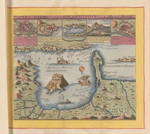
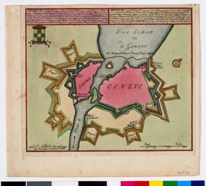
Star map of the southern sky Northern Hemisphere of the Celestial Planisphere, from Atlas Coelestis, published 1706 Star Chart for the Southern Hemisphere, End of the Year 1700, c. 1700, 1936 Planisphaerii Coelestis Hemisphaerium Meridionale, from Atlas Coelestis, published 1706 Map of Asia, Tartaria, Japan, the Philippines and the East Indies, engraved by G. van Gouwen, c. 1690 Map of the Coast near Hyères and the Nearby Îles d Fireworks celebrating the arrival of the embassy of Muscovy in Amsterdam, 1697 Caricature of the English Quakers, ca. 1656 Carel Allard (1648-1709) Geneva Planesphaeri Coelestis Hemisphaerium Meridionale Louis XIV Quaker Meeting Planesphaerii Coelestis Hemisphaerium Septentrionale 1696 Map of the World
Show more works by Carel Allard

More art prints by Carel Allard

Star map of the southern sky Northern Hemisphere of the Celestial Planisphere, from Atlas Coelestis, published 1706 Star Chart for the Southern Hemisphere, End of the Year 1700, c. 1700, 1936 Planisphaerii Coelestis Hemisphaerium Meridionale, from Atlas Coelestis, published 1706 Map of Asia, Tartaria, Japan, the Philippines and the East Indies, engraved by G. van Gouwen, c. 1690 Map of the Coast near Hyères and the Nearby Îles d Fireworks celebrating the arrival of the embassy of Muscovy in Amsterdam, 1697 Caricature of the English Quakers, ca. 1656 Carel Allard (1648-1709) Geneva Planesphaeri Coelestis Hemisphaerium Meridionale Louis XIV Quaker Meeting Planesphaerii Coelestis Hemisphaerium Septentrionale 1696 Map of the World
Show more works by Carel Allard

More motifs from the category Cartography

Map of Szolnok, from ’Civitates Orbis Terrarum’ by Georg Braun (1541-1622) and Frans Hogenberg (1535-90), 1617 Maps of York, Shrewsbury, Lancaster, and Richmond, from ’Civitates Orbis Terrarum’ by Georg Braun (1541-1622) and Frans Hogenberg (1535-90), c. 1572-1617 A Map of St Paul Map showing the geography of the Hebrews and exhibiting the dispersion of the descendants of Noah Map No. 5 Showing the route of the Armada fleet, engraved by Augustine Ryther, 1588 The globe Map of Forata and Jeresa from Map of Trento, from Les Villes de Venetie, 1704, published by Pierre Mortier in Amsterdam Map of Central and North America, published in 1700, Paris Ayer MS 1801 Map 1: Map of lands in the Tultepec and Jaltocan regions adjacent to the Hacienda de Santa Ines, Mexico, published 1569 ’Map of New England, Being the first that ever was here cut...’, 1677 Map of Florence, 1730 Map of the Battle of Wagram, published by William Blackwood and Sons, Edinburgh and London, 1848 Map of the Coast of New England, Observed and Described by Captain John Smith (1580-1631), 1614, from Ireland, detail from a Renaissance map of Europe, after Jacopo Russo, 1528
View More from "Cartography"

More motifs from the category Cartography

Map of Szolnok, from ’Civitates Orbis Terrarum’ by Georg Braun (1541-1622) and Frans Hogenberg (1535-90), 1617 Maps of York, Shrewsbury, Lancaster, and Richmond, from ’Civitates Orbis Terrarum’ by Georg Braun (1541-1622) and Frans Hogenberg (1535-90), c. 1572-1617 A Map of St Paul Map showing the geography of the Hebrews and exhibiting the dispersion of the descendants of Noah Map No. 5 Showing the route of the Armada fleet, engraved by Augustine Ryther, 1588 The globe Map of Forata and Jeresa from Map of Trento, from Les Villes de Venetie, 1704, published by Pierre Mortier in Amsterdam Map of Central and North America, published in 1700, Paris Ayer MS 1801 Map 1: Map of lands in the Tultepec and Jaltocan regions adjacent to the Hacienda de Santa Ines, Mexico, published 1569 ’Map of New England, Being the first that ever was here cut...’, 1677 Map of Florence, 1730 Map of the Battle of Wagram, published by William Blackwood and Sons, Edinburgh and London, 1848 Map of the Coast of New England, Observed and Described by Captain John Smith (1580-1631), 1614, from Ireland, detail from a Renaissance map of Europe, after Jacopo Russo, 1528
View More from "Cartography"

A selection of our top sellers

Cartoon by Daumier: Series “Les Gens de justice”, published in “Charivari” of 15/08/1845. A lawyer pleading in court while sleeping. Still Life - Grapes and Peaches The Japanese Footbridge and the Water Lily Pool, Giverny Rome, From Mount Aventine The Kiss, 1907-08, detail of 601 Faculty Painting Medicine Lisbeth Ponte Fabricio Reflection in the Surface of the Water, Misaka, Kai Province from the series Thirty-Six Views of Mt Fuji, 1830-1833 Solitude, 1843 The Pink Peach Tree, 1888 Starry Night over the Rhône, 1888 The Stages of Life The Letter Carrier in Rosenthal Moon over Landscape
Show more artworks

A selection of our top sellers

Cartoon by Daumier: Series “Les Gens de justice”, published in “Charivari” of 15/08/1845. A lawyer pleading in court while sleeping. Still Life - Grapes and Peaches The Japanese Footbridge and the Water Lily Pool, Giverny Rome, From Mount Aventine The Kiss, 1907-08, detail of 601 Faculty Painting Medicine Lisbeth Ponte Fabricio Reflection in the Surface of the Water, Misaka, Kai Province from the series Thirty-Six Views of Mt Fuji, 1830-1833 Solitude, 1843 The Pink Peach Tree, 1888 Starry Night over the Rhône, 1888 The Stages of Life The Letter Carrier in Rosenthal Moon over Landscape
Show more artworks


What our customers think about us


Frequently Asked Questions about Meisterdrucke


Personalizing your art print at Meisterdrucke is simple and intuitive: Choose a frame, set the image size, pick a printing medium, and add suitable glazing or a stretcher frame. We also offer additional customization options like mats, fillets, and spacers. If you have any questions, our customer service team is ready to help you create your perfect artwork.

At Meisterdrucke, you can visualize your configured artwork directly in your own room. Simply upload a photo of your space and see how the artwork looks in it. If you're visiting us on a mobile device — phone or tablet — our augmented reality feature brings the picture to life and projects it right into your room. A unique experience that combines art and technology.

Choosing the right medium is often a matter of personal taste. To give you a better idea, we've provided some images for each medium. We also offer a sample set of all paper variants, so you can decide not just visually but by touch as well. You can order the sample set free of charge — only shipping costs apply.

Don't worry! At Meisterdrucke, we don't just process orders mechanically. Every order is manually reviewed by our team. If we spot any inconsistencies or issues with your configuration, we'll get in touch with you right away. And of course, our friendly and patient support team is always here to help you with your configuration. We'll work with you by phone or email to adjust your image so the final result is exactly what you had in mind.


Still have questions?

Are you interested in an art print from our manufactory but still unsure? Do you need advice on choosing the medium or help with the order?

Our experts are happy to assist you.

+43 4257 29415
support@meisterdrucke.com
Mo-Do: 7:00 - 16:00 | Fr: 7:00 - 13:00

Still have questions?

Are you interested in an art print from our manufactory but still unsure? Do you need advice on choosing the medium or help with the order?

Our experts are happy to assist you.

+43 4257 29415
support@meisterdrucke.com
Mo-Do: 7:00 - 16:00 | Fr: 7:00 - 13:00


Meisterdrucke

   Kärntner Strasse 46
        9586 Finkenstein am Faaker See
        Austria
        +43 4257 29415
        support@meisterdrucke.com
Other languages

                   
Erfahrungen & Bewertungen zu Meisterdrucke
Post.at DHL Express Quehenberger Cargoboard
Kaiser Franz Joseph

Meisterdrucke
Kärntner Strasse 46
9586 Finkenstein am Faaker See · Austria
+43 4257 29415 · support@meisterdrucke.com
Post.at DHL Express Quehenberger Cargoboard


(c) 2026 meisterdrucke.us