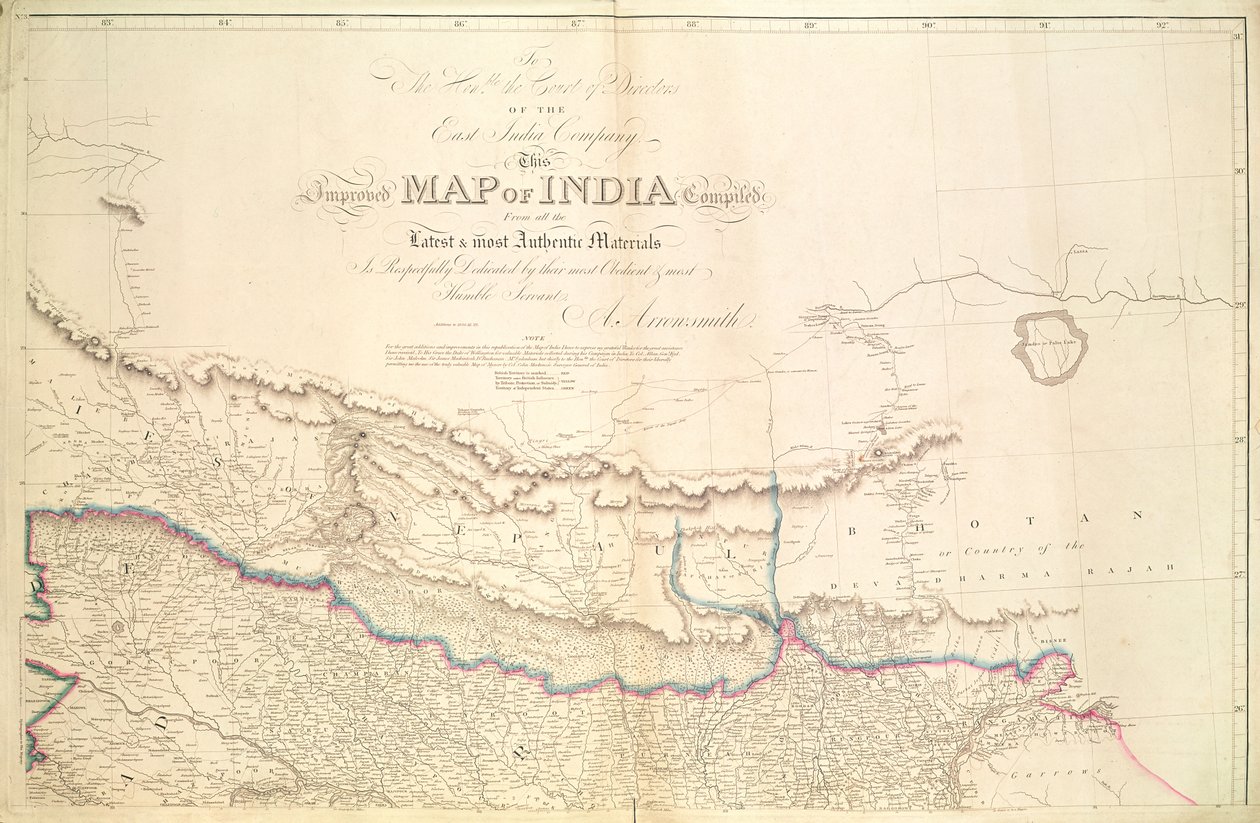
Map of India, 1822 by Aaron Arrowsmith

Map of India, 1822

(Map of India, 1822 )


Aaron Arrowsmith

€ 116.37
Enthält 0% MwSt.
   Configure art print
1822  ·  colour lithograph  ·  Picture ID: 99570

Nonclassified artists  ·  Cartography

Map of India, 1822 by Aaron Arrowsmith. Available as an art print on canvas, photo paper, watercolor board, uncoated paper or Japanese paper.
mapping · cartography · geographical · east india company · nepal · bhutan · colonial · british india · british empire · border · frontier · geography · Private Collection / Bridgeman Images
AR/3D   View in 3D / AR zu Favoriten hinzufügen   Add to favorites    Select wall color    View painting in a room
0 Reviews

Configure art print

Picture Frame

Medium & Stretcher

Glass & Passepartout

Miscellaneous & Extras

 Save / compare configuration
Preview Icon

Summary

Gemälde
Veredelung
Keilrahmen
Museumslizenz

€ 116.37
(inkl. 20% MwSt)
   Add to cart

Bildschärfe: PERFEKT

Should you desire adjustments to brightness and color, or a custom crop of the motif, we are happy to make these changes at no additional cost to you. Please do not hesitate to contact us.

Similar artworks selected for you

Map of India showing the Proposed Route of HRH the Prince of Wales Map of India, 1857 Overland Route to India Map of the Congo region, from an album belonging to Henry Morton Stanley Detail of a Map of the India-Tibet Border Map of India and Southeastern Asia; Il Disegno Della Terza Parte Dell Map of Central Asia Stanfords Map of India, 1872 Map of India, Showing the Railways Finished, in Progress and Intended, the Cotton and Coal Districts Map of the Cutch region of India and its border with neighbouring Baluchistan, by Carl Zimmerman, 1851 Outlines of the Physical and Political Divisions of South America A Map of the Kingdom of Kabul Relief Shown by Hachures and Pictorially Map of the Bay of Bengal Map from the National Library Maryland, Southern New Jersey, Delaware and the Eastern Part of Virginia and North Carolina, Engraving by G. Zuliani from Tome I of the "Newest Atlas" Map of India, 1803 Map of the United States, 1816 Outlines of the Physical and Political Divisions of South America Land of the Cherokees with the western part of North Carolina and Virginia, engraving by G. Zuliani taken from Tome I of the The Euphrates and the Tigris from D Sketch Map of India Illustrating the History from the Earliest Period to the Battle of Plassy Turkey in Asia, Asia Minor, and Transcaucasia Map of the Irtysh River, the Southern Part of the Siberian Governorate West Asia Improved Map of India published in London 1820 Geographical Map of Ejdangerske Company in Tellemarkske Infantry The Mediterranean Sea and North Africa. Scale 1 A Map of the Province of New York with Part of Pennsylvania, and New England, from an Actual Survey by Captain Montrésor, Engineer, 1775
Show more similar artworks

Other art prints by Aaron Arrowsmith

Map of Western India, 1816 A Map of the United States of North America Chart of the West Indies and Spanish Dominions in North America Map of India, 1822 Chart of the West Indies and Spanish Dominions in North America A Map of the United States of North America Outlines of the Physical and Political Divisions of South America Chart of the West Indies and Spanish Dominions in North America A New Map of Mexico and Adjacent Provinces A Map Exhibiting All the New Discoveries in the Interior Parts of North America A Map Exhibiting All the New Discoveries in the Interior Parts of North America A New Map of Mexico and Adjacent Provinces Outlines of the Physical and Political Divisions of South America Outlines of the Physical and Political Divisions of South America A Map of the United States of North America
Discover more works by Aaron Arrowsmith

Other motives from the category Cartography

Map of Amsterdam, 1662 Map of France depicting the departmental divisions, 1798 Map of the world, based on descriptions and co-ordinates given in Map of Siberia and China from Le Theatre du Monde or Nouvel Atlas, 1645 Map of the Kingdom of Scotland, 17th century Scotia Regnum (influenced by Mercator Map of Cripplegate Ward, London Map of Palmanova, from Les Villes de Venetie, 1704, published by Rutgert Alberts in the Hague Map of China showing the Position of the Provinces and Towns under Insurrection Map of Lower New York State and surrounding areas, c.1775 Antiquae Urbis Perfecta Imago, Map of Rome, c.1600 Map of Rome Map of Florence (detail) Map of Palestine, Palestina Antiqua, from Map of France, c. 1914 Map of Britain in 634, from
View More from "Cartography"

Excerpt from our top sellers

The Lady of Shalott Asakusa Rice Fields During the Festival of the Cock, c.1857 Garden in Giverny Sunset Over the Lake The Lute Player Self-Portrait (Melancholy of the Mountains). 1929 View of El Castillo, 1844 Emilie Floege The Scream The Birth of Venus The Japanese Footbridge and the Water Lily Pool, Giverny The Mountain Mowers, First Version Rosa centifolia foliacea, from Les Roses, 1817-24 Girl with Child The Great Wave off Kanagawa
Show More Artworks


What our customers think about us


Frequently Asked Questions about Meisterdrucke


Personalizing your art print at Meisterdrucke is a simple and intuitive process that allows you to design an artwork exactly to your specifications: Choose a frame, determine the image size, decide on a printing medium, and add suitable glazing or a stretcher frame. We also offer customization options such as mats, fillets, and spacers. Our customer service is available to help you design your perfect artwork.

At Meisterdrucke, you have the fascinating option to visualize the artwork you configured directly in your own space. For a tailored preview, simply upload a photo of your room and let the artwork appear on it. If you visit us via a mobile device, be it a phone or tablet, our augmented reality feature brings the image to life and seamlessly projects it into your space. An experience that uniquely combines art and technology.

Choosing the medium is often a matter of personal taste. To give you a clearer idea, we have provided some images for each medium. For a holistic experience, we also offer you a sample set of all paper variants so you can make a decision not just visually but also haptically. You can take advantage of the sample set free of charge – only the shipping costs will apply. You can order the sample set directly.

Do not worry. At Meisterdrucke, we do not proceed mechanically. We manually review each order. If there are any inconsistencies or peculiarities in the configuration, we will immediately contact you. Of course, our courteous and patient support is always at your side to assist you with the configuration. Together with you, we adjust your image by phone or email so that the final result exactly meets your expectations.


Do you have any questions?

Are you interested in an art print from our manufactory but still unsure? Do you need advice on choosing the medium or help with the order?

Our experts are happy to assist you.

+43 4257 29415
support@meisterdrucke.com
Mo-Do: 7:00 - 16:00 | Fr: 7:00 - 13:00

Do you have any questions?

Are you interested in an art print from our manufactory but still unsure? Do you need advice on choosing the medium or help with the order?

Our experts are happy to assist you.

+43 4257 29415
support@meisterdrucke.com
Mo-Do: 7:00 - 16:00 | Fr: 7:00 - 13:00


Meisterdrucke

   Kärntner Strasse 46
        9586 Finkenstein am Faaker See
        Austria
        +43 4257 29415
        support@meisterdrucke.com
Other languages

                   
Erfahrungen & Bewertungen zu Meisterdrucke
Post.at DHL Express Quehenberger Cargoboard
Kaiser Franz Joseph

Meisterdrucke
Kärntner Strasse 46
9586 Finkenstein am Faaker See · Austria
+43 4257 29415 · office@meisterdrucke.com
Post.at DHL Express Quehenberger Cargoboard


Meisterdrucke 2705 Bewertungen auf ProvenExpert.com

(c) 2025 meisterdrucke.us