Search by artist, work title or style – e.g. Monet, Starry Night, Impressionism, Hokusai wave, nude. Describe the scene – e.g. green meadow, abstract with lots of red, dark oil painting, standing nude next to a tree.

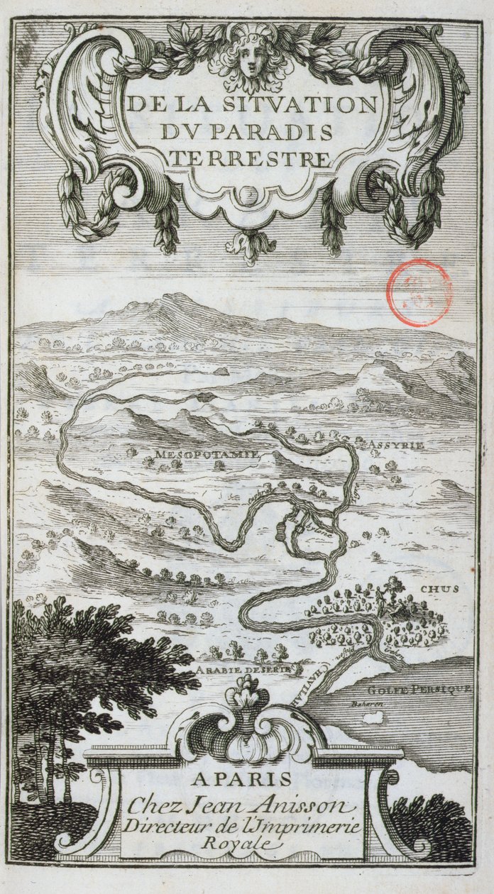
Map from De La Situation du Paradis Terrestre, 1691 by French School

Map from De La Situation du Paradis Terrestre, 1691

(Map from De La Situation du Paradis Terrestre, 1691 )


French School

€ 107.65
Enthält 0% MwSt.
   Configure art print
1691  ·  engraving  ·  Picture ID: 432028

Cultural Circles  ·  Cartography

Map from De La Situation du Paradis Terrestre, 1691 by French School. Available as an art print on canvas, photo paper, watercolor board, uncoated paper or Japanese paper.
garden of eden · paradise · middle east · mesopotamia · assyria · iraq · irak · theology · exegesis · bible · persian gulf · arabia · desert · arabian · tigris · euphrates · illustration · Bibliotheque Sainte-Genevieve, Paris, France / Bridgeman Images
AR/3D   View in 3D / AR zu Favoriten hinzufügen   Add to favorites    Select wall color    View painting in a room
0 Reviews

Configure art print

Picture Frame

Medium & Stretcher

Glass & Passepartout

Miscellaneous & Extras

 Save / compare configuration
Preview Icon

Summary

Gemälde
Veredelung
Keilrahmen
Museumslizenz

€ 107.65
(inkl. 20% MwSt)
   Add to cart

Bildschärfe: PERFEKT

Should you desire adjustments to brightness and color, or a custom crop of the motif, we are happy to make these changes at no additional cost to you. Please do not hesitate to contact us.

Similar artworks selected for you

Allegorical Map of the Stages of Love Circulation of water between sea and mountains, 1665 Map of the Garden of Eden Parke of the Artillery from Aubry de La Mottraye Map of the Village and Castle of Trarbach, 1704 (Plan de la Ville et: Chateau: de Traarbach) Robinson Crusoe Siege of Turin, 1706 Confluence of the Black, the Joto and the Senegal, illustration from Cartographic representation of Charybdis and Scylla in the Strait of Messina, Sicily. Engraving from The English and Dutch Force Facing the Spanish Fleet in the Port of Cadiz in 1596 Map of Trinity Island in the Antilles from Universal Cosmography Geography map of the Loire territory with the castles and towns bordering the river (Beaumont, Aigueperse, Clermont and Montferan, Beauregard, Cignac, Montaigu, Puy Guillaume) taken from An Iroquois Village, 1703 The Principality of Orange and Comtat Venaissin Connecticut A Map of the Country and City of Panama. Part. 3 : Chap : 5. (engraving) The Uktus Iron and Copper Factory, 1730 The Siege of Breda [plate 4 of 6] The Siege of Breda [plate 4 of 6] Map of Palestine, from a Passover Haggadah, printed in 1695 The Harbour of Fowey, Cornwall Map of Bavaria, Germany, from Theatrum Orbis Terrarum by Abraham Ortelius The Mount of Olives, Jerusalem, from Itinerarium Hierosolymitanum, by J. Cotovico, 1619 Siege of Ath, 1706 Germany, Austria The Flotilla of Admiral Joris van Spilbergen (c.1568-1620) Crossing the Magellan Straits Fort Rosalie des Natchez Canal du Midi, linking the Atlantic to the Mediterranean, beginning at Toulouse and ending, after Agde, at the Etang de Thau Map Showing the Supposed Location of Paradise
Show more similar artworks

Other art prints by French School

Birth of Jesus, from the Book of Hours of the Master of Jacques de Besançon Genealogical Tree of the Rougon-Macquart Family Poster Advertising the Baron Hotel in Aleppo The Shield of Achilles, After the Description in Homer The Carte du Tendre, a map of an imaginary country, from volume II of Clelie written by Mademoiselle de Scudery, engraved by Francois Chauveau (1613-76) 1656 Beef: Diagram Depicting the Different Cuts of Meat Reproduction of Map of Routes of St. James of Compostel, Originally Engraved by D. Serveaux 1648 Poster advertising Pur Champagne, from Damery, Epernay Lyrics to Equestrian Statue of Charlemagne (742-814) The Man with Six Heads, Caricature of Charles Maurice de Talleyrand-Perigord, 1815 Veal: diagram depicting the different cuts of meat Poster advertising Maggi Cuts of Pork, illustration from a French Domestic Science Manual by H. de Puytorac, published by Editions Fernand Nathan, late 19th century Frederic Chopin (1810-49) Engraved from a Daguerrotype
Discover more works by French School

Other motives from the category Cartography

Map of the Battle of Rivoli, published by William Blackwood and Sons, Edinburgh and London Map of Countries First Discovered by Christopher Columbus (1451-1506) 1500 Map tracing Magellan The Holy Land, from an Atlas of the World in 33 Maps, Venice Map of the world with possessions of the British Empire coloured red, c.1870 Detail of Copy of a Catalan Map of Europe and North Africa, presented to Charles V of France in 1381 Map of the City of New York [as far north as East 53rd Street], 1885 Map Depicting the Destruction of the Spanish Colony of St. Augustine in Florida on 7th July 1586 by the English Fleet Commanded by Sir Francis Drake Map of India, published by William Blackwood and Sons, Edinburgh and London, 1848 Map of Great Britain, Europe and North West Africa, from Portugaliae Monumenta Cartographica, an Account of the Discoveries of Fernao Gomez from 1470-75 Map of the China Sea, from a Facsimile of the Map No.5 Showing the route of the Armada fleet, engraved by Augustine Ryther Map of Sussex Map of the Battles of Turcoing and Tournay, Published by William Blackwood and Sons Map of Shropshire
View More from "Cartography"

Excerpt from our top sellers

The Plain of Auvers The Swing Evening at the Iris Field Carnival Evening Little Oak Tree The Consummation of Empire Boy viewing Mount Fuji, 1839 The Two Crowns The Birth of Venus (edited) Autumn Landscape with Four Trees Moa Luncheon of the Boating Party The Great Wave off Kanagawa Valencian Fishermen Mother of the World
Show More Artworks


What our customers think about us


Frequently Asked Questions about Meisterdrucke


Personalizing your art print at Meisterdrucke is a simple and intuitive process that allows you to design an artwork exactly to your specifications: Choose a frame, determine the image size, decide on a printing medium, and add suitable glazing or a stretcher frame. We also offer customization options such as mats, fillets, and spacers. Our customer service is available to help you design your perfect artwork.

At Meisterdrucke, you have the fascinating option to visualize the artwork you configured directly in your own space. For a tailored preview, simply upload a photo of your room and let the artwork appear on it. If you visit us via a mobile device, be it a phone or tablet, our augmented reality feature brings the image to life and seamlessly projects it into your space. An experience that uniquely combines art and technology.

Choosing the medium is often a matter of personal taste. To give you a clearer idea, we have provided some images for each medium. For a holistic experience, we also offer you a sample set of all paper variants so you can make a decision not just visually but also haptically. You can take advantage of the sample set free of charge – only the shipping costs will apply. You can order the sample set directly.

Do not worry. At Meisterdrucke, we do not proceed mechanically. We manually review each order. If there are any inconsistencies or peculiarities in the configuration, we will immediately contact you. Of course, our courteous and patient support is always at your side to assist you with the configuration. Together with you, we adjust your image by phone or email so that the final result exactly meets your expectations.


Do you have any questions?

Are you interested in an art print from our manufactory but still unsure? Do you need advice on choosing the medium or help with the order?

Our experts are happy to assist you.

+43 4257 29415
support@meisterdrucke.com
Mo-Do: 7:00 - 16:00 | Fr: 7:00 - 13:00

Do you have any questions?

Are you interested in an art print from our manufactory but still unsure? Do you need advice on choosing the medium or help with the order?

Our experts are happy to assist you.

+43 4257 29415
support@meisterdrucke.com
Mo-Do: 7:00 - 16:00 | Fr: 7:00 - 13:00


Meisterdrucke

   Kärntner Strasse 46
        9586 Finkenstein am Faaker See
        Austria
        +43 4257 29415
        support@meisterdrucke.com
Other languages

                   
Erfahrungen & Bewertungen zu Meisterdrucke
Post.at DHL Express Quehenberger Cargoboard
Kaiser Franz Joseph

Meisterdrucke
Kärntner Strasse 46
9586 Finkenstein am Faaker See · Austria
+43 4257 29415 · office@meisterdrucke.com
Post.at DHL Express Quehenberger Cargoboard


Meisterdrucke 2764 Bewertungen auf ProvenExpert.com

(c) 2025 meisterdrucke.us