support@meisterdrucke.com  ·  0043 4257 29415

Deutsch English Italiano Español Français Nederlands Português Svenska Polski Dansk
Search by artist, work title or style – e.g. Monet, Starry Night, Impressionism, Hokusai wave, nude. Describe the scene – e.g. green meadow, abstract with lots of red, dark oil painting, standing nude next to a tree.

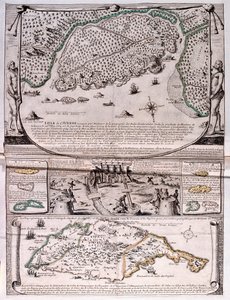
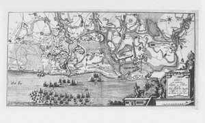
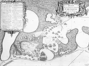
Map of Barbados by French School

Map of Barbados

(Map of Barbados )


French School

€ 112.28
Tax-free
   Configure art print
18th century  ·  engraving  ·  Image ID: 115638

Cultural Circles  ·  Cartography

Map of Barbados by French School. Available as an art print on canvas, photo paper, watercolor board, natural paper, or Japanese paper.
island · caribbean · west indies · Private Collection / Bridgeman Images
AR/3D   View in 3D / AR zu Favoriten hinzufügen   Add to favorites    Change wall color    View picture in a room
0 Reviews

Configure art print

Picture Frame

Medium & Stretcher

Glass & Passepartout

Miscellaneous & Extras

 Save / compare configuration
Preview Icon

Summary

Gemälde
Veredelung
Keilrahmen
Museumslizenz

€ 112.28
(inkl. 20% MwSt)
   Add to cart

Bildschärfe: PERFEKT

If you'd like us to adjust the brightness, colors, or crop the image, we're happy to do this for you at no extra cost. Just get in touch!

Similar artworks selected for you

Plan of the Town and Harbour of Cartagena, Colombia Plan of Rhodes (Rodos) - in The Harbour of Cape Cod, from Voyages de Sieur Champlain by Samuel de Champlain, Published in Paris, 1613 Map No.10 showing the route of the Armada fleet, engraved by Augustine Ryther Map of the Siege of Quebec by the British Fleet, 1670 The Capture of Cádiz in 1596 Plan of the Bay and City of Rio de Janeiro and the disposition of the French and Portuguese naval forces during the French attack under Duguay-Trouin in 1711, c.1730 A New and Accurate Plan of the City and Harbour of Cartagena, Showing the Descent of That Place by the British Fleet and Land Forces, Under the Command of the Admirals Vernon and Ogle and General Wentworth in March & April 1741 Island Elba with Piombino, Italy Plan of the Attack against Basse-Terre on the Island of Guadeloupe by a Squadron of His Majesty New France: The Course of the St Lawrence River as far as Quebec Town and Harbour of Charles Town (Charleston), South Carolina Easter Island, from Travel Atlas by James Cook Siege of Krakow (1655) Map of Havana, 1608 Map of the City and Port of Gaeta, Italy Map of Atlantis, from Plan of the Ile d Turtle Island and Santo Domingo from a 17th century map by Pierre Vandier Lutetia or the First Plan of Paris, Taken from Caesar, Strabo, Emperor Julian and Ammianus Marcellinus, 1705 Map of the Island of Tinos with the Venetian fleet, 17th century The port of Alexandria. 17th century drawing Easter Island (Rapa Nui): Itinerary of Mr. Pinart Port of St. Louis, Montevideo Erivan Panorama Map of the Island of Zante, a Venetian Stronghold Against the Turks French Guiana, South America The capture of the Prussian fortress of Kolberg on 16 December 1761
Show more similar artworks

More art prints by French School

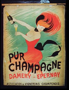
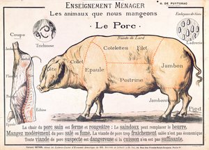
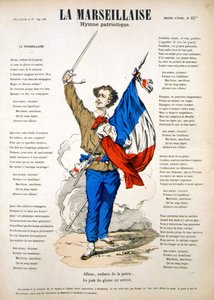
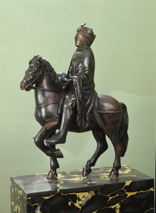
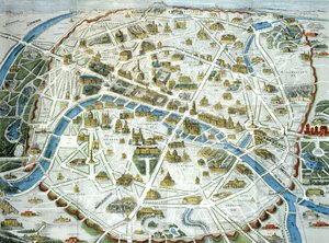
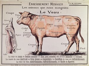
Manuscript 69 f. 48r, Birth of Jesus, from the Book of Hours of the "Master of Jacques de Besançon" Genealogical tree of the Rougon-Macquart family The Carte du Tendre, a map of an imaginary country, from volume II of Beef: diagram depicting the different cuts of meat Poster advertising the Baron Hotel in Aleppo, c. 1920 The Shield of Achilles, after the description in Homer Reproduction of Map of Routes of St. James of Compostela, originally engraved by D. Serveaux 1648 Poster advertising Pur Champagne, from Damery, Épernay "The Man with Six Heads", caricature of Charles Maurice de Talleyrand-Périgord (1754-1838), 1815 Cuts of Pork, illustration from a French Domestic Science Manual by H. de Puytorac, published by Éditions Fernand Nathan, late 19th century Lyrics to «La Marseillaise». Image of Épinal Military honours being paid to General Georges de Villebois-Mareuil (1847-1900) by the British at the cemetery of Boshof, illustration from Le Petit Journal, 29 April 1900 Equestrian statue of Charlemagne (742-814) Map of Paris depicting the city Veal: diagram depicting the different cuts of meat
Show more works by French School

More motifs from the category Cartography

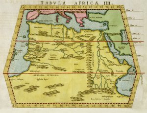
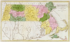
Map of New France dedicated to Colbert by Duchesneau, Intendant, 1681 Map of Central Europe, from the Map of the Battle of Wagram, published by William Blackwood and Sons, Edinburgh and London, 1848 Map of North Africa, c. 1580s Map of Manhattan, c. 1740 Map of Massachusetts, from Map of Toledo, from Civitates Orbis Terrarum by Georg Braun (1541-1622) and Frans Hogenberg (1535-90), 1566 Map of Visby, from ‘Civitates Orbis Terrarum’ by Georg Braun (1541-1622) and Frans Hogenberg (1535-90), c.1572-1617 Map of the Tribe of Asher, 1590 Map of Transylvania, from an atlas, Amsterdam, 1657 Scene of the Zodiac including a Galleon, detail from the vault of the Commissioner Plan, a map of the City of New York, by the Commissioners appointed by an act of legislature passed April 3, 1807, engraved by P. Maverick, 1811 Map of the Russian Empire, in Europe and Asia, from A Map of the Kingdom of Kabul Map of Vilnius, Lithuania, from
View More from "Cartography"

A selection of our top sellers

Starry Night, c. 1850-65 Japanese Vase with Roses and Anemones, 1890 Bordighera, 1884 Song of the Angels, 1881 Winter Landscape with Ice Skaters, circa 1608 Portrait of a Young Woman The Fall of the Damned into Hell Composition, 1930 Fishermen at Sea Les Flamants The Boxer Poster for the 14th Exhibition of Vienna Secession, 1902 Rocky Mountain Landscape Self-Portrait (Melancholy of the Mountains). 1929 The Night Watch
Show more artworks


What our customers think about us


Frequently Asked Questions about Meisterdrucke


Personalizing your art print at Meisterdrucke is simple and intuitive: Choose a frame, set the image size, pick a printing medium, and add suitable glazing or a stretcher frame. We also offer additional customization options like mats, fillets, and spacers. If you have any questions, our customer service team is ready to help you create your perfect artwork.

At Meisterdrucke, you can visualize your configured artwork directly in your own room. Simply upload a photo of your space and see how the artwork looks in it. If you're visiting us on a mobile device — phone or tablet — our augmented reality feature brings the picture to life and projects it right into your room. A unique experience that combines art and technology.

Choosing the right medium is often a matter of personal taste. To give you a better idea, we've provided some images for each medium. We also offer a sample set of all paper variants, so you can decide not just visually but by touch as well. You can order the sample set free of charge — only shipping costs apply.

Don't worry! At Meisterdrucke, we don't just process orders mechanically. Every order is manually reviewed by our team. If we spot any inconsistencies or issues with your configuration, we'll get in touch with you right away. And of course, our friendly and patient support team is always here to help you with your configuration. We'll work with you by phone or email to adjust your image so the final result is exactly what you had in mind.


Still have questions?

Are you interested in an art print from our manufactory but still unsure? Do you need advice on choosing the medium or help with the order?

Our experts are happy to assist you.

+43 4257 29415
support@meisterdrucke.com

Mo-Do: 7:00 - 16:00 | Fr: 7:00 - 13:00

Still have questions?

Are you interested in an art print from our manufactory but still unsure? Do you need advice on choosing the medium or help with the order?

Our experts are happy to assist you.

+43 4257 29415
support@meisterdrucke.com
Mo-Do: 7:00 - 16:00 | Fr: 7:00 - 13:00


Meisterdrucke

   Kärntner Strasse 46
        9586 Finkenstein am Faaker See
        Austria
        +43 4257 29415
        support@meisterdrucke.com
Other languages

                   
Erfahrungen & Bewertungen zu Meisterdrucke
Post.at DHL Express Quehenberger Cargoboard
Kaiser Franz Joseph

Meisterdrucke
Kärntner Strasse 46
9586 Finkenstein am Faaker See · Austria
+43 4257 29415 · support@meisterdrucke.com
Post.at DHL Express Quehenberger Cargoboard


(c) 2026 meisterdrucke.us