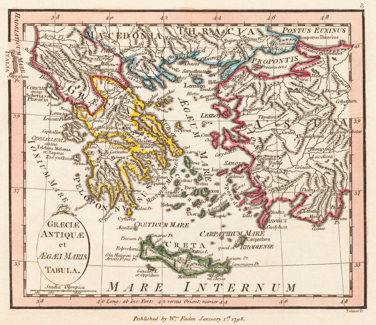
Ancient Greece. Aegean Sea. Asia Minor. Map. by William Faden

Ancient Greece. Aegean Sea. Asia Minor. Map.

(Ancient Greece. Aegian Sea. Asia Minor. Map.)


William Faden

€ 105.5
Enthält 0% MwSt.
   Configure art print
Undated  ·  engraving  ·  Picture ID: 1422718

Nonclassified artists

Ancient Greece. Aegean Sea. Asia Minor. Map. by William Faden. Available as an art print on canvas, photo paper, watercolor board, uncoated paper or Japanese paper.
18th century · xviiith century · xviii · c18th · eighteenth century · 18 18th xviii xviiith century · 18 18th 18th 18th 18th 18th century · 18 18th 18th 18th xviii 18th century · 18 18th xviii 18th century · early 18th century · 18 18th xviii xviiith eighteenth century · antiquity · antique · arts · works of art · geographical map · cartography · geography · colour · color · coloured · colors · colours · colored · crete · greece · greek · greeks · greece greek · europe · european · drawing · drawings · engraving · engraver · gravure engraving · ancient greece · antique greece · ancient greeks · history · historic · historical · maps · photo · photos · photograph · photography (art) · print · illustration · illustrations · aegean sea · graeciae antiquae et aegaei maris tabula · Ancient Greece and the Aegean Sea · · Private Collection / Bridgeman Images
AR/3D   View in 3D / AR zu Favoriten hinzufügen   Add to favorites    Select wall color    View painting in a room
0 Reviews

Configure art print

Picture Frame

Medium & Stretcher

Glass & Passepartout

Miscellaneous & Extras

 Save / compare configuration
Preview Icon

Summary

Gemälde
Veredelung
Keilrahmen
Museumslizenz

€ 105.5
(inkl. 20% MwSt)
   Add to cart

Bildschärfe: PERFEKT

Should you desire adjustments to brightness and color, or a custom crop of the motif, we are happy to make these changes at no additional cost to you. Please do not hesitate to contact us.

Similar artworks selected for you

1780 Map - Map of Greece Drawn from a Large Number of Ancient and New Memoirs, Including Those of Messrs. Whele and Tournefort Ottoman Empire in 1696 by Jaillot Western Part of Roman Empire. Map. Albania, large part of Greece (except northeast), large part of Republic of Macedonia (except north) Map of Greece (etching) Eastern Roman Empire Map Ancient Asia Minor. Map. The Curious Atlas or the World Represented in General and Particular Maps of the Sky and Earth, p. 155 1700 Map of the Eastern Mediterranean Ancient Italy Map Germany (State: Saxony), south Poland, large part of Ukraine (except north), west Czech Republic, Slovakia, east Austria, Hungary, Romania, Moldova, Slovenia, Croatia, Italy (east, central and south), Bosnia and Herzegovina, Serbia, Bulgaria, Montenegro Turkey in Asia 1762 map - Turkey in Europe Most Accurate Map of the Entire Archipelago and Greece in Which All the Subordinate Islands Are Shown North Greece Italy Map of the Eastern Mediterranean and Black Sea countries, Turkey and the provinces of Asia Minor The Empire of Charlemagne from 1692 Map of the Turkish Empire in Europe Greece, in A New Map of Turkey in Asia, Divided into Its Provinces, from the Best Authorities Map of Southern Italy, Corsica, and Sardinia Known in Ancient Times as Great Greece or Magnia Graecia Southern Part of Italy or Kingdom of Naples, Obedient to Spain, Divided into Districts, Lands, and Principalities, with Sicily and Malta A New Map of Turkey in Asia 1801 map of Turkey in Asia by John Cary Illustration from the book Atlas of All Parts of the Earth by unknown author and published by Chr. Steen & Søn (Copenhagen, 1857) The Mediterranean Sea and North Africa. Scale 1 Map of the Ottoman and Persian Empires (Cropped) Map of the Eastern Roman Empire and Adjacent Regions During the Time of Constantine VII Porphyrogennetos and His Predecessors (8th-9th Centuries)
Show more similar artworks

Other art prints by William Faden

Ancient Britain. Map. Ancient Asia Minor. Map. Ancient Greece. Aegean Sea. Asia Minor. Map. Ancient Gaul Map Ancient Italy Map Ancient Egypt. Map. Australia and New Zealand. New Holland. Map. Ancient Spain and Portugal. Map. Composite World Atlas A Map of a Part of Yucatan or of That Part of the Eastern Shore Within the Bay of Honduras Alloted to Great Britain for the Cutting of Logwood, in Consequence of the Convention Signed with Spain on the 14th July 1786. By a Bay Man. Composite World Atlas by William Faden Plan of the City of New York in North America Surveyed in the Years 1766 and 1767 Published in Faden Indians in the Fur Trade in Canada Western Part of Roman Empire. Map. Palestine Map
Discover more works by William Faden

Excerpt from our top sellers

The Gate of the Great Umayyad Mosque, Damascus Still Life with Coffee The Interior of the Palm House Fish Magic White Waterlilies Starry Night, c.1850-65 Striped Jug with Spring Flowers, 1992 Stein on the Danube (District of Krems) The Singing Man Poppies Childhood Friends The Attic Room Meadows near Greifswald The Creation of the World Representing the Cosmic Sphere of the Earth (Back Panels of the Triptych The Plain of Auvers
Show More Artworks


What our customers think about us


Frequently Asked Questions about Meisterdrucke


Personalizing your art print at Meisterdrucke is a simple and intuitive process that allows you to design an artwork exactly to your specifications: Choose a frame, determine the image size, decide on a printing medium, and add suitable glazing or a stretcher frame. We also offer customization options such as mats, fillets, and spacers. Our customer service is available to help you design your perfect artwork.

At Meisterdrucke, you have the fascinating option to visualize the artwork you configured directly in your own space. For a tailored preview, simply upload a photo of your room and let the artwork appear on it. If you visit us via a mobile device, be it a phone or tablet, our augmented reality feature brings the image to life and seamlessly projects it into your space. An experience that uniquely combines art and technology.

Choosing the medium is often a matter of personal taste. To give you a clearer idea, we have provided some images for each medium. For a holistic experience, we also offer you a sample set of all paper variants so you can make a decision not just visually but also haptically. You can take advantage of the sample set free of charge – only the shipping costs will apply. You can order the sample set directly.

Do not worry. At Meisterdrucke, we do not proceed mechanically. We manually review each order. If there are any inconsistencies or peculiarities in the configuration, we will immediately contact you. Of course, our courteous and patient support is always at your side to assist you with the configuration. Together with you, we adjust your image by phone or email so that the final result exactly meets your expectations.


Do you have any questions?

Are you interested in an art print from our manufactory but still unsure? Do you need advice on choosing the medium or help with the order?

Our experts are happy to assist you.

+43 4257 29415
support@meisterdrucke.com
Mo-Do: 7:00 - 16:00 | Fr: 7:00 - 13:00

Do you have any questions?

Are you interested in an art print from our manufactory but still unsure? Do you need advice on choosing the medium or help with the order?

Our experts are happy to assist you.

+43 4257 29415
support@meisterdrucke.com
Mo-Do: 7:00 - 16:00 | Fr: 7:00 - 13:00


Meisterdrucke

   Kärntner Strasse 46
        9586 Finkenstein am Faaker See
        Austria
        +43 4257 29415
        support@meisterdrucke.com
Other languages

                   
Erfahrungen & Bewertungen zu Meisterdrucke
Post.at DHL Express Quehenberger Cargoboard
Kaiser Franz Joseph

Meisterdrucke
Kärntner Strasse 46
9586 Finkenstein am Faaker See · Austria
+43 4257 29415 · office@meisterdrucke.com
Post.at DHL Express Quehenberger Cargoboard


Meisterdrucke 2716 Bewertungen auf ProvenExpert.com

(c) 2025 meisterdrucke.us