Search by artist, work title or style – e.g. Monet, Starry Night, Impressionism, Hokusai wave, nude. Describe the scene – e.g. green meadow, abstract with lots of red, dark oil painting, standing nude next to a tree.

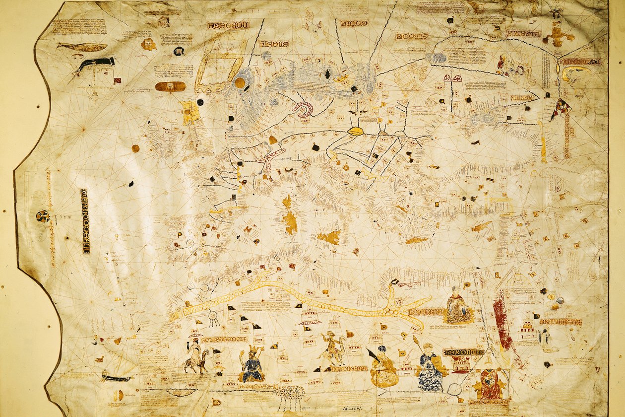
Map of Charles V, Map of Mecia de Viladestes, a portulan of Europe and North Africa, 1413 by Spanish School

Map of Charles V, Map of Mecia de Viladestes, a portulan of Europe and North Africa, 1413

(Map of Charles V, Map of Mecia de Viladestes, a portulan of Europe and North Africa, 1413 (vellum))


Spanish School

€ 124.38
Enthält 0% MwSt.
   Configure art print
1413  ·  vellum  ·  Picture ID: 36081

Cultural Circles  ·  Cartography

Map of Charles V, Map of Mecia de Viladestes, a portulan of Europe and North Africa, 1413 by Spanish School. Available as an art print on canvas, photo paper, watercolor board, uncoated paper or Japanese paper.
villadestes · sahara · niger river · african · europe · portulan · Bibliotheque Nationale, Paris, France / Bridgeman Images
AR/3D   View in 3D / AR zu Favoriten hinzufügen   Add to favorites    Select wall color    View painting in a room
0 Reviews

Configure art print

Picture Frame

Medium & Stretcher

Glass & Passepartout

Miscellaneous & Extras

 Save / compare configuration
Preview Icon

Summary

Gemälde
Veredelung
Keilrahmen
Museumslizenz

€ 124.38
(inkl. 20% MwSt)
   Add to cart

Bildschärfe: PERFEKT

Should you desire adjustments to brightness and color, or a custom crop of the motif, we are happy to make these changes at no additional cost to you. Please do not hesitate to contact us.

Similar artworks selected for you

World Chart, from Eastern Coasts of America to India Chart by Juan de la Cosa (1500) Unknown Image Marine Map of the Mediterranean Sea and the Black Sea Coasts of Europe and North Africa Geographic map of the Mediterranean Guillmus Soleri civis maioricaru me fecit Marco Polo Marine Map of the Mediterranean Sea and the Black Sea Nautical chart of the Mediterranean area, including Europe with British Isles and part of Scandinavia Map of the Moluccas, 1522 Cotton Roll XIII, 44 Italie provincie modernus situs Map of China (Cathay), with descriptions of small scenes, delimitation of the kingdoms with its sovereign represented each time Cathay, China from the Catalan Atlas View of China (Cambaluc, now Beijing) Detail of the world map of brother Maurus Camaldolese 1459 Nautical Chart of the Mediterranean Sea and the Black Sea Portolan Chart of Gabriel de Vallseca Catalan Atlas Europe, from a 19th century copy of the nautical planisphere Detail from a Catalan World Map Plan of Rome Mappa Mundi, 1502 A Nautical Map, detail of Western Europe, 1564 World Chart, from Eastern Coasts of America to India Genoese World Map, Designed by Toscanelli Detail of the Mediterranean from the Mappa Mundi, c.1290 Spanish portolan chart View of the Archipelago of Borneo (detail) Catalan Atlas, 1375
Show more similar artworks

Other art prints by Spanish School

Cristo de Burgos, in the Capilla del Santisimo Cristo Map of Tenochtitlan and the Gulf of Mexico, from Praeclara Ferdinadi Cortesii de Nova maris Oceani Hyspania Narratio by Hernando Cortes (1485-1547) 1524 Map Showing the Route of Christopher Columbus on His First Voyage to the New World Genealogy of the Inca Rulers and Their Spanish Successors from Manco Capac to Ferdinand VI of Spain, c.1750 The Hand of God (Detail) Anacaona, the Golden Flower Angels and David with the Ark of the Covenant standing before the Temple of Solomon, from the Visigothic-Mozarabic Bible of St. Isidores, A.D. 960 Game of pelota in the open air, from the manuscript made under the direction of Alfonso X The Wise, King of Castile and Leon Map of the Island of Mallorca, 1785 The Wedding at Cana Scene of the crucifixion Portraits of the children of Philip I (1478-1506) The Handsome and Joanna Assassination of Julius Caesar The Cathedral at Plaza de la Independencia Beatriz Enriquez de Arana, mistress of Columbus
Discover more works by Spanish School

Other motives from the category Cartography

Map of France, c. 1914 A Map of Marylebone, London, 1746 Map of Berlin and Coelln, 1688 New York and its Environs, 1867 Map of the Town of Lille, from Map Showing the Extent of Work During the Haussmann Period of Development in Paris from 1854-71, 1871 Map of the newly discovered Nova Zembla, illustration from Diarium Nauticum, seu vera descriptio trium navigationum admirandarum... by Gerrit de Veer Map of the Middle East, from Theatrvm Orbis Terrarvm, 1570 Nicolaus Copernicus, Detail from a Map Showing the Copernican System of Planetary Orbits, Map of Sixteenth Century Europe, from the Map of India, 1865 Detail of the Ile de la Cité, from the Map of Paris c. 1540, known as the Plan de la Tapisserie, made as a Tapestry c. 1570 Map of the world, based on descriptions and co-ordinates given in Map of Africa Town Map of Cairo
View More from "Cartography"

Excerpt from our top sellers

The Luncheon: Monet Portrait of the Artist Rain Steam and Speed, The Great Western Railway Far, Far Away Soria Moria Palace Shimmered Like Gold Carnation, Lily, Lily, Rose The Wild Hunt of Odin Fishermen at Sea Circles in a Circle Boys Bathing Strolling along the Seashore, 1909 The Blue Grotto on Capri Ponte Fabricio The Girl with a Pearl Earring Water Lilies, the Cloud The Singing Man
Show More Artworks


What our customers think about us


Frequently Asked Questions about Meisterdrucke


Personalizing your art print at Meisterdrucke is a simple and intuitive process that allows you to design an artwork exactly to your specifications: Choose a frame, determine the image size, decide on a printing medium, and add suitable glazing or a stretcher frame. We also offer customization options such as mats, fillets, and spacers. Our customer service is available to help you design your perfect artwork.

At Meisterdrucke, you have the fascinating option to visualize the artwork you configured directly in your own space. For a tailored preview, simply upload a photo of your room and let the artwork appear on it. If you visit us via a mobile device, be it a phone or tablet, our augmented reality feature brings the image to life and seamlessly projects it into your space. An experience that uniquely combines art and technology.

Choosing the medium is often a matter of personal taste. To give you a clearer idea, we have provided some images for each medium. For a holistic experience, we also offer you a sample set of all paper variants so you can make a decision not just visually but also haptically. You can take advantage of the sample set free of charge – only the shipping costs will apply. You can order the sample set directly.

Do not worry. At Meisterdrucke, we do not proceed mechanically. We manually review each order. If there are any inconsistencies or peculiarities in the configuration, we will immediately contact you. Of course, our courteous and patient support is always at your side to assist you with the configuration. Together with you, we adjust your image by phone or email so that the final result exactly meets your expectations.


Do you have any questions?

Are you interested in an art print from our manufactory but still unsure? Do you need advice on choosing the medium or help with the order?

Our experts are happy to assist you.

+43 4257 29415
support@meisterdrucke.com
Mo-Do: 7:00 - 16:00 | Fr: 7:00 - 13:00

Do you have any questions?

Are you interested in an art print from our manufactory but still unsure? Do you need advice on choosing the medium or help with the order?

Our experts are happy to assist you.

+43 4257 29415
support@meisterdrucke.com
Mo-Do: 7:00 - 16:00 | Fr: 7:00 - 13:00


Meisterdrucke

   Kärntner Strasse 46
        9586 Finkenstein am Faaker See
        Austria
        +43 4257 29415
        support@meisterdrucke.com
Other languages

                   
Erfahrungen & Bewertungen zu Meisterdrucke
Post.at DHL Express Quehenberger Cargoboard
Kaiser Franz Joseph

Meisterdrucke
Kärntner Strasse 46
9586 Finkenstein am Faaker See · Austria
+43 4257 29415 · office@meisterdrucke.com
Post.at DHL Express Quehenberger Cargoboard


Meisterdrucke 2745 Bewertungen auf ProvenExpert.com

(c) 2025 meisterdrucke.us