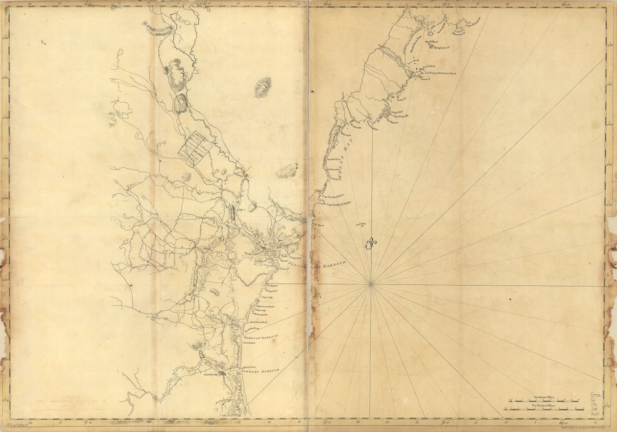
Coast of New England from Cape Elizabeth, Me. to Newburyport, Mass. by Joseph F. W. Des Barres

Coast of New England from Cape Elizabeth, Me. to Newburyport, Mass.

((Coast of New England from Cape Elizabeth, Me. to Newburyport, Mass. LOC 77693969)


Joseph F. W. Des Barres

€ 110.05
Enthält 0% MwSt.
   Configure art print
1776  ·  Picture ID: 1554246

Nonclassified artists

Coast of New England from Cape Elizabeth, Me. to Newburyport, Mass. by Joseph F. W. Des Barres. Available as an art print on canvas, photo paper, watercolor board, uncoated paper or Japanese paper.
AR/3D   View in 3D / AR zu Favoriten hinzufügen   Add to favorites    Select wall color    View painting in a room
0 Reviews

Configure art print

Picture Frame

Medium & Stretcher

Glass & Passepartout

Miscellaneous & Extras

 Save / compare configuration
Preview Icon

Summary

Gemälde
Veredelung
Keilrahmen
Museumslizenz

€ 110.05
(inkl. 20% MwSt)
   Add to cart

Bildschärfe: PERFEKT

Should you desire adjustments to brightness and color, or a custom crop of the motif, we are happy to make these changes at no additional cost to you. Please do not hesitate to contact us.

Similar artworks selected for you

Coast of New England from Narragansett to Cape Cod Ipswich Bay and Cape Ann The Atlantic Neptune, published for the use of the Royal Navy of Great Britain The Atlantic Neptune, published for the use of the Royal Navy of Great Britain Chart of Arnola Island Coast of Maine from Salter Island to Portland Head Chart of Ipswich Bay and Cape Ann, Atlantic coast of North America A chart of the harbour of Boston The south west coast of Ireland from the Staggs of Castle Haven to Dursey I. Surveyed and navigated by M. Mackenzie Sen. 1775. A plan of Fort Montgomery & Fort Clinton, 1774-1779 Chart of the harbour of Point de Galle. Surveyed in January and March 1800, by Captain David Inverarity. To whom this plate is inscribed, by his most obliged A.Dalrymple. A Map of Nautical Remarks on Observations for the Chart of the Harbour of Boston A Chart of the Harbour of Rhode Island and Narragansett Bay Depths shown by soundings Wyre to Black Combe, from Mecklenburg Bay The Atlantic Neptune, Published for the Use of the Royal Navy of Great Britain A Chart of the Harbour of Rhode Island and Narraganset Bay Penobscot Bay (detail) A New Chart of the Coast from Lowestoff to Hasbrough Including Yarmouth Roads and Sands, Hasbrough Gatt, and the New Lights Chart of Terra Australis by M Flinders, Commr of His Majesty China Sea Singapore Strait by Staff Commander JW Reed Navg Lieuts TH Tizard... Assisted by the Officers of HMS Rifleman 1865-69 Map of Charleston, South Carolina, 3 August 1781 Plymouth Bay Map of the Bay of Gale A Topographical Chart of Rhode Island A Special Map of the Port of Boston with Soundings, Sandbanks, Rocks, and Other Useful Directions for Navigation England East Coast from Dungeness to Flamborough Head A Plan of Charlestown, S.C. by Faden
Show more similar artworks

Other art prints by Joseph F. W. Des Barres

The Atlantic Neptune The Atlantic Neptune, Published for the Use of the Royal Navy of Great Britain The Atlantic Neptune The Atlantic Neptune The Atlantic Neptune, published for the use of the Royal Navy of Great Britain The Atlantic Neptune, Published for the Use of the Royal Navy of Great Britain The Atlantic Neptune, published for the use of the Royal Navy of Great Britain The Atlantic Neptune, published for the use of the Royal Navy of Great Britain The Atlantic Neptune The Atlantic Neptune The Atlantic Neptune The Atlantic Neptune The Atlantic Neptune The Atlantic Neptune, Published for the Use of the Royal Navy of Great Britain The Atlantic Neptune
Discover more works by Joseph F. W. Des Barres

Excerpt from our top sellers

The Artist Landscape with Church and Path Noon Neptune The Buddha Group of Egrets, 1925-36 Villa by the Sea The Disciples Peter and John Running to the Sepulchre on the Morning of the Resurrection Blackman Street, Borough, London The Bathing Pool Woman with Flag, Mexico City Two Reclining Figures Seated Nude Back View Mont Sainte-Victoire The Geographer
Show More Artworks


What our customers think about us


Frequently Asked Questions about Meisterdrucke


Personalizing your art print at Meisterdrucke is a simple and intuitive process that allows you to design an artwork exactly to your specifications: Choose a frame, determine the image size, decide on a printing medium, and add suitable glazing or a stretcher frame. We also offer customization options such as mats, fillets, and spacers. Our customer service is available to help you design your perfect artwork.

At Meisterdrucke, you have the fascinating option to visualize the artwork you configured directly in your own space. For a tailored preview, simply upload a photo of your room and let the artwork appear on it. If you visit us via a mobile device, be it a phone or tablet, our augmented reality feature brings the image to life and seamlessly projects it into your space. An experience that uniquely combines art and technology.

Choosing the medium is often a matter of personal taste. To give you a clearer idea, we have provided some images for each medium. For a holistic experience, we also offer you a sample set of all paper variants so you can make a decision not just visually but also haptically. You can take advantage of the sample set free of charge – only the shipping costs will apply. You can order the sample set directly.

Do not worry. At Meisterdrucke, we do not proceed mechanically. We manually review each order. If there are any inconsistencies or peculiarities in the configuration, we will immediately contact you. Of course, our courteous and patient support is always at your side to assist you with the configuration. Together with you, we adjust your image by phone or email so that the final result exactly meets your expectations.


Do you have any questions?

Are you interested in an art print from our manufactory but still unsure? Do you need advice on choosing the medium or help with the order?

Our experts are happy to assist you.

+43 4257 29415
support@meisterdrucke.com
Mo-Do: 7:00 - 16:00 | Fr: 7:00 - 13:00

Do you have any questions?

Are you interested in an art print from our manufactory but still unsure? Do you need advice on choosing the medium or help with the order?

Our experts are happy to assist you.

+43 4257 29415
support@meisterdrucke.com
Mo-Do: 7:00 - 16:00 | Fr: 7:00 - 13:00


Meisterdrucke

   Kärntner Strasse 46
        9586 Finkenstein am Faaker See
        Austria
        +43 4257 29415
        support@meisterdrucke.com
Other languages

                   
Erfahrungen & Bewertungen zu Meisterdrucke
Post.at DHL Express Quehenberger Cargoboard
Kaiser Franz Joseph

Meisterdrucke
Kärntner Strasse 46
9586 Finkenstein am Faaker See · Austria
+43 4257 29415 · office@meisterdrucke.com
Post.at DHL Express Quehenberger Cargoboard


Meisterdrucke 2705 Bewertungen auf ProvenExpert.com

(c) 2025 meisterdrucke.us