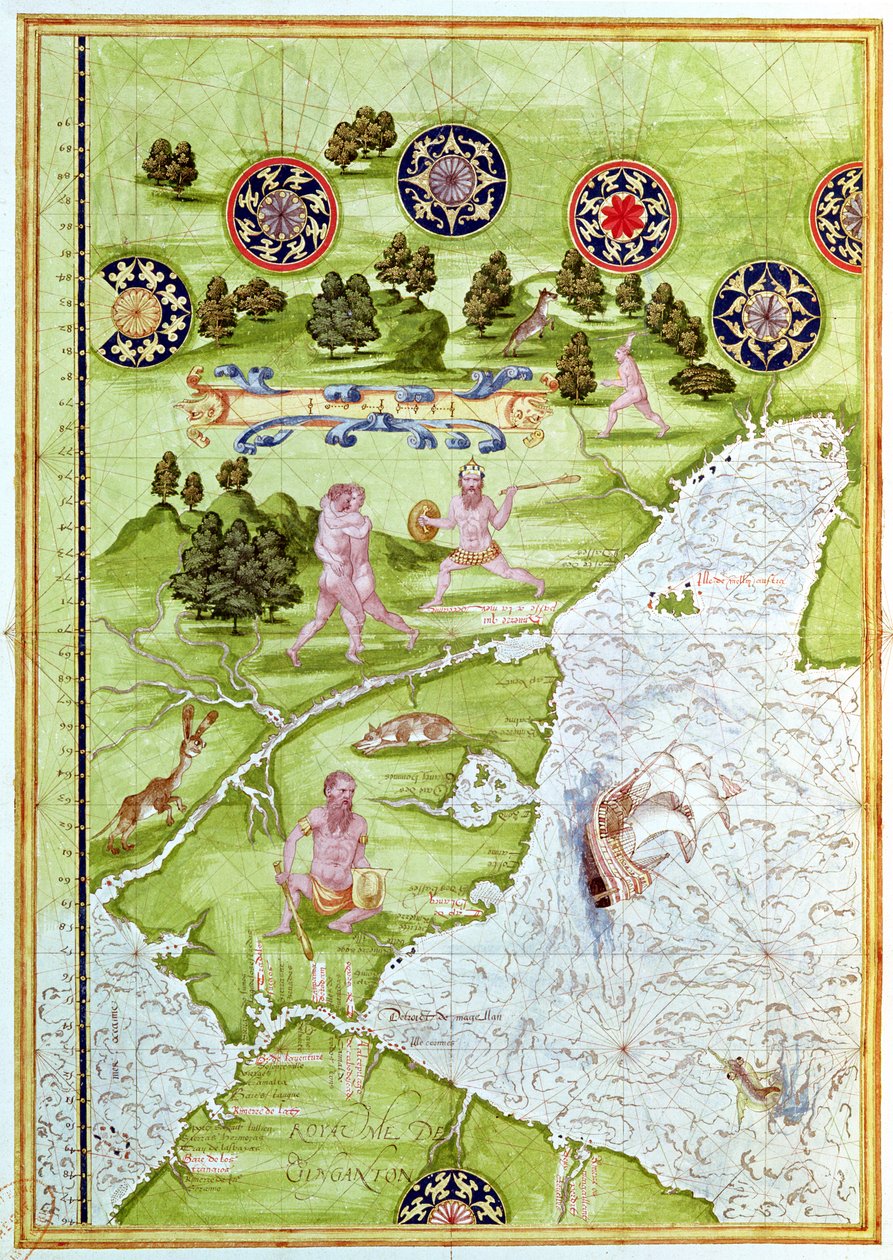
Map of the Magellan Straits, from

Map of the Magellan Straits, from 'Cosmographie Universelle', 1555 (Fol.40v)

(Fol.40v Map of the Magellan Straits, from 'Cosmographie Universelle', 1555 )


Guillaume Le Testu

€ 122.73
Enthält 0% MwSt.
   Configure art print
1555  ·  Wasserfarbe auf Papier  ·  Picture ID: 91977

Nonclassified artists  ·  Cartography

Map of the Magellan Straits, from 'Cosmographie Universelle', 1555 (Fol.40v) by Guillaume Le Testu. Available as an art print on canvas, photo paper, watercolor board, uncoated paper or Japanese paper.
tierra del fuego · patagonia · south american · ocean · animal · bird · compass · native · ship · hunting · strait · savage · wild · Min. Defense - Service Historique de l'Armee de Terre,France / Bridgeman Images
Other color variations of this picture  
AR/3D   View in 3D / AR zu Favoriten hinzufügen   Add to favorites    Select wall color    View painting in a room
0 Reviews

Configure art print

Picture Frame

Medium & Stretcher

Glass & Passepartout

Miscellaneous & Extras

 Save / compare configuration
Preview Icon

Summary

Gemälde
Veredelung
Keilrahmen
Museumslizenz

€ 122.73
(inkl. 20% MwSt)
   Add to cart

Bildschärfe: PERFEKT

Should you desire adjustments to brightness and color, or a custom crop of the motif, we are happy to make these changes at no additional cost to you. Please do not hesitate to contact us.

Similar artworks selected for you

Map of Australia, from The Spice Trade in the Moloccas, from Map of Peru, from Map of Australia and Magellan Island from Map of Florida and the Antilles, from Map of Florida, Canada and Labrador (from Map of Brasil, from Map of Florida, from Fol.10v Map of Scandinavia and Northern Russia, from Map of the Magellan Straits, from Atlas by Diego Homem of South America, showing Indians in their settlements, Spanish Expeditionary Force Camp and Men in Armour Map of the City of Jerusalem, from Hydrographic Map of Brazil Map of the China Sea, from a Facsimile of the Arabia and India, from the The Indes Portuguese nautical atlas. Page of the Atlas Miller manuscript made in 1519 by Pierre and Georges Reinel, Lopo Homem (cartographers) and Antoine de Hollande (miniaturist) Map of China (Cathay), with descriptions of small scenes, delimitation of the kingdoms with its sovereign represented each time Map of Concarneau, from the Arabian Peninsula Miller Atlas, c1519 Brazil from the Map of Sixteenth Century Arabia, from the Chart of the Mediterranean, Black Sea, and the coasts of western Europe and northwest Africa Map of Europe, from a Facsimile of the Map of Asia, Including Armenia, Iran, Afghanistan, with Wind Rose, Details of Ports, Coasts and Sea Routes, in Atlas de Joan Martines Geographic Map of the Mediterranean Sea Map of Sardinia and Sicily, Ptolemy Map of the Sea of Maluku, from the Cosmographie Universelle
Show more similar artworks

Other art prints by Guillaume Le Testu

Map of Australia and Magellan Island from Map of the Sea of Maluku, from the Cosmographie Universelle The Spice Trade in the Moloccas, from Map of Florida and the Antilles, from Map of Brasil, from Map of Australia, from Map of the Magellan Straits, from Map of Florida, Canada and Labrador (from Fol.10v Map of Scandinavia and Northern Russia, from Map of the Magellan Straits, from Map of Florida, from Map of Western Europe, from Map of Peru, from Map of Australia, from Map of the North Pole, from
Discover more works by Guillaume Le Testu

Other motives from the category Cartography

Map of Amsterdam, 1662 Map of the parish of St Giles in the Fields, London World Map; Vera Totius Expeditionis Nauticae, charting the circumnavigation of the globe by Sir Francis Drake and Thomas Cavendish c.1595 Map of Phillipsburg, from Map of the United States in 1861, from Nicolaus Copernicus, Detail from a Map Showing the Copernican System of Planetary Orbits, Map of Poznan and Gruczno, from Map of Padua, from Map of New Spain, New Galicia and Guatemala, 1625 Londinium Antiqua, map of London, published by William Darton, 1563 A Map of Chelsea, 1746 Map of Central Europe (detail) Map of the Kingdom of Siam Italy and Sicily from a Renaissance map of Europe, Jacopo Russo (after) 1528 Copy of Map showing the Toll-Gates and Principal Bars within Six Miles of Charing-Cross, exhibited to Lord Palmerston by the Toll Reform Committee
View More from "Cartography"

Excerpt from our top sellers

The Zaporozhye Cossacks Writing a Letter to the Turkish Sultan The Course of Empire: The Arcadian or Pastoral State Two Reclining Figures Monkey in a Persimmon Tree, 1935 Drifting Clouds Tibet. Himalayas Trees and Undergrowth, 1887 Lisbeth Genealogical Tree of the Rougon-Macquart Family Kingfisher by the Waterside The Monk by the Sea, 1808-1810 The Magpie Main and Side Paths Lady in the Garden The Terrace at the Restaurant Jacob in Nienstedten on the Elbe
Show More Artworks


What our customers think about us


Frequently Asked Questions about Meisterdrucke


Personalizing your art print at Meisterdrucke is a simple and intuitive process that allows you to design an artwork exactly to your specifications: Choose a frame, determine the image size, decide on a printing medium, and add suitable glazing or a stretcher frame. We also offer customization options such as mats, fillets, and spacers. Our customer service is available to help you design your perfect artwork.

At Meisterdrucke, you have the fascinating option to visualize the artwork you configured directly in your own space. For a tailored preview, simply upload a photo of your room and let the artwork appear on it. If you visit us via a mobile device, be it a phone or tablet, our augmented reality feature brings the image to life and seamlessly projects it into your space. An experience that uniquely combines art and technology.

Choosing the medium is often a matter of personal taste. To give you a clearer idea, we have provided some images for each medium. For a holistic experience, we also offer you a sample set of all paper variants so you can make a decision not just visually but also haptically. You can take advantage of the sample set free of charge – only the shipping costs will apply. You can order the sample set directly.

Do not worry. At Meisterdrucke, we do not proceed mechanically. We manually review each order. If there are any inconsistencies or peculiarities in the configuration, we will immediately contact you. Of course, our courteous and patient support is always at your side to assist you with the configuration. Together with you, we adjust your image by phone or email so that the final result exactly meets your expectations.


Do you have any questions?

Are you interested in an art print from our manufactory but still unsure? Do you need advice on choosing the medium or help with the order?

Our experts are happy to assist you.

+43 4257 29415
support@meisterdrucke.com
Mo-Do: 7:00 - 16:00 | Fr: 7:00 - 13:00

Do you have any questions?

Are you interested in an art print from our manufactory but still unsure? Do you need advice on choosing the medium or help with the order?

Our experts are happy to assist you.

+43 4257 29415
support@meisterdrucke.com
Mo-Do: 7:00 - 16:00 | Fr: 7:00 - 13:00


Meisterdrucke

   Kärntner Strasse 46
        9586 Finkenstein am Faaker See
        Austria
        +43 4257 29415
        support@meisterdrucke.com
Other languages

                   
Erfahrungen & Bewertungen zu Meisterdrucke
Post.at DHL Express Quehenberger Cargoboard
Kaiser Franz Joseph

Meisterdrucke
Kärntner Strasse 46
9586 Finkenstein am Faaker See · Austria
+43 4257 29415 · office@meisterdrucke.com
Post.at DHL Express Quehenberger Cargoboard


Meisterdrucke 2716 Bewertungen auf ProvenExpert.com

(c) 2025 meisterdrucke.us