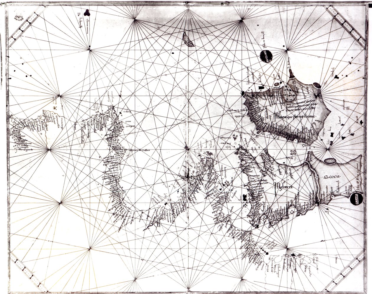
Map of Great Britain, France and Spain by Grazioso Benincasa

Map of Great Britain, France and Spain

(Map of Great Britain, France and Spain, 1473 )


Grazioso Benincasa

€ 111.89
Enthält 0% MwSt.
   Configure art print
1473  ·  Gravur  ·  Picture ID: 91071

Nonclassified artists  ·  Cartography

Map of Great Britain, France and Spain by Grazioso Benincasa. Available as an art print on canvas, photo paper, watercolor board, uncoated paper or Japanese paper.
british isles · cartography · made for italian merchants · coast · ocean · grid reference · island · inaccurate · mapping · Private Collection / Bridgeman Images
AR/3D   View in 3D / AR zu Favoriten hinzufügen   Add to favorites    Select wall color    View painting in a room
0 Reviews

Configure art print

Picture Frame

Medium & Stretcher

Glass & Passepartout

Miscellaneous & Extras

 Save / compare configuration
Preview Icon

Summary

Gemälde
Veredelung
Keilrahmen
Museumslizenz

€ 111.89
(inkl. 20% MwSt)
   Add to cart

Bildschärfe: PERFEKT

Should you desire adjustments to brightness and color, or a custom crop of the motif, we are happy to make these changes at no additional cost to you. Please do not hesitate to contact us.

Similar artworks selected for you

Map showing Gibraltar, Morocco and the Canary Islands. 15th century Portulan A Chart of Brazil Bound in Jacob Colom Map of Italy by sailor cartographer Andrea Bianco (15th century) Bay of Bengal from Ceylon to Malacca Map of Countries First Discovered by Christopher Columbus (1451-1506) 1500 Mediterranean and Black Seas 1546 Map of the Adriatic Sea Map of the Pacific Ocean Map, from The Navigation of King James V, Round Scotland, the Orkney Isles, and the Hebrides or Western Isles: Under the Conduct of That Excellent Pilot Alexander Lindsay Map of the Central Mediterranean England East Coast from Thames Estuary to the Wash Portulan Chart Constructed by William Borough Showing the Sea Area of the North Sea and Baltic, from the East Coast of England to the Head of the Gulf of Sweden, c.1580 Sea chart of the north coast of Ireland, c.1600 A Chart of the Channel in the Philippine Islands Through Which the Manila Galleon Passes Together with the Adjacent Islands Map of Maritime Greenland, Iceland, Davis Strait, Jan Mayen Island, and the Northern Coasts of Scotland and Ireland Navigation Chart Showing China, Ceylon and the Philippines and the Tropics of Cancer and Capricorn, c.1540 A Chart of the Entrance into the Channel Containing the West Coast of Cornwall and Scilly Islands with All the Soundings River Approach to Surat, c.1726 Tenerife Nautical Chart of the Pacific Ocean and Central America New Rising, Detailed Map of the Entire Black Sea from Asaff to Constantinople with Indication of Most of the Ports, Rivers and Fortresses Found on the Sea Coast A New Chart of the Coast from Lowestoff to Hasbrough Including Yarmouth Roads and Sands, Hasbrough Gatt, and the New Lights The Atlantic Neptune Map of the Mediterranean Sea and coastline (Detail) The map is published in Amsterdam (1610) and shows Scandinavia, Norway A Double-Page Map of the Atlantic Ocean, Showing the East Coast of North and South America Map of the Compass Rose from a 16th Century Atlas, Based on the Original Preserved in the Library of the Museo Civico in Venice Unknown Image Plan of the Bay and Harbour of Rio de Janeiro on the Coast of Brazil
Show more similar artworks

Other art prints by Grazioso Benincasa

Map of the Central Mediterranean Map of the French Atlantic Coast and of England Detail of Tall Mast Ships from the Nautical Chart by Grazioso Benincasa Map of Great Britain, France and Spain Galley and Portuguese caravel (detail) Map of the Eastern Mediterranean The Earliest Known Separate Map of the Island of Ireland, Portolan Atlas Map of the Adriatic Sea Map of the Western Mediterranean Map of the Black Sea
Discover more works by Grazioso Benincasa

Other motives from the category Cartography

Map of America and Directions to China Map of Jerusalem, from Map of the Island of Santo Domingo, from Maps of the Battle of Gross Beeren and Battle of Dennewitz, published by William Blackwood and Sons, Edinburgh and London, 1848 Map of the Austro-Hungarian empire, illustration from a French geography school textbook, 1905 Map of Berlin, 1737 Map of Bosnia with Details of the Areas Occupied by Minority Ethnic Groups, 1910 Partial Map of the Middle East in the 1890s, from A Map of the North Pole Map of Trento, from Map of the route taken by Vitus Bering across Siberia to Kamchatka, from Navigantium atque Itinerantium Bibliotheca published 1744 Map of Paris depicting the city Map of Paris at the Outbreak of the French Revolution, published by William Blackwood and Sons Reproduction of Map of Routes of St. James of Compostel, Originally Engraved by D. Serveaux 1648 Map of Siberia Showing the Immense Natural Resources of the Area and Depicting a Sea Route Which Would Open Up Trade, 1933
View More from "Cartography"

Excerpt from our top sellers

Composition No. VII, 1913 Watercolor No. 326 The young Napoleon Bonaparte studying Judith with the Head of Holofernes Red Tree Two Riders on the Beach Sailboats on the Wannsee The Origin of the World Friends Portrait of a Woman Roses, or The Artist Women of Tahiti, On the Beach, 1891 Sadko The Japanese Footbridge and the Water Lily Pool, Giverny Man and Woman, Embrace
Show More Artworks


What our customers think about us


Frequently Asked Questions about Meisterdrucke


Personalizing your art print at Meisterdrucke is a simple and intuitive process that allows you to design an artwork exactly to your specifications: Choose a frame, determine the image size, decide on a printing medium, and add suitable glazing or a stretcher frame. We also offer customization options such as mats, fillets, and spacers. Our customer service is available to help you design your perfect artwork.

At Meisterdrucke, you have the fascinating option to visualize the artwork you configured directly in your own space. For a tailored preview, simply upload a photo of your room and let the artwork appear on it. If you visit us via a mobile device, be it a phone or tablet, our augmented reality feature brings the image to life and seamlessly projects it into your space. An experience that uniquely combines art and technology.

Choosing the medium is often a matter of personal taste. To give you a clearer idea, we have provided some images for each medium. For a holistic experience, we also offer you a sample set of all paper variants so you can make a decision not just visually but also haptically. You can take advantage of the sample set free of charge – only the shipping costs will apply. You can order the sample set directly.

Do not worry. At Meisterdrucke, we do not proceed mechanically. We manually review each order. If there are any inconsistencies or peculiarities in the configuration, we will immediately contact you. Of course, our courteous and patient support is always at your side to assist you with the configuration. Together with you, we adjust your image by phone or email so that the final result exactly meets your expectations.


Do you have any questions?

Are you interested in an art print from our manufactory but still unsure? Do you need advice on choosing the medium or help with the order?

Our experts are happy to assist you.

+43 4257 29415
support@meisterdrucke.com
Mo-Do: 7:00 - 16:00 | Fr: 7:00 - 13:00

Do you have any questions?

Are you interested in an art print from our manufactory but still unsure? Do you need advice on choosing the medium or help with the order?

Our experts are happy to assist you.

+43 4257 29415
support@meisterdrucke.com
Mo-Do: 7:00 - 16:00 | Fr: 7:00 - 13:00


Meisterdrucke

   Kärntner Strasse 46
        9586 Finkenstein am Faaker See
        Austria
        +43 4257 29415
        support@meisterdrucke.com
Other languages

                   
Erfahrungen & Bewertungen zu Meisterdrucke
Post.at DHL Express Quehenberger Cargoboard
Kaiser Franz Joseph

Meisterdrucke
Kärntner Strasse 46
9586 Finkenstein am Faaker See · Austria
+43 4257 29415 · office@meisterdrucke.com
Post.at DHL Express Quehenberger Cargoboard


Meisterdrucke 2717 Bewertungen auf ProvenExpert.com

(c) 2025 meisterdrucke.us