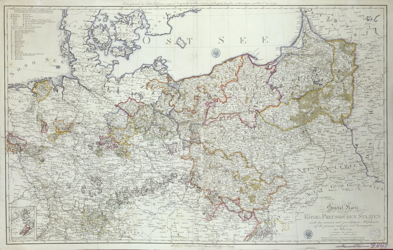
Map of the Prussian States in 1799 by German School

Map of the Prussian States in 1799

(Map of the Prussian States in 1799 (print))


German School

€ 115.23
Enthält 0% MwSt.
   Configure art print
1799  ·  print  ·  Picture ID: 435003

Cultural Circles  ·  Cartography

Map of the Prussian States in 1799 by German School. Available as an art print on canvas, photo paper, watercolor board, uncoated paper or Japanese paper.
master sheet · geographical · political · historic state · north sea · territory · region · ost see · baltic sea · prussia · Staatsbibliothek, Berlin, Germany / Bridgeman Images
zu Favoriten hinzufügen   Add to favorites    Select wall color    View painting in a room AR/3D   View in 3D / AR
0 Reviews

Configure art print

Picture Frame

Medium & Stretcher

Glass & Passepartout

Miscellaneous & Extras

 Save / compare configuration
Preview Icon

Summary

Gemälde
Veredelung
Keilrahmen
Museumslizenz

€ 115.23
(inkl. 20% MwSt)
   Add to cart

Bildschärfe: PERFEKT

Should you desire adjustments to brightness and color, or a custom crop of the motif, we are happy to make these changes at no additional cost to you. Please do not hesitate to contact us.

Similar artworks selected for you

Map of the Gujarat state of India, published under the direction of Colonel J.T. Walker, Surveyor General of India Map of the County of Flanders (present-day Western and Eastern Flanders of Belgium) Map of Artois (France) and Flanders (Belgium, Netherlands) (engraving) Map of Muscovy Electorate of Hanover Map of the Western Part of the Roman Empire General Map of Kazan Governorate General Map of Kazan Governorate Map of Belgium Map of Russia and Poland Map of Russia and Poland Map of Russia Map of Bavaria, Nicolaes Visscher, cartographer, Around 1730 Zeeland, Nord-Pas-de-Calais, Flemish Region, Wallonia, Brussels, Netherlands, France, Belgium Map of Estonia and Livonia Russia, from Europe, Describing All the Changes of Territory, Published 1816 County of Flanders in 1704 Ferro. Unbound. Similar Version Described In Low Countries General Map of European Russia and the Caucasian Countries Map of the Theatre of War in Poland, Muscovy & Turkey by Nicolas Visscher Bavarian Monarchy Map of Belgium The Third Partition of Poland Germany Map of Russia Map of Russia from: Imperii Russici et Tartariae Universae tam Majoris et Asiaticae quam Minoris et Map of the County of Flanders (France and Belgium) New Map of Europe Done from the Most Accurate Observations Communicated to the Royal Society
Show more similar artworks

Other art prints by German School

Poster advertising the Hamburg-Amerika Line Wyk auf Föhr, Poster Advertising the Wyk Steam Shipping Company, 1897 Poster advertising the Hamburg-Amerika Line Woman Bathing Poster for the Industrial Exhibition in Berlin, Germany, 1896 St. Brendan and a Siren, from the German Translation of Navigatio Sancti Brendani Abbatis Portrait of Kaiser Wilhelm II (1859-1941) The Whore of Babylon, from the Luther Bible King Frederick William I on Horseback with Potsdam in the background, c.1735 Fantastic Depiction of the Solar System Arthur Schopenhauer Prince Otto of Bismarck-Schoenhausen, 8th February 1891 Poster Advertising the German East Africa Line, 1890 Sylt North Sea Baths, Poster Advertising the Sylt Steamship Company, 1893 Poster advertising Hamburg-Amerika Linie routes to the West Indies and Central America
Discover more works by German School

Other motives from the category Cartography

A Map of The King Map of Sixteenth Century India, from the Map of Verona, from Map of Atlantis, from Map of European Russia showing its Earliest Extent, its Encroachments upon Adjacent Countries, and the Present Boundary of the Empire Map of Wilnis, from Map of Western Europe, from Italy and Sicily from a Renaissance map of Europe, Jacopo Russo (after) 1528 Map of Constantinople and Surrounding Areas, 1855-63 Map of the Battle of Trafalgar, published by William Blackwood and Sons, Edinburgh and London, 1848 Partial Map of the Middle East Showing the Red Sea, Persian Gulf and Horn of Africa in the 1890s, from Map of Asia, from the Map of the United States in 1803, from Our Whole Country: The Past and Present of the United States, Historical and Descriptive, by John Warner Barber and Henry Hare, 1861 Map of London, from Map of the Turkish Empire, from the Mercator Atlas pub. by Jodocus Hondius Amsterdam, 1606
View More from "Cartography"

Excerpt from our top sellers

The Garden at Giverny, 1900 The Family Heath Princess Summer Night by the Beach Circe The Geographer Karelia and Murmansk agitation panel, 1926 The Redoutable at Trafalgar, 21st October 1805 The Three Sisters on the Beach The Red Tree Renard the Fox Antibes Dominant Curve Praying Hands On Board a Sailing Ship
Show More Artworks


What our customers think about us


Frequently Asked Questions about Meisterdrucke


Personalizing your art print at Meisterdrucke is a simple and intuitive process that allows you to design an artwork exactly to your specifications: Choose a frame, determine the image size, decide on a printing medium, and add suitable glazing or a stretcher frame. We also offer customization options such as mats, fillets, and spacers. Our customer service is available to help you design your perfect artwork.

At Meisterdrucke, you have the fascinating option to visualize the artwork you configured directly in your own space. For a tailored preview, simply upload a photo of your room and let the artwork appear on it. If you visit us via a mobile device, be it a phone or tablet, our augmented reality feature brings the image to life and seamlessly projects it into your space. An experience that uniquely combines art and technology.

Choosing the medium is often a matter of personal taste. To give you a clearer idea, we have provided some images for each medium. For a holistic experience, we also offer you a sample set of all paper variants so you can make a decision not just visually but also haptically. You can take advantage of the sample set free of charge – only the shipping costs will apply. You can order the sample set directly.

Do not worry. At Meisterdrucke, we do not proceed mechanically. We manually review each order. If there are any inconsistencies or peculiarities in the configuration, we will immediately contact you. Of course, our courteous and patient support is always at your side to assist you with the configuration. Together with you, we adjust your image by phone or email so that the final result exactly meets your expectations.


Do you have any questions?

Are you interested in an art print from our manufactory but still unsure? Do you need advice on choosing the medium or help with the order?

Our experts are happy to assist you.

+43 4257 29415
support@meisterdrucke.com
Mo-Do: 7:00 - 16:00 | Fr: 7:00 - 13:00

Do you have any questions?

Are you interested in an art print from our manufactory but still unsure? Do you need advice on choosing the medium or help with the order?

Our experts are happy to assist you.

+43 4257 29415
support@meisterdrucke.com
Mo-Do: 7:00 - 16:00 | Fr: 7:00 - 13:00


Meisterdrucke

   Kärntner Strasse 46
        9586 Finkenstein am Faaker See
        Austria
        +43 4257 29415
        support@meisterdrucke.com
Other languages

                   
Erfahrungen & Bewertungen zu Meisterdrucke
Partner Logos

Kaiser Franz Joseph

Meisterdrucke
Kärntner Strasse 46
9586 Finkenstein am Faaker See · Austria
+43 4257 29415 · office@meisterdrucke.com
Partner Logos


(c) 2025 meisterdrucke.us