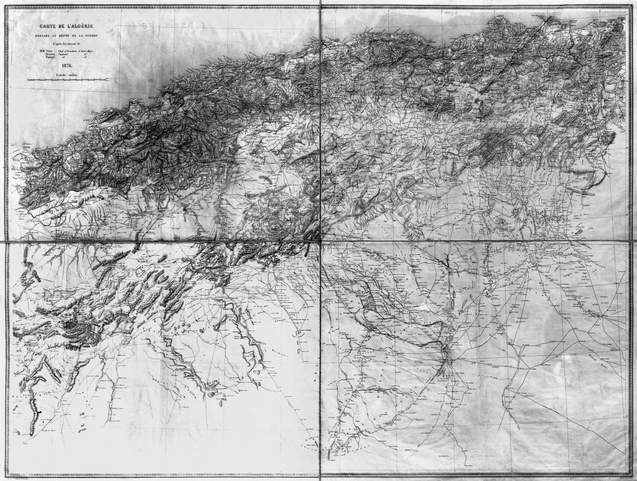
Map of Algeria by French School

Map of Algeria

(Map of Algeria, 1876 )


French School

€ 116.48
Enthält 0% MwSt.
   Configure art print
1876  ·  lithograph  ·  Picture ID: 60718

Cultural Circles  ·  Cartography

Map of Algeria by French School. Available as an art print on canvas, photo paper, watercolor board, uncoated paper or Japanese paper.
algerie · north african coast · coastal · mediterranean · Min. Defense - Service Historique de l'Armee de Terre,France / Bridgeman Images
zu Favoriten hinzufügen   Add to favorites    Select wall color    View painting in a room AR/3D   View in 3D / AR
0 Reviews

Configure art print

Picture Frame

Medium & Stretcher

Glass & Passepartout

Miscellaneous & Extras

 Save / compare configuration
Preview Icon

Summary

Gemälde
Veredelung
Keilrahmen
Museumslizenz

€ 116.48
(inkl. 20% MwSt)
   Add to cart

Bildschärfe: PERFEKT

Should you desire adjustments to brightness and color, or a custom crop of the motif, we are happy to make these changes at no additional cost to you. Please do not hesitate to contact us.

Similar artworks selected for you

Preparatory Map of the Suez Canal, 1855 Hand-drawn Map of Southern Norway Topographic Map of One Hundred Square Miles around Berlin The Map is Published in Oslo (1845) and Shows Southern Norway Roy Dalnawhinny, Roy Military Survey of Scotland Map of Northern Italy, Showing the Watershed of the Arno, c1480 Roy Military Survey of Scotland Constantinople and the Bosphorus, c.1850 Roy Military Survey of Scotland Roy Military Survey of Scotland Roy Military Survey of Scotland Map (from Beauvais to Senlis) of Cassini Prepared by the Cassini Family, Especially by Cesar-François Cassini (Cassini III) and His Son Jean-Dominique Cassini (Cassini IV). The Leves were Made between 1756 and 1789 and the 181 Sheets of the Map were Publis Roy Military Survey of Scotland Bird Birds-Eye View of Part of Tuscany Cold Harbor (June 1-3, 1864) Geological and Geographical Atlas of Colorado and Portions of Adjacent Territory Egypt and Nubia, Volume III: Map to Illustrate the Sketches of David Roberts, Esq: R.A. in Egypt and Nubia 1849 Christiania Shanzhou Quan Tu (translation) Map of Northumberland Map of Afghanistan, 1898 A Chart of Nova Scotia Tongguk Chido Anyang County, Henan Province Geological and Geographical Atlas of Colorado and Portions of Adjacent Territory Egypt and Nubia, Volume III: Map to Illustrate the Sketches of David Roberts, Esq The Chain of Mont Blanc, from an actual survey in 1863 by A. Adams Reilly, published in A Record of Mountain Adventure and Scientific Observation for the Alpine Club, 1865
Show more similar artworks

Other art prints by French School

Birth of Jesus, from the Book of Hours of the Master of Jacques de Besançon Genealogical Tree of the Rougon-Macquart Family Poster Advertising the Baron Hotel in Aleppo Beef: Diagram Depicting the Different Cuts of Meat The Shield of Achilles, After the Description in Homer The Carte du Tendre, a map of an imaginary country, from volume II of Clelie written by Mademoiselle de Scudery, engraved by Francois Chauveau (1613-76) 1656 Reproduction of Map of Routes of St. James of Compostel, Originally Engraved by D. Serveaux 1648 Poster advertising Pur Champagne, from Damery, Epernay The Man with Six Heads, Caricature of Charles Maurice de Talleyrand-Perigord, 1815 Interior of the Alhambra, Granada Veal: diagram depicting the different cuts of meat Lyrics to Samuel Hahnemann (1755 - 1843), discovering homeopathy. engraving after Pauquet Cuts of Pork, illustration from a French Domestic Science Manual by H. de Puytorac, published by Editions Fernand Nathan, late 19th century Frederic Chopin (1810-49) Engraved from a Daguerrotype
Discover more works by French School

Other motives from the category Cartography

A map of Spain and Portugal, c.1869 Mappa Mundi, c.1290 View of Quebec, cartouche of a map depicting St. Lawrence River from Sorel, 1699 Map of Persia, from the Theatrum Orbis Terrarum, pub. by Abraham Ortelius Antwerp, c.1590 Map of the Ottoman Empire, Kingdom of Greece, and the Russian Provinces on the Black Sea Map Showing the Toll Gates and Principal Bars Within 6 Miles of Charing Cross, Exhibited to Lord Palmerston by the Toll Reform Committee Double Hemisphere World Map, 1587 Map of Berlin, 1802 Map No.8 Showing the Route of the Armada Fleet, Engraved by Augustine Ryther, 1588 Admiranta Narratio... Map of Virginia, 1585-1588 Map of the Bay of Bengal Map of the Old and New Worlds, c.1500 Map of the Travels and the Expeditions of Alexander the Great in Asia Map of Aldersgate Ward, City of London Map of South America
View More from "Cartography"

Excerpt from our top sellers

Salvator Mundi Vitruvian Man The Redoutable at Trafalgar, 21st October 1805 The Water Lily Pond, Green Reflections The Japanese Footbridge and the Water Lily Pool, Giverny Lying Dog in the Snow The Destruction of Herculaneum and Pompeii Roses, or The Artist Untitled No. 1 from a Series of Altar Paintings Fish Blood Grützner Benedictine Monk with Wine at Breakfast Snow at Benzaiten Shrine in the Pond of Inokashira, 1843-1847 The Apple Harvest The Course of Empire: The Arcadian or Pastoral State The Great Wave off Kanagawa
Show More Artworks


What our customers think about us


Frequently Asked Questions about Meisterdrucke


Personalizing your art print at Meisterdrucke is a simple and intuitive process that allows you to design an artwork exactly to your specifications: Choose a frame, determine the image size, decide on a printing medium, and add suitable glazing or a stretcher frame. We also offer customization options such as mats, fillets, and spacers. Our customer service is available to help you design your perfect artwork.

At Meisterdrucke, you have the fascinating option to visualize the artwork you configured directly in your own space. For a tailored preview, simply upload a photo of your room and let the artwork appear on it. If you visit us via a mobile device, be it a phone or tablet, our augmented reality feature brings the image to life and seamlessly projects it into your space. An experience that uniquely combines art and technology.

Choosing the medium is often a matter of personal taste. To give you a clearer idea, we have provided some images for each medium. For a holistic experience, we also offer you a sample set of all paper variants so you can make a decision not just visually but also haptically. You can take advantage of the sample set free of charge – only the shipping costs will apply. You can order the sample set directly.

Do not worry. At Meisterdrucke, we do not proceed mechanically. We manually review each order. If there are any inconsistencies or peculiarities in the configuration, we will immediately contact you. Of course, our courteous and patient support is always at your side to assist you with the configuration. Together with you, we adjust your image by phone or email so that the final result exactly meets your expectations.


Do you have any questions?

Are you interested in an art print from our manufactory but still unsure? Do you need advice on choosing the medium or help with the order?

Our experts are happy to assist you.

+43 4257 29415
support@meisterdrucke.com
Mo-Do: 7:00 - 16:00 | Fr: 7:00 - 13:00

Do you have any questions?

Are you interested in an art print from our manufactory but still unsure? Do you need advice on choosing the medium or help with the order?

Our experts are happy to assist you.

+43 4257 29415
support@meisterdrucke.com
Mo-Do: 7:00 - 16:00 | Fr: 7:00 - 13:00


Meisterdrucke

   Kärntner Strasse 46
        9586 Finkenstein am Faaker See
        Austria
        +43 4257 29415
        support@meisterdrucke.com
Other languages

                   
Erfahrungen & Bewertungen zu Meisterdrucke
Partner Logos

Kaiser Franz Joseph

Meisterdrucke
Kärntner Strasse 46
9586 Finkenstein am Faaker See · Austria
+43 4257 29415 · office@meisterdrucke.com
Partner Logos


(c) 2025 meisterdrucke.us