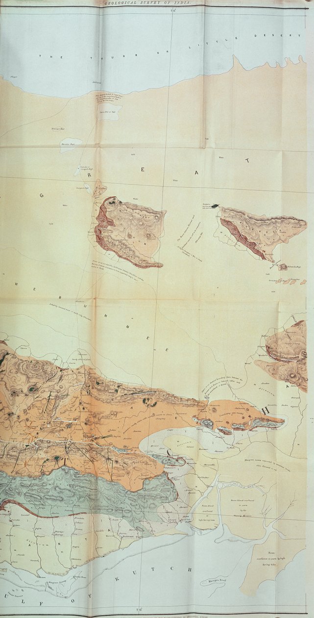
Geological Map of the Cutch Desert, 1870 by English School

Geological Map of the Cutch Desert, 1870

(Geological Map of the Cutch Desert, 1870 )


English School

€ 100.17
Enthält 0% MwSt.
   Configure art print
1870  ·  colour lithograph  ·  Picture ID: 434388

Cultural Circles  ·  Cartography

Geological Map of the Cutch Desert, 1870 by English School. Available as an art print on canvas, photo paper, watercolor board, uncoated paper or Japanese paper.
indian · gulf · country · cartography · state · boundary · boundaries · kutch · geographical · geographic · british empire · asia · asian · indian · mapping · boundary · rann · region · colonial · colony · territory · topography · Geology · geography · Private Collection / Bridgeman Images
AR/3D   View in 3D / AR zu Favoriten hinzufügen   Add to favorites    Select wall color    View painting in a room
0 Reviews

Configure art print

Picture Frame

Medium & Stretcher

Glass & Passepartout

Miscellaneous & Extras

 Save / compare configuration
Preview Icon

Summary

Gemälde
Veredelung
Keilrahmen
Museumslizenz

€ 100.17
(inkl. 20% MwSt)
   Add to cart

Bildschärfe: PERFEKT

Should you desire adjustments to brightness and color, or a custom crop of the motif, we are happy to make these changes at no additional cost to you. Please do not hesitate to contact us.

Similar artworks selected for you

Geological Map of the Kutch Region of India, Geological Survey of India 1868-69 Map of Rhode Island, from Map of the Yenisei River Maps 8.Tab.C.8.80 Reconnaissance of King Roy Military Survey of Scotland Map of Newport and Rhode Island A Map of Nautical Remarks on Observations for the Chart of the Harbour of Boston Preparatory Map of the Suez Canal, 1855 Map of Rhode Island at the time of its occupation 1780-81 by the French Army on the orders of Jean-Baptiste de Vimeur Count of Rochambeau Map of the Operations of the American Army in the Valley of Mexico in August and September 1847 during the Mexican-American War The Gallipoli Campaign, First World War, 1915 The Atlantic Neptune, published for the use of the Royal Navy of Great Britain Map of the New Croton Aqueduct, Old Aqueduct and Bronx River Pipeline also the Watersheds of the Croton, Bronx The Rock of Gibraltar The Chain of Mont Blanc, from an actual survey in 1863 by A. Adams Reilly, published in A Record of Mountain Adventure and Scientific Observation for the Alpine Club, 1865 Map of East Africa (map of the route that Solomon fleets took) - in Journey to Nubia and Abyssinia undertaken to discover the sources of the Nile during the years 1768 to 1772, by James Bruce, Paris Chart of the Island of Timor Reconnaissance of King Map from the National Library Anyang County, Henan Province The Battle of Viborg Bay, 1790 Map, 1790 A Plan of Rhode Island by Holland Wilmington and Cape Fear River, North Carolina A plan of Fort Montgomery & Fort Clinton, 1774-1779 A Collection of Surveys of Scottish Estates of the Earl of Selkirk: The Farm Consisting of Kirkland Drumcroy, Auchenfloor, Cannee, Barhill and Silvercraigs (formerly Nuntons) Map of crossings on Saint Lawrence River near Quebec, near island of Orleans Picturesque Journey through the Isthmus of Suez (Plan of Suez) in A Geological Map of Manhattan Island of New York, 1842
Show more similar artworks

Other art prints by English School

The Nonpareil with Portraits of Queen Victoria and Prince Albert Church and Cottage with Lighted Windows Woman beating her husband with a shoe Portrait of a bodybuilder The Lavater Lee and Sons, acrobats Elephant (engraving) View of the Acropolis of Athens Roman Augurs Princes Street Edinburgh - West End English Rose Great Green Tree Frog English Rose Ships Arriving Map of Europe in 1910
Discover more works by English School

Other motives from the category Cartography

Map of Namur, from Froggett Map of Linz, from Reproduction of Map of Routes of St. James of Compostel, Originally Engraved by D. Serveaux 1648 Map of Warsaw, from Map of Frankfurt, from Map of the parts of Europe and Asia adjacent to Constantinople, from Map of Exeter, from Map of Candia and Corfu, from Map of the world with possessions of the British Empire coloured red, c.1870 Map of Lyon Map depicting plantations on the Mississippi River from Natchez to New Orleans Map of France, Gallia Antique, from Map of the Battle of Montmirail, published by William Blackwood and Sons, Edinburgh and London, 1848 Map of Cordoba, from
View More from "Cartography"

Excerpt from our top sellers

Friends Beautiful Princess Sunset Over the Lake The Piri Reis World Map, 1513 Houses in Munich, 1908 Rosa centifolia foliacea, from Les Roses, 1817-24 Wanderer Above the Sea of Fog Marie Kroyer Seated in the Deckchair in the Garden by Mrs. Bendsen Blooming Front Garden Haystacks Roller Skating Club Around the Alex Starry Night Ruby, Gold and Malachite Wheatfield with Crows The Chocolate Girl (La Belle Chocolatière de Vienne)
Show More Artworks


What our customers think about us


Frequently Asked Questions about Meisterdrucke


Personalizing your art print at Meisterdrucke is a simple and intuitive process that allows you to design an artwork exactly to your specifications: Choose a frame, determine the image size, decide on a printing medium, and add suitable glazing or a stretcher frame. We also offer customization options such as mats, fillets, and spacers. Our customer service is available to help you design your perfect artwork.

At Meisterdrucke, you have the fascinating option to visualize the artwork you configured directly in your own space. For a tailored preview, simply upload a photo of your room and let the artwork appear on it. If you visit us via a mobile device, be it a phone or tablet, our augmented reality feature brings the image to life and seamlessly projects it into your space. An experience that uniquely combines art and technology.

Choosing the medium is often a matter of personal taste. To give you a clearer idea, we have provided some images for each medium. For a holistic experience, we also offer you a sample set of all paper variants so you can make a decision not just visually but also haptically. You can take advantage of the sample set free of charge – only the shipping costs will apply. You can order the sample set directly.

Do not worry. At Meisterdrucke, we do not proceed mechanically. We manually review each order. If there are any inconsistencies or peculiarities in the configuration, we will immediately contact you. Of course, our courteous and patient support is always at your side to assist you with the configuration. Together with you, we adjust your image by phone or email so that the final result exactly meets your expectations.


Do you have any questions?

Are you interested in an art print from our manufactory but still unsure? Do you need advice on choosing the medium or help with the order?

Our experts are happy to assist you.

+43 4257 29415
support@meisterdrucke.com
Mo-Do: 7:00 - 16:00 | Fr: 7:00 - 13:00

Do you have any questions?

Are you interested in an art print from our manufactory but still unsure? Do you need advice on choosing the medium or help with the order?

Our experts are happy to assist you.

+43 4257 29415
support@meisterdrucke.com
Mo-Do: 7:00 - 16:00 | Fr: 7:00 - 13:00


Meisterdrucke

   Kärntner Strasse 46
        9586 Finkenstein am Faaker See
        Austria
        +43 4257 29415
        support@meisterdrucke.com
Other languages

                   
Erfahrungen & Bewertungen zu Meisterdrucke
Post.at DHL Express Quehenberger Cargoboard
Kaiser Franz Joseph

Meisterdrucke
Kärntner Strasse 46
9586 Finkenstein am Faaker See · Austria
+43 4257 29415 · office@meisterdrucke.com
Post.at DHL Express Quehenberger Cargoboard


Meisterdrucke 2705 Bewertungen auf ProvenExpert.com

(c) 2025 meisterdrucke.us