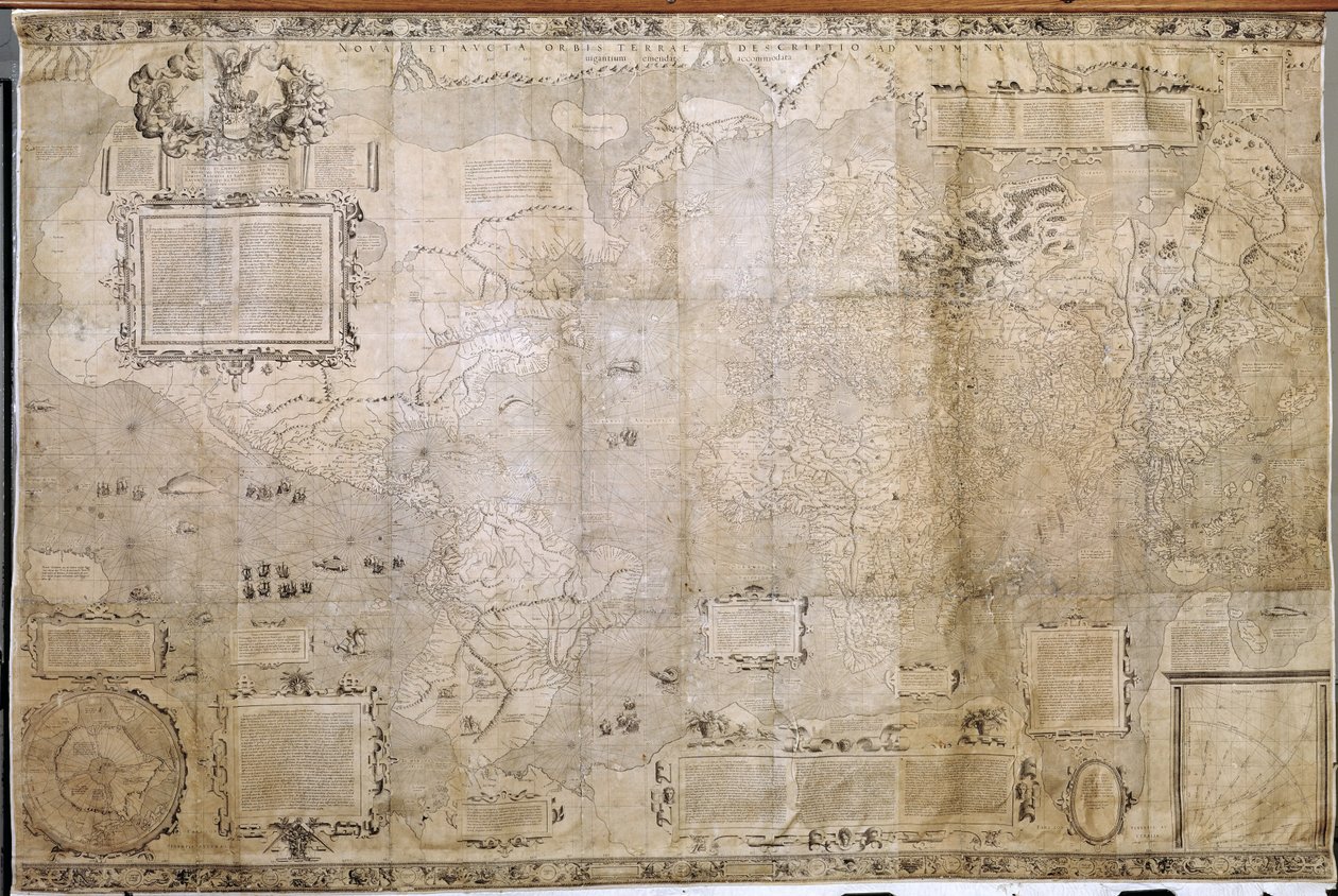
Map of the World by Dutch School

Map of the World

(Map of the World )


Dutch School

€ 126.18
Enthält 0% MwSt.
   Configure art print
Undated  ·  engraving  ·  Picture ID: 425016

Cultural Circles  ·  Cartography

Map of the World by Dutch School. Available as an art print on canvas, photo paper, watercolor board, uncoated paper or Japanese paper.
mercators projection · gerard mercator · 1512-94 · cartographer · mapping · maps · Bibliotheque Nationale de Cartes et Plans, Paris, France / Bridgeman Images
Other color variations of this picture  
AR/3D   View in 3D / AR zu Favoriten hinzufügen   Add to favorites    Select wall color    View painting in a room
0 Reviews

Configure art print

Picture Frame

Medium & Stretcher

Glass & Passepartout

Miscellaneous & Extras

 Save / compare configuration
Preview Icon

Summary

Gemälde
Veredelung
Keilrahmen
Museumslizenz

€ 126.18
(inkl. 20% MwSt)
   Add to cart

Bildschärfe: PERFEKT

Should you desire adjustments to brightness and color, or a custom crop of the motif, we are happy to make these changes at no additional cost to you. Please do not hesitate to contact us.

Similar artworks selected for you

Kunyu Wanguo Quantu A Map of the Myriad Countries of the World, 1602 1551 Map of the Western Hemisphere The Selden Map of China Geographic Map of the Mediterranean Sea Land Van Aalst, Belgium Territorial holdings of the Dutch West India Company, 1710 Situation of the City of Christiansand with its Surrounding Elves Americae Sive Quartae Orbis Partis Nova Et Exactissima Descriptio, by Diego Gutierrez Cotton Roll XIII, 44 Italie provincie modernus situs Geographic map of Gauls showing the borders with Germany and Italy. Realised by cartographer Jean Jolivet (16th century) Nova & Acurata Totius Asiae Tabula, by G. Blaeu, c.1673 Planisphere Showing the Different Climatic Zones Map of the coast between Fowey and Salcombe, including Plymouth. Part of a panoramic map of the coast from Land Flanders, Belgium (engraving) Portulan of the Atlantic and Pacific Lorraine, France (engraving) Map of Asia, La Cosmographie Universelle d Valloton Amplissima Terrae Sanctae descripto ad utriusque testamenti intelligentiam, 1537 Map of Peru by Egnazio Danti, Mathematician, Cosmographer and Italian Architect. Around 1567. Florence, Palazzo Vecchio, Sala del Mappamondo Shanzhou Quan Tu (translation) Map of Brazil, from Dutch Marine Maps, 1637 To his excellency George Clinton, Esq. . . .This plan of the City of New York and its environs . . ., 1785 The Map is Published in Christiania Map of the English Channel (English South Coast and French North Coast) by Jean Rotz Ireland between Londonderry and Dublin Da Ming Yi Tong Shan He Tu World map on vellum, c.1540
Show more similar artworks

Other art prints by Dutch School

China Terrarum Orbis Tabula (after G. a Schagen, c.1689) Martin Luther preaching (detail) A Dodo A Planisphere with Signs of Zodiac Map of New Holland, Now Australia, and of New Zealand Plaque with a Chinoiserie Landscape and Gilt Details, c.1680 Miracle of Our Lady of Nazare, Our Lady of Nazare Church, Portugal Title Page of Principia Philosophiae by Rene Descartes Draining fluid from a Hydrocele of the Scrotum, from Exercitationes Practicae circa Medendi Methodum by Frederik Dekkers, 1694 Compass Rose, from a Blaue Atlas, published in Amsterdam Map of the Magellan Straits, Patagonia Colonization: the Dutch fleets chasing Portuguese from Ceylon in 1658. Dutch print from Afgoderye de oost-indische heydenen by Philippus Baldaeus Map of Greece, Hungary and Their Surrounding Countries Interior of a Dutch House, 1st Half of 17th Century
Discover more works by Dutch School

Other motives from the category Cartography

Map of Rovigo, from Copy of Catalan Map of Europe, North Africa and the Middle East Map of Lower Egypt and part of Syria, published by William Blackwood and Sons Map of Atlantis, from The Continent of Africa, from an Atlas of the World in 33 Maps, Venice, 1st September 1553 Map of Africa, from Nova Africa Descriptio, published in Amsterdam by Dutch cartographer Frederik de Wit A Map of Mile End and Stepney Green, London, 1746 Map of the Island of Haiti Map of Lord Kitchener Map of Warsaw, from Map of Asia, Tartaria, Japan, the Philippines and the East Indies, engraved by G. van Gouwen, c.1690 Map of the City of Westminster and the Duchy of Lancaster, London Double-Hemisphere World Map from Goos Map of the Turkish Empire, from the Mercator Atlas pub. by Jodocus Hondius Amsterdam, 1606 Map of Saint-Quentin, from the
View More from "Cartography"

Excerpt from our top sellers

The Times of Day: The Evening, 1821-1822 Poppies The Road to Bas-Breau, Fontainebleau (Le Pave de Chailly) K. Kollwitz, Head of a Child in Hands Ploughing in Nivernais, 1849 Evening at the Iris Field Sunset on the Seine at Lavacourt, Winter Effect Pillars of Creation (NIRCam and MIRI Composite) Circe Offering the Cup to Ulysses, 1891 The Tortoise Trainer Nymphs and Satyr Homage to Jacquin ( Native Birds, Including the Toucan, Amazon, Brazil, from Standing Male Nude The Scream
Show More Artworks


What our customers think about us


Frequently Asked Questions about Meisterdrucke


Personalizing your art print at Meisterdrucke is a simple and intuitive process that allows you to design an artwork exactly to your specifications: Choose a frame, determine the image size, decide on a printing medium, and add suitable glazing or a stretcher frame. We also offer customization options such as mats, fillets, and spacers. Our customer service is available to help you design your perfect artwork.

At Meisterdrucke, you have the fascinating option to visualize the artwork you configured directly in your own space. For a tailored preview, simply upload a photo of your room and let the artwork appear on it. If you visit us via a mobile device, be it a phone or tablet, our augmented reality feature brings the image to life and seamlessly projects it into your space. An experience that uniquely combines art and technology.

Choosing the medium is often a matter of personal taste. To give you a clearer idea, we have provided some images for each medium. For a holistic experience, we also offer you a sample set of all paper variants so you can make a decision not just visually but also haptically. You can take advantage of the sample set free of charge – only the shipping costs will apply. You can order the sample set directly.

Do not worry. At Meisterdrucke, we do not proceed mechanically. We manually review each order. If there are any inconsistencies or peculiarities in the configuration, we will immediately contact you. Of course, our courteous and patient support is always at your side to assist you with the configuration. Together with you, we adjust your image by phone or email so that the final result exactly meets your expectations.


Do you have any questions?

Are you interested in an art print from our manufactory but still unsure? Do you need advice on choosing the medium or help with the order?

Our experts are happy to assist you.

+43 4257 29415
support@meisterdrucke.com
Mo-Do: 7:00 - 16:00 | Fr: 7:00 - 13:00

Do you have any questions?

Are you interested in an art print from our manufactory but still unsure? Do you need advice on choosing the medium or help with the order?

Our experts are happy to assist you.

+43 4257 29415
support@meisterdrucke.com
Mo-Do: 7:00 - 16:00 | Fr: 7:00 - 13:00


Meisterdrucke

   Kärntner Strasse 46
        9586 Finkenstein am Faaker See
        Austria
        +43 4257 29415
        support@meisterdrucke.com
Other languages

                   
Erfahrungen & Bewertungen zu Meisterdrucke
Post.at DHL Express Quehenberger Cargoboard
Kaiser Franz Joseph

Meisterdrucke
Kärntner Strasse 46
9586 Finkenstein am Faaker See · Austria
+43 4257 29415 · office@meisterdrucke.com
Post.at DHL Express Quehenberger Cargoboard


Meisterdrucke 2717 Bewertungen auf ProvenExpert.com

(c) 2025 meisterdrucke.us